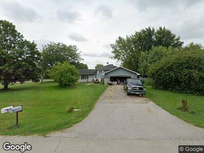
26301 W 128th St Plainfield, IL 60585
North Plainfield NeighborhoodEstimated Value: $426,821 - $598,000
--
Bed
--
Bath
3,544
Sq Ft
$143/Sq Ft
Est. Value
About This Home
This home is located at 26301 W 128th St, Plainfield, IL 60585 and is currently estimated at $508,205, approximately $143 per square foot. 26301 W 128th St is a home located in Will County with nearby schools including Lincoln Elementary School, Heritage Grove Middle School, and Plainfield North High School.
Ownership History
Date
Name
Owned For
Owner Type
Purchase Details
Closed on
Feb 14, 2005
Sold by
Malone Marilyn A
Bought by
Malone Peter
Current Estimated Value
Home Financials for this Owner
Home Financials are based on the most recent Mortgage that was taken out on this home.
Original Mortgage
$0
Interest Rate
5.79%
Mortgage Type
Unknown
Create a Home Valuation Report for This Property
The Home Valuation Report is an in-depth analysis detailing your home's value as well as a comparison with similar homes in the area
Home Values in the Area
Average Home Value in this Area
Purchase History
| Date | Buyer | Sale Price | Title Company |
|---|---|---|---|
| Malone Peter | -- | -- |
Source: Public Records
Mortgage History
| Date | Status | Borrower | Loan Amount |
|---|---|---|---|
| Closed | Malone Peter W | $0 | |
| Closed | Malone Peter W | $230,000 | |
| Closed | Malone Peter W | $0 | |
| Closed | Malone Peter W | $255,000 | |
| Closed | Malone Peter | $190,000 |
Source: Public Records
Tax History Compared to Growth
Tax History
| Year | Tax Paid | Tax Assessment Tax Assessment Total Assessment is a certain percentage of the fair market value that is determined by local assessors to be the total taxable value of land and additions on the property. | Land | Improvement |
|---|---|---|---|---|
| 2023 | $9,337 | $135,016 | $22,307 | $112,709 |
| 2022 | $7,696 | $114,107 | $21,102 | $93,005 |
| 2021 | $7,416 | $108,673 | $20,097 | $88,576 |
| 2020 | $7,423 | $106,952 | $19,779 | $87,173 |
| 2019 | $7,319 | $103,938 | $19,222 | $84,716 |
| 2018 | $6,756 | $94,473 | $18,798 | $75,675 |
| 2017 | $6,739 | $92,034 | $18,313 | $73,721 |
| 2016 | $6,770 | $90,053 | $17,919 | $72,134 |
| 2015 | $6,854 | $86,590 | $17,230 | $69,360 |
| 2014 | $6,854 | $86,590 | $17,230 | $69,360 |
| 2013 | $6,854 | $83,872 | $17,700 | $66,172 |
Source: Public Records
Map
Nearby Homes
- 12929 Alpine Way
- 12923 Grande Pines Blvd
- 26200 W Chatham Dr
- 26100 W Chatham Dr
- 26125 Oakcrest Ln
- 25907 W Canyon Blvd
- 12941 Grande Poplar Cir
- 26403 W Red Apple Rd
- 5291 S Ridge Rd
- 12305 S Prairie Ridge Ln
- 25700 Pastoral Dr
- 26101 W Sherwood Cir
- 26101 Forrester Dr
- 26205 Forrester Dr
- 12414 Dublin Ln
- 26005 W Forrester Dr
- 26341 W Sablewood Cir
- 13424 S Olivewood Dr
- 26158 W Sherwood Cir
- 13425 S Olivewood Dr
- 26301 W 128th St
- 12801 S Elizabeth Dr
- 43 128th Rd
- 12811 S Elizabeth Dr
- 12759 S Elizabeth Dr
- 26300 W 128th St
- 12801 S Hadfield Dr
- 12821 S Elizabeth Dr
- 12811 S Hadfield Dr
- 12830 S Hadfield Dr
- 12755 S Elizabeth Dr
- 12821 S Hadfield Dr
- 12831 S Elizabeth Dr
- 26230 W 128th St
- 12831 S Hadfield Dr
- 12800 S Elizabeth Dr
- 12910 S Hadfield Dr
- 12747 S Elizabeth Dr
- 12764 S Elizabeth Dr
- 12810 S Elizabeth Dr