Estimated Value: $296,483 - $346,000
3
Beds
2
Baths
1,604
Sq Ft
$200/Sq Ft
Est. Value
About This Home
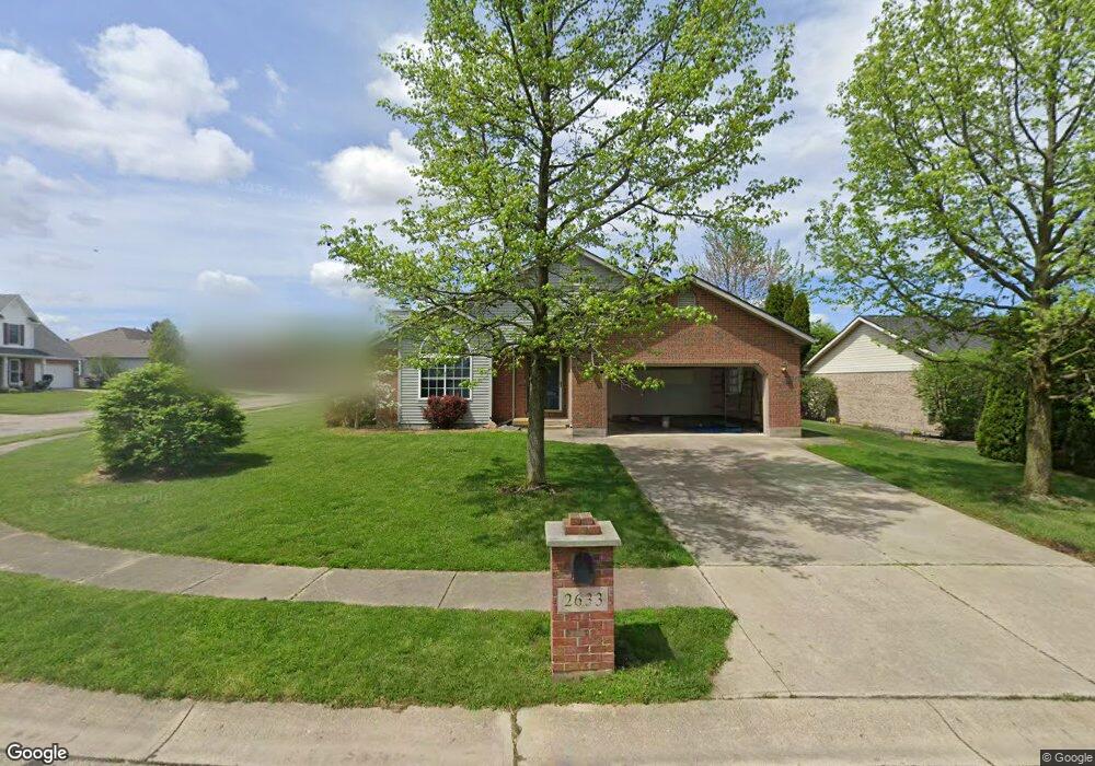
This home is located at 2633 Walnut Ridge Dr, Troy, OH 45373 and is currently estimated at $321,371, approximately $200 per square foot. 2633 Walnut Ridge Dr is a home located in Miami County with nearby schools including Concord Elementary School, Van Cleve Elementary School, and Troy Junior High School.
Ownership History
Date
Name
Owned For
Owner Type
Purchase Details
Closed on
Dec 30, 2011
Sold by
Barga Timothy P and Barga Phyllis L
Bought by
Barga Timothy P
Current Estimated Value
Home Financials for this Owner
Home Financials are based on the most recent Mortgage that was taken out on this home.
Original Mortgage
$116,250
Outstanding Balance
$77,947
Interest Rate
3.98%
Mortgage Type
New Conventional
Estimated Equity
$243,424
Purchase Details
Closed on
Dec 22, 2011
Sold by
Barga Timothy P and Barga Phyllis L
Bought by
Barga Timothy P
Home Financials for this Owner
Home Financials are based on the most recent Mortgage that was taken out on this home.
Original Mortgage
$116,250
Outstanding Balance
$77,947
Interest Rate
3.98%
Mortgage Type
New Conventional
Estimated Equity
$243,424
Purchase Details
Closed on
Dec 29, 2006
Sold by
Gaeke Joseph C and Gaeke Dixie L
Bought by
Barga Timothy P and Barga Phyllis L
Purchase Details
Closed on
Jul 11, 2003
Sold by
Baileys David N and Baileys Kimberly A
Bought by
Gaeke Joseph C and Gaeke Dixie L
Home Financials for this Owner
Home Financials are based on the most recent Mortgage that was taken out on this home.
Original Mortgage
$100,000
Interest Rate
5.36%
Mortgage Type
New Conventional
Purchase Details
Closed on
Aug 1, 1995
Sold by
Northridge Professional
Bought by
Armentrout Brent A and Armentrout Catherine M
Home Financials for this Owner
Home Financials are based on the most recent Mortgage that was taken out on this home.
Original Mortgage
$109,750
Interest Rate
7.59%
Mortgage Type
New Conventional
Create a Home Valuation Report for This Property
The Home Valuation Report is an in-depth analysis detailing your home's value as well as a comparison with similar homes in the area
Home Values in the Area
Average Home Value in this Area
Purchase History
| Date | Buyer | Sale Price | Title Company |
|---|---|---|---|
| Barga Timothy P | -- | -- | |
| Barga Timothy P | -- | -- | |
| Barga Timothy P | $160,000 | -- | |
| Gaeke Joseph C | $160,000 | -- | |
| Armentrout Brent A | $125,740 | -- |
Source: Public Records
Mortgage History
| Date | Status | Borrower | Loan Amount |
|---|---|---|---|
| Open | Gaeke Joseph C | $116,250 | |
| Closed | Barga Timothy P | $116,250 | |
| Previous Owner | Gaeke Joseph C | $100,000 | |
| Previous Owner | Armentrout Brent A | $109,750 |
Source: Public Records
Tax History
| Year | Tax Paid | Tax Assessment Tax Assessment Total Assessment is a certain percentage of the fair market value that is determined by local assessors to be the total taxable value of land and additions on the property. | Land | Improvement |
|---|---|---|---|---|
| 2025 | $3,736 | $102,590 | $13,690 | $88,900 |
| 2024 | $3,736 | $76,690 | $13,690 | $63,000 |
| 2023 | $3,045 | $76,690 | $13,690 | $63,000 |
| 2022 | $2,562 | $76,690 | $13,690 | $63,000 |
| 2021 | $2,274 | $63,910 | $11,410 | $52,500 |
| 2020 | $2,276 | $63,910 | $11,410 | $52,500 |
| 2019 | $2,297 | $63,910 | $11,410 | $52,500 |
| 2018 | $2,040 | $54,010 | $12,320 | $41,690 |
| 2017 | $2,059 | $54,010 | $12,320 | $41,690 |
| 2016 | $2,033 | $54,010 | $12,320 | $41,690 |
| 2015 | $1,958 | $50,020 | $11,410 | $38,610 |
| 2014 | $1,958 | $50,020 | $11,410 | $38,610 |
| 2013 | $1,971 | $50,020 | $11,410 | $38,610 |
Source: Public Records
Map
Nearby Homes
- 2882 Red Oak Cir
- 591 Countryside Dr S
- 173 Countryside Dr N
- 3135 Honeysuckle Dr
- 120 Windmere Dr
- 974 Stony Brook Ln
- 2550 Broken Woods Dr
- 2685 Merrimont Dr
- 0 Lincolnshire Unit 939331
- 1704 Chevington Chase
- 1704 Chevington Chase
- 1245 Wind Rock Dr
- 2672 Pleasant View Dr
- 2650 Pleasant View Dr
- 1234 Wind Rock Dr
- 2215 Merrimont Dr
- 807 Claymore Ct
- 1117 Honeydew Dr
- 2065 S Co Road 25a
- 735 Chaucer Ln
- 2643 Walnut Ridge Dr
- 185 Locust View Way
- 2901 Red Oak Cir
- 2659 Walnut Ridge Dr
- 162 Locust View Way
- 176 Locust View Way
- 2885 Red Oak Cir
- 150 Locust View Way
- 2636 Walnut Ridge Dr
- 190 Locust View Way
- 2626 Walnut Ridge Dr
- 2650 Walnut Ridge Dr
- 2675 Walnut Ridge Dr
- 140 Locust View Way
- 202 Locust View Way
- 2875 Red Oak Cir
- 2912 Red Oak Cir
- 181 Green Oak Dr
- 2664 Walnut Ridge Dr
- 175 Green Oak Dr
Your Personal Tour Guide
Ask me questions while you tour the home.