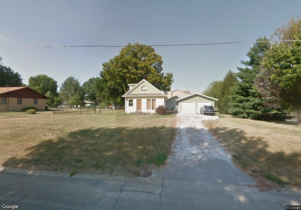
2635 Cliff Rd Burlington, IA 52601
Estimated Value: $139,000 - $161,377
2
Beds
2
Baths
1,061
Sq Ft
$143/Sq Ft
Est. Value
About This Home
This home is located at 2635 Cliff Rd, Burlington, IA 52601 and is currently estimated at $151,344, approximately $142 per square foot. 2635 Cliff Rd is a home located in Des Moines County with nearby schools including Burlington Community High School, Burlington Christian School, and Notre Dame High School.
Ownership History
Date
Name
Owned For
Owner Type
Purchase Details
Closed on
Oct 23, 2006
Sold by
Staub Joseph T and Staub Joan M
Bought by
Pelt Robert C Van
Current Estimated Value
Home Financials for this Owner
Home Financials are based on the most recent Mortgage that was taken out on this home.
Original Mortgage
$61,290
Interest Rate
6.45%
Mortgage Type
VA
Create a Home Valuation Report for This Property
The Home Valuation Report is an in-depth analysis detailing your home's value as well as a comparison with similar homes in the area
Home Values in the Area
Average Home Value in this Area
Purchase History
| Date | Buyer | Sale Price | Title Company |
|---|---|---|---|
| Pelt Robert C Van | $54,000 | None Available |
Source: Public Records
Mortgage History
| Date | Status | Borrower | Loan Amount |
|---|---|---|---|
| Closed | Pelt Robert C Van | $61,290 |
Source: Public Records
Tax History Compared to Growth
Tax History
| Year | Tax Paid | Tax Assessment Tax Assessment Total Assessment is a certain percentage of the fair market value that is determined by local assessors to be the total taxable value of land and additions on the property. | Land | Improvement |
|---|---|---|---|---|
| 2025 | $2,476 | $142,200 | $27,600 | $114,600 |
| 2024 | $2,476 | $127,400 | $27,600 | $99,800 |
| 2023 | $2,312 | $127,400 | $27,600 | $99,800 |
| 2022 | $2,348 | $115,300 | $27,600 | $87,700 |
| 2021 | $2,348 | $115,300 | $27,600 | $87,700 |
| 2020 | $2,502 | $115,300 | $27,600 | $87,700 |
| 2019 | $1,850 | $115,300 | $27,600 | $87,700 |
| 2018 | $1,854 | $80,400 | $24,700 | $55,700 |
| 2017 | $1,862 | $79,000 | $0 | $0 |
| 2016 | $1,798 | $79,000 | $0 | $0 |
| 2015 | $1,798 | $79,000 | $0 | $0 |
| 2014 | $1,822 | $78,000 | $0 | $0 |
Source: Public Records
Map
Nearby Homes
- 2728 Sunnyside Ave
- 2604 Sunnyside Ave
- 2801 Sunnyside Ave
- 2706 Bittersweet Place
- 2405 Bittersweet Place
- 2224 Sunnyside Ave
- 2826 Sunnyside Ave
- 2832 Lesylvia St
- 1 Golf Ct
- 2917 Woodland Dr
- 0 Hwy 61 Unit 23351978
- 2544 Surrey Rd
- 10552 Rolling Hills Dr
- 2035 Highland Ave
- 2012 Osborn St
- 1408 Orchard Meadow Dr Unit D
- 10591 Rolling Hills Dr
- 11161 Iroquois Rd
- 1409 Orchard Meadow Dr
- 1404 Orchard Meadow Dr Unit D
- 2601 Cliff Rd
- 2609 Cliffwood Dr
- 2533 Cliff Rd
- 2642 Cliff Rd
- 2630 Cliff Rd
- 2600 Cliffwood Dr
- 2606 Cliffwood Dr
- 2540 Gerdes Dr
- 2529 Cliff Rd
- 2534 Cliff Rd
- 2600 Northwood Ave
- 2612 Cliffwood Dr
- 2538 Gerdes Dr
- 2525 Cliff Rd
- 2621 Cliffwood Dr
- 2534 Gerdes Dr
- 2622 Northwood Ave
- 2618 Cliffwood Dr
- 2530 Gerdes Dr
- 2727 Cliff Rd