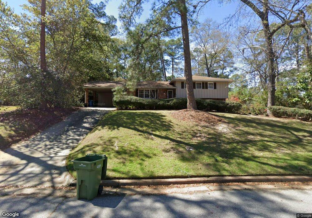
2635 Habersham Ave Columbus, GA 31906
Hilton Heights-Clubview Heights NeighborhoodEstimated Value: $286,645 - $340,000
4
Beds
3
Baths
2,258
Sq Ft
$136/Sq Ft
Est. Value
About This Home
This home is located at 2635 Habersham Ave, Columbus, GA 31906 and is currently estimated at $307,161, approximately $136 per square foot. 2635 Habersham Ave is a home located in Muscogee County with nearby schools including Clubview Elementary School, Richards Middle School, and Hardaway High School.
Ownership History
Date
Name
Owned For
Owner Type
Purchase Details
Closed on
Dec 29, 2017
Sold by
Cash Samuel
Bought by
Frank Jonathan D and Frank Frauke E
Current Estimated Value
Home Financials for this Owner
Home Financials are based on the most recent Mortgage that was taken out on this home.
Original Mortgage
$205,934
Outstanding Balance
$174,005
Interest Rate
3.99%
Estimated Equity
$133,156
Purchase Details
Closed on
Oct 28, 2016
Sold by
Robert J
Bought by
Cash Samuel D
Create a Home Valuation Report for This Property
The Home Valuation Report is an in-depth analysis detailing your home's value as well as a comparison with similar homes in the area
Home Values in the Area
Average Home Value in this Area
Purchase History
| Date | Buyer | Sale Price | Title Company |
|---|---|---|---|
| Frank Jonathan D | $201,600 | -- | |
| Cash Samuel D | $65,000 | -- |
Source: Public Records
Mortgage History
| Date | Status | Borrower | Loan Amount |
|---|---|---|---|
| Open | Frank Jonathan D | $205,934 |
Source: Public Records
Tax History Compared to Growth
Tax History
| Year | Tax Paid | Tax Assessment Tax Assessment Total Assessment is a certain percentage of the fair market value that is determined by local assessors to be the total taxable value of land and additions on the property. | Land | Improvement |
|---|---|---|---|---|
| 2025 | $3,527 | $90,108 | $18,860 | $71,248 |
| 2024 | $3,527 | $90,108 | $18,860 | $71,248 |
| 2023 | $3,549 | $90,108 | $18,860 | $71,248 |
| 2022 | $2,930 | $71,760 | $18,860 | $52,900 |
| 2021 | $2,198 | $67,216 | $18,860 | $48,356 |
| 2020 | $2,198 | $67,216 | $18,860 | $48,356 |
| 2019 | $2,207 | $67,216 | $18,860 | $48,356 |
| 2018 | $2,754 | $67,216 | $18,860 | $48,356 |
| 2017 | $1,069 | $26,000 | $7,080 | $18,920 |
| 2016 | $706 | $69,285 | $14,130 | $55,155 |
| 2015 | $709 | $69,285 | $14,130 | $55,155 |
| 2014 | $285 | $69,285 | $14,130 | $55,155 |
| 2013 | -- | $69,235 | $14,130 | $55,105 |
Source: Public Records
Map
Nearby Homes
- 2576 Habersham Ave
- 2604 Sue MacK Dr
- 2637 Sue MacK Dr
- 2940 Birchfield Dr
- 2722 E Lindsay Dr
- 2817 Carson Dr
- 2930 Sue MacK Dr
- 2820 Nancy St
- 2525 Norris Rd Unit 36
- 2525 Norris Rd Unit 73
- 2525 Norris Rd Unit 91
- 1903 Marilon Dr
- 2917 Edgewood Rd
- 3224 Carden Dr
- 1712 Marilon Dr
- 2010 Wells Dr
- 1714 Iris Dr
- 3402 Cambridge Dr
- 2609 Hilton Ave
- 3129 Avon Dr
- 2643 Habersham Ave
- 2632 Auburn Ave
- 2640 Auburn Ave
- 2709 Habersham Ave
- 2619 Habersham Ave
- 2624 Auburn Ave
- 2700 Auburn Ave
- 2634 Habersham Ave
- 2644 Habersham Ave
- 2626 Habersham Ave
- 2702 Habersham Ave
- 2611 Habersham Ave
- 2616 Auburn Ave
- 2710 Auburn Ave
- 2618 Habersham Ave
- 2710 Habersham Ave
- 2643 Fremont Ave
- 2643 Auburn Ave
- 2607 Habersham Ave
- 2635 Auburn Ave