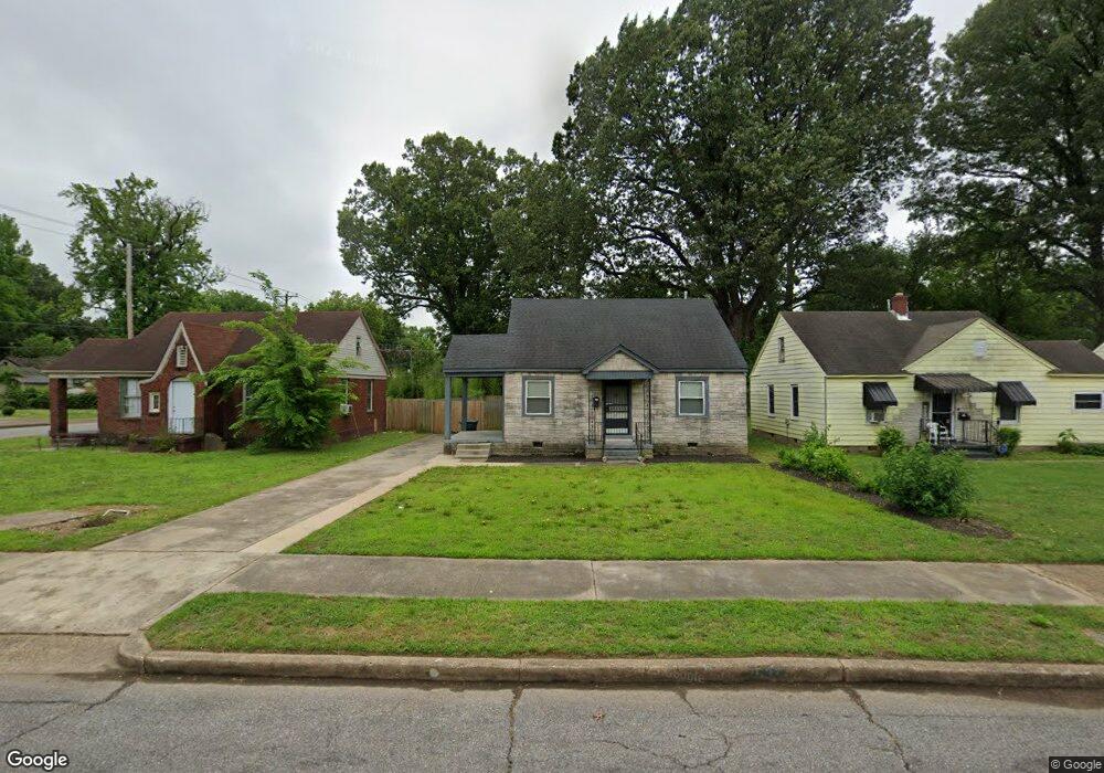
2637 Burns Ave Memphis, TN 38114
Southeast Memphis NeighborhoodEstimated Value: $68,000 - $88,000
2
Beds
1
Bath
960
Sq Ft
$81/Sq Ft
Est. Value
About This Home
This home is located at 2637 Burns Ave, Memphis, TN 38114 and is currently estimated at $78,009, approximately $81 per square foot. 2637 Burns Ave is a home located in Shelby County with nearby schools including Bethel Grove Elementary School, Sherwood Middle, and Melrose High School.
Ownership History
Date
Name
Owned For
Owner Type
Purchase Details
Closed on
Aug 28, 1996
Sold by
Downs Ronald H and Downs Jane
Bought by
Cauley Ethel L
Current Estimated Value
Home Financials for this Owner
Home Financials are based on the most recent Mortgage that was taken out on this home.
Original Mortgage
$38,343
Outstanding Balance
$3,284
Interest Rate
8.17%
Mortgage Type
FHA
Estimated Equity
$74,725
Purchase Details
Closed on
Apr 18, 1996
Bought by
Hattie Ross and Hattie Beatrice S
Create a Home Valuation Report for This Property
The Home Valuation Report is an in-depth analysis detailing your home's value as well as a comparison with similar homes in the area
Home Values in the Area
Average Home Value in this Area
Purchase History
| Date | Buyer | Sale Price | Title Company |
|---|---|---|---|
| Cauley Ethel L | $38,000 | -- | |
| Hattie Ross | $21,105 | -- |
Source: Public Records
Mortgage History
| Date | Status | Borrower | Loan Amount |
|---|---|---|---|
| Open | Cauley Ethel L | $38,343 | |
| Closed | Cauley Ethel L | $2,251 |
Source: Public Records
Tax History Compared to Growth
Tax History
| Year | Tax Paid | Tax Assessment Tax Assessment Total Assessment is a certain percentage of the fair market value that is determined by local assessors to be the total taxable value of land and additions on the property. | Land | Improvement |
|---|---|---|---|---|
| 2025 | $396 | $15,925 | $2,450 | $13,475 |
| 2024 | $396 | $11,675 | $1,125 | $10,550 |
| 2023 | $711 | $11,675 | $1,125 | $10,550 |
| 2022 | $711 | $11,675 | $1,125 | $10,550 |
| 2021 | $720 | $11,675 | $1,125 | $10,550 |
| 2020 | $592 | $8,175 | $1,125 | $7,050 |
| 2019 | $592 | $8,175 | $1,125 | $7,050 |
| 2018 | $592 | $8,175 | $1,125 | $7,050 |
| 2017 | $336 | $8,175 | $1,125 | $7,050 |
| 2016 | $391 | $8,950 | $0 | $0 |
| 2014 | $391 | $8,950 | $0 | $0 |
Source: Public Records
Map
Nearby Homes
- 2589 Browning Ave
- 2481 Browning Ave
- 2585 Filmore Ave
- 2637 Arlington Ave
- 2764 Burns Ave
- 2768 Burns Ave
- 2621 Dunn Ave
- 2727 Dunn Ave
- 2481 Kimball Ave
- 1928 Brandon Cir
- 2758 Smith Haven Dr
- 2763 Fizer Rd
- 2607 Barron Ave
- 2715 Donna Ave
- 2400 Kimball Ave
- 1609 Hugenot St
- 2126 Labelle St
- 1580 Marianna St
- 2421 Arlington Ave
- 2383 Lowell Ave
- 2633 Burns Ave
- 2643 Burns Ave
- 2627 Burns Ave
- 2638 Browning Ave
- 2653 Burns Ave
- 2621 Burns Ave
- 2634 Browning Ave
- 2644 Browning Ave
- 2628 Browning Ave
- 2638 Burns Ave
- 2657 Burns Ave
- 2644 Burns Ave
- 2632 Burns Ave
- 2615 Burns Ave
- 2654 Browning Ave
- 2622 Browning Ave
- 2628 Burns Ave
- 2654 Burns Ave
- 2667 Burns Ave
- 2658 Browning Ave