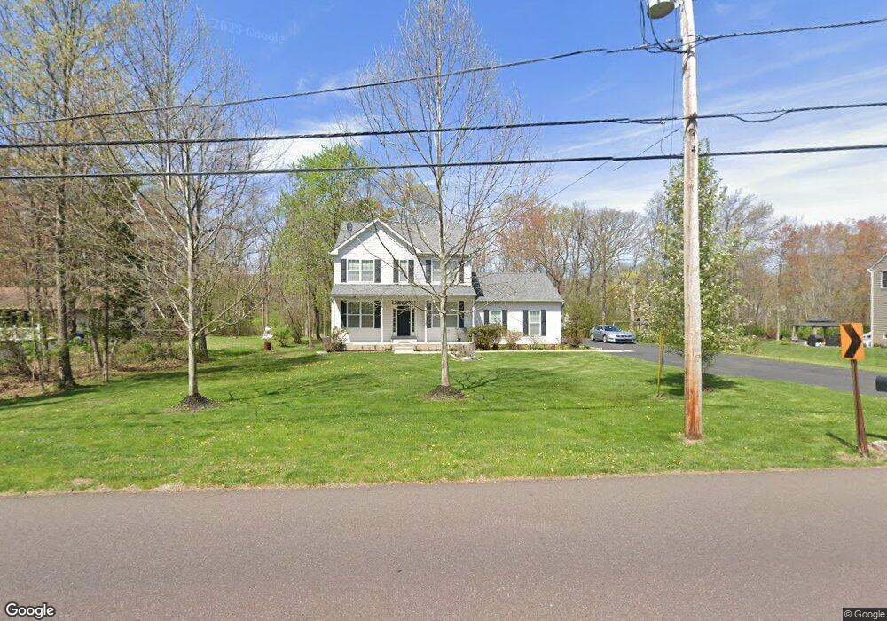
2638 Lenhart Rd Colmar, PA 18915
Estimated Value: $526,000 - $591,000
4
Beds
3
Baths
2,012
Sq Ft
$279/Sq Ft
Est. Value
About This Home
This home is located at 2638 Lenhart Rd, Colmar, PA 18915 and is currently estimated at $560,863, approximately $278 per square foot. 2638 Lenhart Rd is a home with nearby schools including A. M. Kulp Elementary School, Penndale Middle School, and North Penn Senior High School.
Ownership History
Date
Name
Owned For
Owner Type
Purchase Details
Closed on
Apr 30, 2012
Sold by
Mje Builders Inc
Bought by
Makadia Bhavin K and Makadia Ashaben
Current Estimated Value
Home Financials for this Owner
Home Financials are based on the most recent Mortgage that was taken out on this home.
Original Mortgage
$260,000
Outstanding Balance
$180,984
Interest Rate
4%
Estimated Equity
$379,879
Purchase Details
Closed on
May 12, 2011
Sold by
Pennise Cynthia M
Bought by
Mje Builders Inc
Create a Home Valuation Report for This Property
The Home Valuation Report is an in-depth analysis detailing your home's value as well as a comparison with similar homes in the area
Home Values in the Area
Average Home Value in this Area
Purchase History
| Date | Buyer | Sale Price | Title Company |
|---|---|---|---|
| Makadia Bhavin K | $325,000 | None Available | |
| Mje Builders Inc | $80,000 | None Available |
Source: Public Records
Mortgage History
| Date | Status | Borrower | Loan Amount |
|---|---|---|---|
| Open | Makadia Bhavin K | $260,000 |
Source: Public Records
Tax History Compared to Growth
Tax History
| Year | Tax Paid | Tax Assessment Tax Assessment Total Assessment is a certain percentage of the fair market value that is determined by local assessors to be the total taxable value of land and additions on the property. | Land | Improvement |
|---|---|---|---|---|
| 2025 | $6,433 | $160,670 | -- | -- |
| 2024 | $6,433 | $160,670 | -- | -- |
| 2023 | $6,157 | $160,670 | $0 | $0 |
| 2022 | $5,956 | $160,670 | $0 | $0 |
| 2021 | $5,787 | $160,670 | $0 | $0 |
| 2020 | $5,650 | $160,670 | $0 | $0 |
| 2019 | $5,556 | $160,670 | $0 | $0 |
| 2018 | $5,557 | $160,670 | $0 | $0 |
| 2017 | $5,344 | $160,670 | $0 | $0 |
| 2016 | $5,281 | $160,670 | $0 | $0 |
| 2015 | $5,070 | $160,670 | $0 | $0 |
| 2014 | $5,070 | $160,670 | $0 | $0 |
Source: Public Records
Map
Nearby Homes
- 2674 Anthony Dr
- 0002 Sydney Ln
- 83 Bethlehem Pike Unit 1213 FIRESTONE
- 83 Bethlehem Pike Unit 1106- MADISON PLAN
- 2943 E Walnut St Unit 59
- 000 Lenape Dr
- 2111 Hidden Meadow Dr
- 417 Wynstone Ct
- 303 Wynstone Ct
- 5 Fortuna Dr
- 6 Fortuna Dr
- 9 Fortuna Dr
- 8 Fortuna Dr
- 732 Cowpath Rd
- 924 Bethlehem Pike
- 6 Lantern Ln
- 1823 N Line St
- 401 Sadie Ave
- 381 Sydney Ave
- 373 Sydney Ln
- 2656 Lenhart Rd
- 2528 Lenhart Rd
- 2531 General Forst Dr
- 2547 General Forst Dr
- 2526 Lenhart Rd
- 2680 Lenhart Rd
- 2563 General Forst Dr
- 2530 General Forst Dr
- 2579 General Forst Dr
- 175 Summit Dr
- 184 Summit Dr
- 2562 General Forst Dr
- 2595 General Forst Dr
- 2708 Lenhart Rd
- 2605 Anthony Dr
- 176 Summit Dr
- 2589 Anthony Dr
- 174 Colmar Ave
- 2573 Anthony Dr
- 2522 Lenhart Rd