Estimated Value: $201,000 - $228,000
3
Beds
2
Baths
1,600
Sq Ft
$135/Sq Ft
Est. Value
About This Home
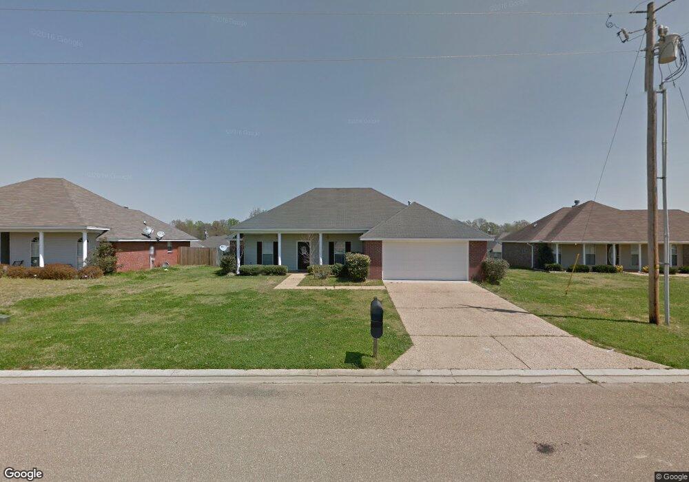
This home is located at 264 Austin Cir, Byram, MS 39272 and is currently estimated at $216,679, approximately $135 per square foot. 264 Austin Cir is a home located in Hinds County with nearby schools including Gary Road Elementary School, Gary Road Intermediate School, and Byram Middle School.
Ownership History
Date
Name
Owned For
Owner Type
Purchase Details
Closed on
May 14, 2010
Sold by
Wilson Denese H
Bought by
Snow Sean
Current Estimated Value
Home Financials for this Owner
Home Financials are based on the most recent Mortgage that was taken out on this home.
Original Mortgage
$137,754
Outstanding Balance
$92,195
Interest Rate
5.02%
Estimated Equity
$124,484
Create a Home Valuation Report for This Property
The Home Valuation Report is an in-depth analysis detailing your home's value as well as a comparison with similar homes in the area
Home Values in the Area
Average Home Value in this Area
Purchase History
| Date | Buyer | Sale Price | Title Company |
|---|---|---|---|
| Snow Sean | -- | -- |
Source: Public Records
Mortgage History
| Date | Status | Borrower | Loan Amount |
|---|---|---|---|
| Open | Snow Sean | $137,754 |
Source: Public Records
Tax History
| Year | Tax Paid | Tax Assessment Tax Assessment Total Assessment is a certain percentage of the fair market value that is determined by local assessors to be the total taxable value of land and additions on the property. | Land | Improvement |
|---|---|---|---|---|
| 2025 | $1,444 | $11,386 | $2,500 | $8,886 |
| 2024 | $1,444 | $11,145 | $2,500 | $8,645 |
| 2023 | $1,444 | $11,145 | $2,500 | $8,645 |
| 2022 | $1,714 | $11,145 | $2,500 | $8,645 |
| 2021 | $1,392 | $11,145 | $2,500 | $8,645 |
| 2020 | $1,346 | $10,988 | $2,500 | $8,488 |
| 2019 | $1,338 | $10,988 | $2,500 | $8,488 |
| 2018 | $1,338 | $10,988 | $2,500 | $8,488 |
| 2017 | $1,308 | $10,988 | $2,500 | $8,488 |
| 2016 | $1,308 | $10,988 | $2,500 | $8,488 |
| 2015 | $1,276 | $10,766 | $2,500 | $8,266 |
| 2014 | $1,254 | $10,766 | $2,500 | $8,266 |
Source: Public Records
Map
Nearby Homes
- 610 Ridge Place
- 2099 Branch Creek Dr
- 2120 Meagan Dr
- 125 Churchill Place
- 0 Crossbridge Blvd Unit 4139885
- 0 Crossbridge Blvd Unit 4139884
- 8834 Gary Rd
- 640 Statesman Dr
- 904 W Lake Dockery Dr
- 0 S Siwell Rd Unit 4088750
- 0 S Siwell Rd Unit 24872982
- 2723 Davis Rd
- 1056 Lake Dockery Rd
- 0 Byram Pkwy
- 328 Barfield Dr
- 699 Meadow Ln
- 0 Hinds Pkwy Unit 4079577
- 0 Terry Rd Unit 24270230
- 0 Terry Rd Unit 4135800
- 0 Terry Rd Unit 4130083
- 268 Austin Cir
- 260 Austin Cir
- 1047 Bullrun Dr
- 1049 Bullrun Dr
- 1043 Bullrun Dr
- 272 Austin Cir
- 229 Austin Cir
- 1051 Bullrun Dr
- 1039 Bullrun Dr
- 256 Austin Cir
- 233 Austin Cir
- 252 Austin Cir
- 1053 Bullrun Dr
- 1035 Bullrun Dr
- 248 Austin Cir
- 9904 Dupuy Dr
- 1055 Bullrun Dr
- 1031 Bullrun Dr
- 1046 Bullrun Dr
- 1048 Bullrun Dr
Your Personal Tour Guide
Ask me questions while you tour the home.