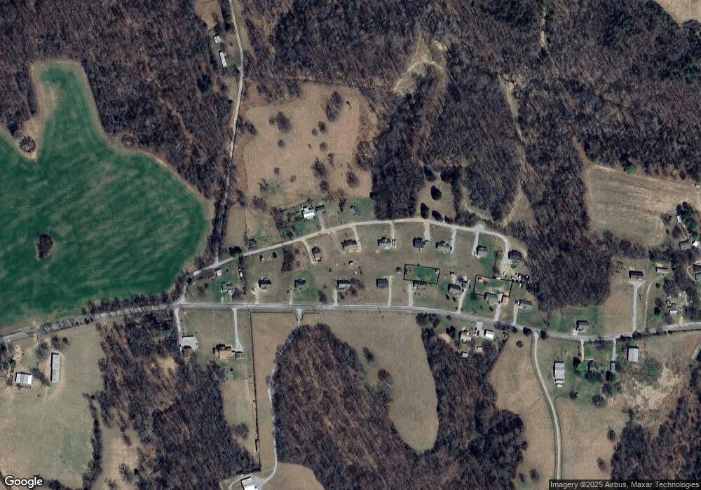
264 Johns Cemetery Rd Pulaski, TN 38478
Estimated Value: $169,000 - $291,000
3
Beds
2
Baths
1,300
Sq Ft
$172/Sq Ft
Est. Value
About This Home
This home is located at 264 Johns Cemetery Rd, Pulaski, TN 38478 and is currently estimated at $223,505, approximately $171 per square foot. 264 Johns Cemetery Rd is a home located in Giles County with nearby schools including Richland Elementary School and Richland School.
Ownership History
Date
Name
Owned For
Owner Type
Purchase Details
Closed on
Nov 23, 2022
Sold by
Bass Donna
Bought by
Polk Shavonda M
Current Estimated Value
Home Financials for this Owner
Home Financials are based on the most recent Mortgage that was taken out on this home.
Original Mortgage
$115,371
Outstanding Balance
$111,793
Interest Rate
6.95%
Mortgage Type
FHA
Estimated Equity
$111,712
Purchase Details
Closed on
May 31, 2007
Bought by
Bass Donna
Create a Home Valuation Report for This Property
The Home Valuation Report is an in-depth analysis detailing your home's value as well as a comparison with similar homes in the area
Home Values in the Area
Average Home Value in this Area
Purchase History
| Date | Buyer | Sale Price | Title Company |
|---|---|---|---|
| Polk Shavonda M | $117,500 | Giles Title And Escrow | |
| Bass Donna | $21,800 | -- |
Source: Public Records
Mortgage History
| Date | Status | Borrower | Loan Amount |
|---|---|---|---|
| Open | Polk Shavonda M | $115,371 |
Source: Public Records
Tax History Compared to Growth
Tax History
| Year | Tax Paid | Tax Assessment Tax Assessment Total Assessment is a certain percentage of the fair market value that is determined by local assessors to be the total taxable value of land and additions on the property. | Land | Improvement |
|---|---|---|---|---|
| 2025 | $746 | $37,550 | $0 | $0 |
| 2024 | $746 | $37,550 | $5,225 | $32,325 |
| 2023 | $746 | $37,550 | $5,225 | $32,325 |
| 2022 | $746 | $37,550 | $5,225 | $32,325 |
| 2021 | $673 | $23,825 | $2,425 | $21,400 |
| 2020 | $673 | $23,825 | $2,425 | $21,400 |
| 2019 | $673 | $23,825 | $2,425 | $21,400 |
| 2018 | $673 | $23,825 | $2,425 | $21,400 |
| 2017 | $673 | $23,825 | $2,425 | $21,400 |
| 2016 | $678 | $22,825 | $2,375 | $20,450 |
| 2015 | $633 | $22,825 | $2,375 | $20,450 |
| 2014 | $633 | $22,830 | $0 | $0 |
Source: Public Records
Map
Nearby Homes
- 226 Sands Rd
- 310 Sands Rd
- 0 Lewisburg Hwy Unit RTC3033027
- 0 Lewisburg Hwy Unit RTC2811267
- 600 Blooming Grove Rd
- 4768 Lewisburg Hwy
- 255 Blooming Grove Rd
- 161 Woodlawn Rd
- 790 Blooming Grove Rd
- 155 Poling Dr
- 220 Poling Dr
- 232 Poling Dr
- 5251 Lewisburg Hwy
- 440 Big Spring Hollow Rd
- 101 Paula Place
- 3345 Pigeon Roost Rd
- 410 Britton Hollow Rd
- 1448 Williams Hollow Rd
- 605 Cedar Hurst Ln
- 1450 Highway 64
- 264 Johns Cemetery Rd
- 270 Johns Cemetery Rd
- 441 Powell Chapel Rd
- 260 Johns Cemetery Rd
- 445 Powell Chapel Rd
- 201 Johns Cemetery Rd
- 421 Powell Chapel Rd
- 274 Johns Cemetery Rd
- 451 Powell Chapel Rd
- 415 Powell Chapel Rd
- 461 Powell Chapel Rd
- 288 Johns Cemetery Rd
- 288 Johns Cemetery Rd
- 288 Johns Cemetery Rd
- 405 Powell Chapel Rd
- 466 Powell Chapel Rd
- 400 Powell Chapel Rd
- 292 Johns Cemetery Rd
- 477 Powell Chapel Rd
- 396 Powell Chapel Rd
