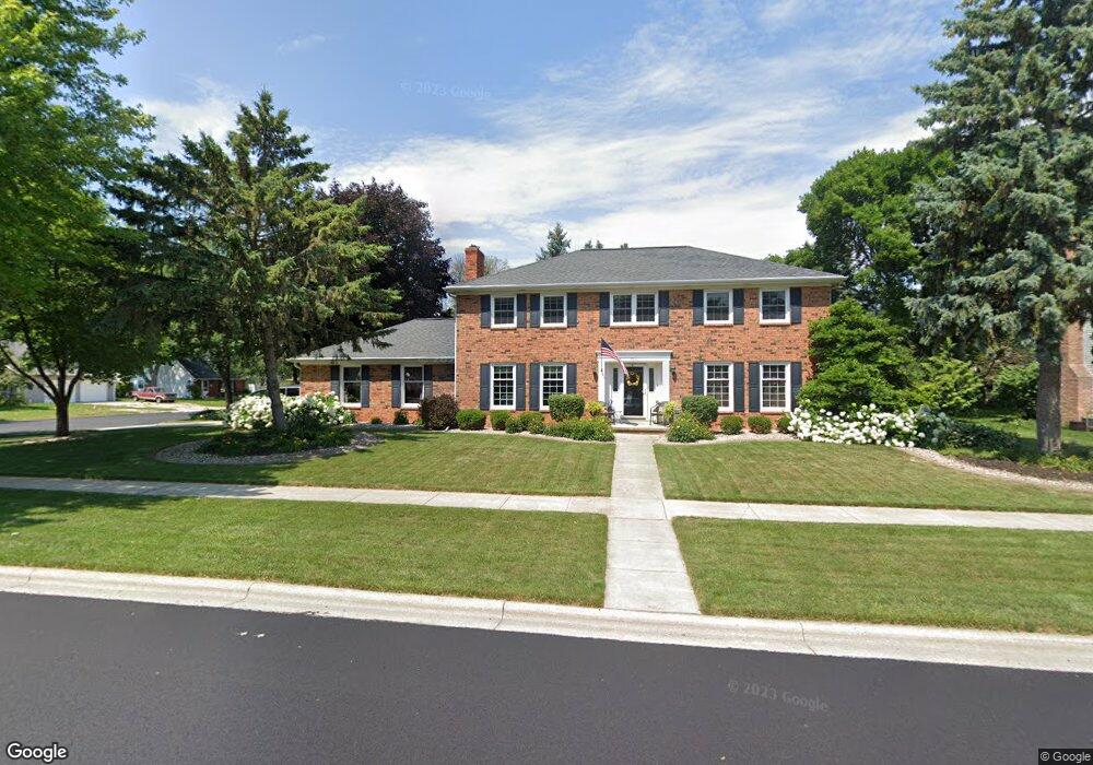
264 Lorrie Way de Pere, WI 54115
Estimated Value: $412,529 - $490,000
4
Beds
3
Baths
2,500
Sq Ft
$185/Sq Ft
Est. Value
About This Home
This home is located at 264 Lorrie Way, de Pere, WI 54115 and is currently estimated at $461,882, approximately $184 per square foot. 264 Lorrie Way is a home located in Brown County with nearby schools including Dickinson Elementary School, Foxview Intermediate School, and De Pere Middle School.
Ownership History
Date
Name
Owned For
Owner Type
Purchase Details
Closed on
Dec 1, 2011
Sold by
Sullivan Timothy W and Brown Sullivan Cynthia J
Bought by
Dickert Jeffrey P
Current Estimated Value
Home Financials for this Owner
Home Financials are based on the most recent Mortgage that was taken out on this home.
Original Mortgage
$209,000
Outstanding Balance
$143,723
Interest Rate
4.12%
Mortgage Type
New Conventional
Estimated Equity
$318,159
Create a Home Valuation Report for This Property
The Home Valuation Report is an in-depth analysis detailing your home's value as well as a comparison with similar homes in the area
Home Values in the Area
Average Home Value in this Area
Purchase History
| Date | Buyer | Sale Price | Title Company |
|---|---|---|---|
| Dickert Jeffrey P | $220,000 | Bay Title & Abstract |
Source: Public Records
Mortgage History
| Date | Status | Borrower | Loan Amount |
|---|---|---|---|
| Open | Dickert Jeffrey P | $209,000 |
Source: Public Records
Tax History Compared to Growth
Tax History
| Year | Tax Paid | Tax Assessment Tax Assessment Total Assessment is a certain percentage of the fair market value that is determined by local assessors to be the total taxable value of land and additions on the property. | Land | Improvement |
|---|---|---|---|---|
| 2024 | $4,947 | $349,600 | $50,200 | $299,400 |
| 2023 | $4,524 | $333,000 | $50,200 | $282,800 |
| 2022 | $4,324 | $302,300 | $50,200 | $252,100 |
| 2021 | $3,971 | $263,100 | $41,900 | $221,200 |
| 2020 | $4,085 | $247,100 | $48,400 | $198,700 |
| 2019 | $4,277 | $237,100 | $48,400 | $188,700 |
| 2018 | $4,358 | $219,900 | $48,400 | $171,500 |
| 2017 | $4,487 | $219,900 | $48,400 | $171,500 |
| 2016 | $4,558 | $219,900 | $48,400 | $171,500 |
| 2015 | $4,748 | $219,900 | $48,400 | $171,500 |
| 2014 | $4,715 | $219,900 | $48,400 | $171,500 |
| 2013 | $4,715 | $219,900 | $48,400 | $171,500 |
Source: Public Records
Map
Nearby Homes
- 1861 Chicago St
- 318 S Webster Ave
- 103 Zita St
- 324 S Ontario St
- 1219 Irwin Ave
- 120 N Winnebago St
- 1421 Ridgeway Dr Unit 1423
- 303 S Huron St
- 1020 Franklin St
- 801 S Erie St
- 1766 Camarillo Ct
- 124 Shelley Ln
- 607 N Winnebago St
- 1202 Ridgeway Blvd
- 1807 Ridgeway Dr Unit 35
- 907 Fulton St
- 166 Brule Rd
- 636 N Erie St
- 1004 Gulfstream Ct
- 1611 N Honeysuckle Cir
- 254 Lorrie Way
- 253 Scout Way
- 247 Scout Way
- 1478 Barbara Ln
- 265 Lorrie Way
- 1484 Barbara Ln
- 244 Lorrie Way
- 255 Lorrie Way
- 1472 Barbara Ln
- 241 Scout Way
- 1502 Barbara Ln
- 245 Lorrie Way
- 1466 Barbara Ln
- 234 Lorrie Way
- 1481 Chicago St
- 1487 Chicago St
- 262 Nob Hill Ln
- 233 Scout Way
- 1475 Chicago St
- 252 Nob Hill Ln