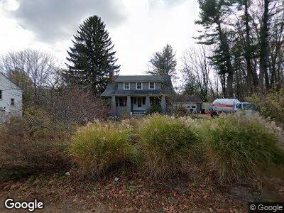
264 Main St Boylston, MA 01505
Estimated Value: $495,000 - $543,000
4
Beds
2
Baths
1,898
Sq Ft
$271/Sq Ft
Est. Value
About This Home
This home is located at 264 Main St, Boylston, MA 01505 and is currently estimated at $514,172, approximately $270 per square foot. 264 Main St is a home located in Worcester County with nearby schools including Tahanto Regional High School and Central New England Christian Academy.
Ownership History
Date
Name
Owned For
Owner Type
Purchase Details
Closed on
Apr 25, 2003
Sold by
264 Main St Rt
Bought by
Abelson Matthew D and Holley Elizabeth A
Current Estimated Value
Home Financials for this Owner
Home Financials are based on the most recent Mortgage that was taken out on this home.
Original Mortgage
$176,000
Interest Rate
5.64%
Mortgage Type
Purchase Money Mortgage
Create a Home Valuation Report for This Property
The Home Valuation Report is an in-depth analysis detailing your home's value as well as a comparison with similar homes in the area
Home Values in the Area
Average Home Value in this Area
Purchase History
| Date | Buyer | Sale Price | Title Company |
|---|---|---|---|
| Abelson Matthew D | $220,000 | -- |
Source: Public Records
Mortgage History
| Date | Status | Borrower | Loan Amount |
|---|---|---|---|
| Open | 264 Main St Rt | $154,400 | |
| Closed | 264 Main St Rt | $176,000 | |
| Previous Owner | 264 Main St Rt | $292,500 |
Source: Public Records
Tax History Compared to Growth
Tax History
| Year | Tax Paid | Tax Assessment Tax Assessment Total Assessment is a certain percentage of the fair market value that is determined by local assessors to be the total taxable value of land and additions on the property. | Land | Improvement |
|---|---|---|---|---|
| 2025 | $6,306 | $456,000 | $238,200 | $217,800 |
| 2024 | $5,601 | $405,600 | $229,000 | $176,600 |
| 2023 | $5,841 | $405,600 | $229,000 | $176,600 |
| 2022 | $6,425 | $405,600 | $229,000 | $176,600 |
| 2021 | $6,863 | $404,200 | $229,000 | $175,200 |
| 2020 | $6,108 | $369,300 | $230,600 | $138,700 |
| 2019 | $5,656 | $352,600 | $230,600 | $122,000 |
| 2018 | $5,815 | $347,600 | $230,600 | $117,000 |
| 2017 | $5,603 | $347,600 | $230,600 | $117,000 |
| 2016 | $5,486 | $335,100 | $217,400 | $117,700 |
| 2015 | $5,834 | $335,100 | $217,400 | $117,700 |
| 2014 | $5,514 | $317,100 | $204,200 | $112,900 |
Source: Public Records
Map
Nearby Homes
- 130 Nicholas Ave
- 48 Poe Ave
- 7 Birchwood Dr
- 2 Brooke Rd
- 19 Stockton St
- 18 Highland St
- 2 Burkhardt Cir Unit 5
- 28 Sewall St
- 627 Edgebrook Dr Unit 627
- 267 Gulf St
- 231 Gulf St
- 915 Edgebrook Dr
- 148 Angell Brook Dr Unit 148
- 122 Angell Brook Dr Unit 122
- 6 Candlewood Way
- 5 Sewall St Unit 259
- 6 Diamond Hill Ave
- 575 Main St Unit B
- 47 Browning Rd
- 16 Bryant Ave
- 264 Main St
- 266 Main St
- 266 Main St Unit 2
- 266 Main St Unit 1
- 274 Main St
- 248 Main St
- 278 Main St
- 244 Main St
- 240 Main St
- 236 Main St
- 284 Main St Unit 286
- 230 Main St
- 131 Nicholas Ave
- 132 Nicholas Ave
- 5 Brookside Ave
- 9 Brookside Ave
- 126 Nicholas Ave
- 119 Nicholas Ave
- 111 Nicholas Ave
- 19 Brookside Ave