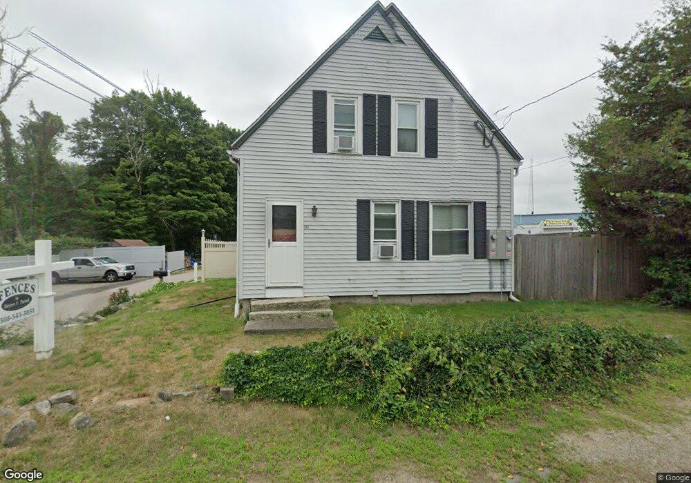
264 Main St Foxboro, MA 02035
Estimated Value: $632,627
--
Bed
1
Bath
--
Sq Ft
0.52
Acres
About This Home
This home is located at 264 Main St, Foxboro, MA 02035 and is currently estimated at $632,627. 264 Main St is a home located in Norfolk County with nearby schools including Foxborough High School, Foxborough Regional Charter School, and The Sage School.
Ownership History
Date
Name
Owned For
Owner Type
Purchase Details
Closed on
Oct 15, 2012
Sold by
Panek Steven F and Panek Deborah J
Bought by
Panek Steven F
Current Estimated Value
Purchase Details
Closed on
Jan 31, 1990
Sold by
Tharp Elizabeth M
Bought by
Panek Steven F
Home Financials for this Owner
Home Financials are based on the most recent Mortgage that was taken out on this home.
Original Mortgage
$122,800
Interest Rate
9.59%
Mortgage Type
Commercial
Create a Home Valuation Report for This Property
The Home Valuation Report is an in-depth analysis detailing your home's value as well as a comparison with similar homes in the area
Home Values in the Area
Average Home Value in this Area
Purchase History
| Date | Buyer | Sale Price | Title Company |
|---|---|---|---|
| Panek Steven F | -- | -- | |
| Panek Steven F | -- | -- | |
| Panek Steven F | $148,000 | -- |
Source: Public Records
Mortgage History
| Date | Status | Borrower | Loan Amount |
|---|---|---|---|
| Previous Owner | Panek Steven F | $102,000 | |
| Previous Owner | Panek Steven F | $122,800 |
Source: Public Records
Tax History Compared to Growth
Tax History
| Year | Tax Paid | Tax Assessment Tax Assessment Total Assessment is a certain percentage of the fair market value that is determined by local assessors to be the total taxable value of land and additions on the property. | Land | Improvement |
|---|---|---|---|---|
| 2025 | -- | $342,200 | $164,800 | $177,400 |
| 2024 | -- | $330,800 | $177,500 | $153,300 |
| 2023 | $0 | $318,100 | $177,500 | $140,600 |
| 2022 | $0 | $320,800 | $183,100 | $137,700 |
| 2021 | $0 | $311,400 | $173,900 | $137,500 |
| 2020 | $0 | $311,400 | $173,900 | $137,500 |
| 2019 | $0 | $274,600 | $163,300 | $111,300 |
| 2018 | $0 | $266,700 | $155,100 | $111,600 |
| 2017 | $0 | $274,900 | $163,300 | $111,600 |
| 2016 | -- | $270,300 | $154,700 | $115,600 |
| 2015 | -- | $236,800 | $121,200 | $115,600 |
| 2014 | -- | $236,800 | $121,200 | $115,600 |
Source: Public Records
Map
Nearby Homes
- 131 Washington St Unit 42
- 11 Goodwin Dr
- 25 Foxboro Rd
- 65 Pond St
- 7 Hill St Unit 10
- 71 Pond St
- 362 East St
- 1 Lorraine Metcalf Dr
- 483 Thurston St
- 11 Orchard Place Unit 11
- 155 Clark Rd Unit 155
- 270 Dedham St
- 14 Baker St
- 120 Hawes St
- 14 Foxhill Rd
- 24 Mechanic St
- 16R Eldor Dr
- 10 W Birch Rd
- 375 Winter St
- 80 Mill St
- 131 Washtington St Unit 42
- 131 Washington St Unit 69
- 131 Washington St Unit 56
- 131 Washington St Unit 68
- 131 Washington St Unit 31
- 131 Washington St Unit 19
- 131 Washington St Unit 3
- 131 Washington St Unit 64
- 131 Washington St Unit 62
- 131 Washington St Unit 65
- 131 Washington St Unit 6
- 131 Washington St Unit 22
- 131 Washington St Unit 45
- 131 Washington St Unit 51
- 131 Washington St Unit 7
- 131 Washington St Unit 35
- 131 Washington St Unit 55
- 131 Washington St Unit 70
- 131 Washington St Unit 52
- 131 Washington St Unit Lot 34