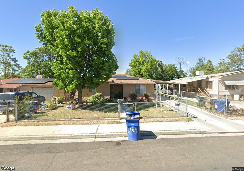
2642 Security Ave Bakersfield, CA 93306
West Pioneer Dr NeighborhoodEstimated Value: $218,000 - $251,000
3
Beds
1
Bath
903
Sq Ft
$259/Sq Ft
Est. Value
About This Home
This home is located at 2642 Security Ave, Bakersfield, CA 93306 and is currently estimated at $234,215, approximately $259 per square foot. 2642 Security Ave is a home located in Kern County with nearby schools including Horace Mann Elementary School, Emerson Middle School, and East Bakersfield High School.
Ownership History
Date
Name
Owned For
Owner Type
Purchase Details
Closed on
Oct 5, 2015
Sold by
Welty Natalie Deroza
Bought by
Mendoza Alberto
Current Estimated Value
Purchase Details
Closed on
Jul 7, 2005
Sold by
Raya Reynaldo C
Bought by
Raya Reynaldo C and Raya Martha H
Home Financials for this Owner
Home Financials are based on the most recent Mortgage that was taken out on this home.
Original Mortgage
$122,400
Interest Rate
5.55%
Mortgage Type
New Conventional
Create a Home Valuation Report for This Property
The Home Valuation Report is an in-depth analysis detailing your home's value as well as a comparison with similar homes in the area
Home Values in the Area
Average Home Value in this Area
Purchase History
| Date | Buyer | Sale Price | Title Company |
|---|---|---|---|
| Mendoza Alberto | $40,000 | None Available | |
| Raya Reynaldo C | -- | Commonwealth Title |
Source: Public Records
Mortgage History
| Date | Status | Borrower | Loan Amount |
|---|---|---|---|
| Previous Owner | Raya Reynaldo C | $122,400 |
Source: Public Records
Tax History Compared to Growth
Tax History
| Year | Tax Paid | Tax Assessment Tax Assessment Total Assessment is a certain percentage of the fair market value that is determined by local assessors to be the total taxable value of land and additions on the property. | Land | Improvement |
|---|---|---|---|---|
| 2025 | $1,886 | $89,175 | $22,494 | $66,681 |
| 2024 | $1,825 | $87,428 | $22,053 | $65,375 |
| 2023 | $1,825 | $85,715 | $21,621 | $64,094 |
| 2022 | $1,737 | $84,036 | $21,198 | $62,838 |
| 2021 | $1,640 | $82,390 | $20,783 | $61,607 |
| 2020 | $1,603 | $81,546 | $20,570 | $60,976 |
| 2019 | $1,546 | $81,546 | $20,570 | $60,976 |
| 2018 | $1,502 | $78,382 | $19,772 | $58,610 |
| 2017 | $1,483 | $76,847 | $19,385 | $57,462 |
| 2016 | $1,282 | $75,341 | $19,005 | $56,336 |
| 2015 | $1,280 | $74,211 | $18,720 | $55,491 |
| 2014 | $1,215 | $70,000 | $18,000 | $52,000 |
Source: Public Records
Map
Nearby Homes
- 2509 Monterey St
- 909 Pentz St
- 2414 Kentucky St
- 2526 Monterey St
- 2700 Monterey St
- 2524 Monterey St
- 2801 Lake St
- 2414 Steele Ave
- 2199 Edison Hwy
- 2525 Avenida Escuela
- 2110 Center St
- 1623 Camino Primavera
- 2601 Lucky St
- 900 Quantico Ave
- 2400 Lucky St
- 2915 Edison Hwy
- 2301 Pacific Dr
- 2311 Quincy Dr
- 1704 Camino Primavera
- 2117 Kentucky St
- 2638 Security Ave
- 2636 Security Ave
- 2650 Security Ave
- 2641 Center St
- 2639 Center St
- 2647 Center St
- 2634 Security Ave
- 2637 Center St
- 2649 Center St
- 2641 Security Ave
- 2637 Security Ave
- 2632 Security Ave
- 2633 Center St
- 2645 Security Ave
- 2651 Center St
- 800 Barlow St
- 806 Barlow St
- 2651 Security Ave
- 2631 Center St
- 2633 Security Ave