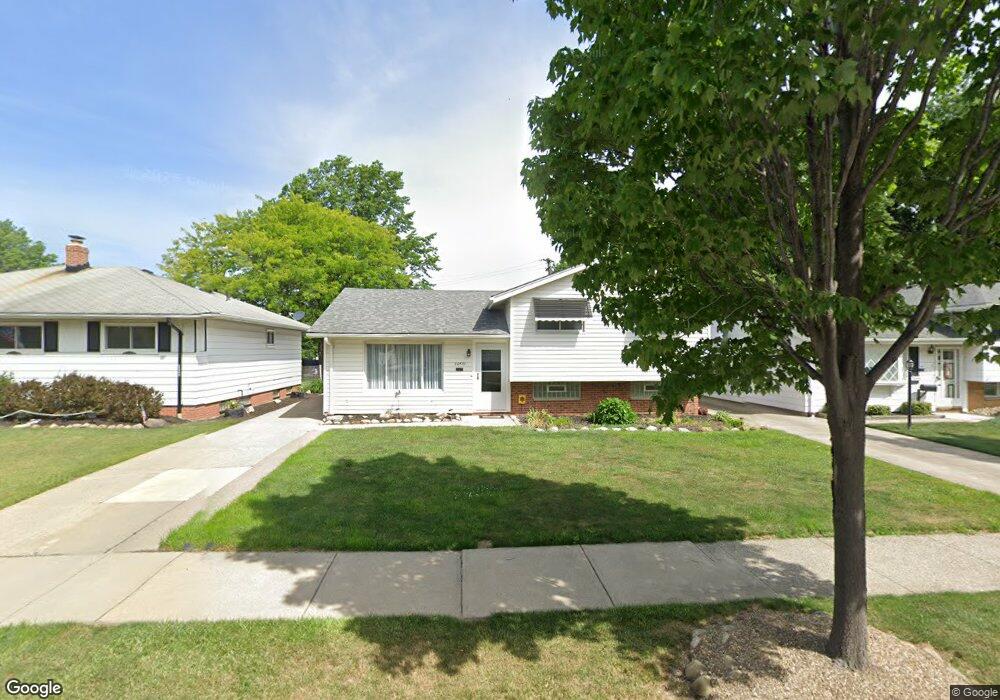
26431 Aaron Dr Euclid, OH 44132
Estimated Value: $149,000 - $185,000
4
Beds
2
Baths
1,892
Sq Ft
$91/Sq Ft
Est. Value
About This Home
This home is located at 26431 Aaron Dr, Euclid, OH 44132 and is currently estimated at $171,475, approximately $90 per square foot. 26431 Aaron Dr is a home located in Cuyahoga County with nearby schools including Shoreview Elementary School, Euclid High School, and Ss Robert & William Catholic School.
Ownership History
Date
Name
Owned For
Owner Type
Purchase Details
Closed on
Sep 16, 2009
Sold by
Souchik Sophie I and Souchik Sophie
Bought by
Fears Timothy
Current Estimated Value
Home Financials for this Owner
Home Financials are based on the most recent Mortgage that was taken out on this home.
Original Mortgage
$99,857
Outstanding Balance
$65,736
Interest Rate
5.32%
Mortgage Type
FHA
Estimated Equity
$105,739
Purchase Details
Closed on
Nov 19, 1992
Sold by
Souchik Walter F and Souchik Sophie I
Bought by
Souchik Sophie
Purchase Details
Closed on
Jan 24, 1986
Sold by
Souchik Walter F and Souchik Sophie I
Bought by
Souchik Walter F and Souchik Sophie I
Purchase Details
Closed on
Jan 1, 1975
Bought by
Souchik Walter F and Souchik Sophie I
Create a Home Valuation Report for This Property
The Home Valuation Report is an in-depth analysis detailing your home's value as well as a comparison with similar homes in the area
Home Values in the Area
Average Home Value in this Area
Purchase History
| Date | Buyer | Sale Price | Title Company |
|---|---|---|---|
| Fears Timothy | $101,700 | Attorney | |
| Souchik Sophie | -- | -- | |
| Souchik Walter F | -- | -- | |
| Souchik Walter F | -- | -- |
Source: Public Records
Mortgage History
| Date | Status | Borrower | Loan Amount |
|---|---|---|---|
| Open | Fears Timothy | $99,857 |
Source: Public Records
Tax History
| Year | Tax Paid | Tax Assessment Tax Assessment Total Assessment is a certain percentage of the fair market value that is determined by local assessors to be the total taxable value of land and additions on the property. | Land | Improvement |
|---|---|---|---|---|
| 2024 | $3,927 | $57,575 | $8,470 | $49,105 |
| 2023 | $3,242 | $37,670 | $6,410 | $31,260 |
| 2022 | $3,168 | $37,660 | $6,410 | $31,260 |
| 2021 | $3,530 | $37,660 | $6,410 | $31,260 |
| 2020 | $3,348 | $32,480 | $5,530 | $26,950 |
| 2019 | $3,011 | $92,800 | $15,800 | $77,000 |
| 2018 | $3,045 | $32,480 | $5,530 | $26,950 |
| 2017 | $3,308 | $29,550 | $4,590 | $24,960 |
| 2016 | $3,315 | $29,550 | $4,590 | $24,960 |
| 2015 | $3,016 | $29,550 | $4,590 | $24,960 |
| 2014 | $3,016 | $29,550 | $4,590 | $24,960 |
Source: Public Records
Map
Nearby Homes
- 825 E 256th St
- 26430 Drakefield Ave
- 815 E 272nd St
- 25650 Richards Ave
- 643 E 261st St
- 25700 Briardale Ave
- 25751 Briardale Ave
- 26351 Farringdon Ave
- 571 E 260th St
- 25671 Farringdon Ave
- 610 E 266th St
- 25401 Farringdon Ave
- 27190 Zeman Ave
- 25731 Zeman Ave
- 26471 Shoreview Ave
- 670 Hemlock Dr
- 890 E 250th St
- 26831 Shoreview Ave
- 24571 Alberton Rd
- 464 E 250th St
- 26409 Aaron Dr
- 26451 Aaron Dr
- 26381 Aaron Dr
- 26475 Aaron Dr
- 26412 Leslie Ave
- 26364 Leslie Ave
- 26361 Aaron Dr
- 26340 Leslie Ave
- 26432 Aaron Dr
- 26456 Aaron Dr
- 26408 Aaron Dr
- 26480 Aaron Dr
- 26384 Aaron Dr
- 26316 Leslie Ave
- 26335 Aaron Dr
- 26504 Aaron Dr
- 26360 Aaron Dr
- 26292 Leslie Ave
- 26311 Aaron Dr
- 26407 Benton Ave