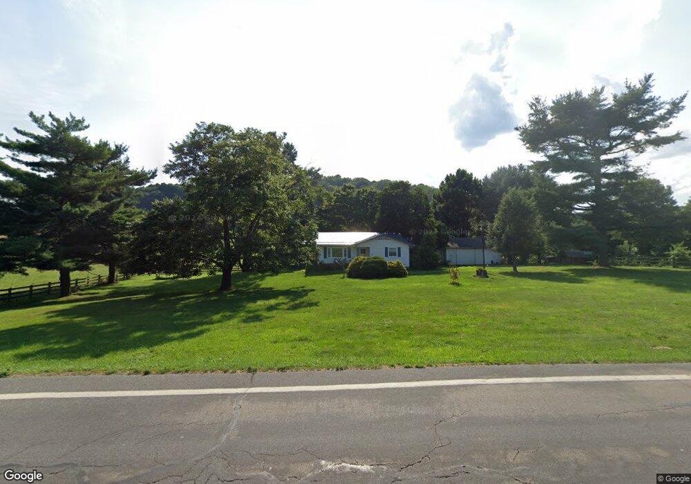
2644 State Route 60 Loudonville, OH 44842
Estimated Value: $172,282 - $216,000
1
Bed
2
Baths
1,000
Sq Ft
$198/Sq Ft
Est. Value
About This Home
This home is located at 2644 State Route 60, Loudonville, OH 44842 and is currently estimated at $198,071, approximately $198 per square foot. 2644 State Route 60 is a home located in Ashland County with nearby schools including McMullen Elementary School, Budd Elementary School, and Loudonville High School.
Ownership History
Date
Name
Owned For
Owner Type
Purchase Details
Closed on
Sep 19, 2025
Sold by
James And Elizabeth Smithhisler Living T and Norman Sandra A
Bought by
Searls Brian
Current Estimated Value
Home Financials for this Owner
Home Financials are based on the most recent Mortgage that was taken out on this home.
Original Mortgage
$217,250
Outstanding Balance
$217,250
Interest Rate
6.63%
Mortgage Type
New Conventional
Estimated Equity
-$19,179
Purchase Details
Closed on
Jan 1, 1990
Bought by
Smithhisler James F
Create a Home Valuation Report for This Property
The Home Valuation Report is an in-depth analysis detailing your home's value as well as a comparison with similar homes in the area
Home Values in the Area
Average Home Value in this Area
Purchase History
| Date | Buyer | Sale Price | Title Company |
|---|---|---|---|
| Searls Brian | $225,000 | Southern Title | |
| Smithhisler James F | -- | -- |
Source: Public Records
Mortgage History
| Date | Status | Borrower | Loan Amount |
|---|---|---|---|
| Open | Searls Brian | $217,250 |
Source: Public Records
Tax History Compared to Growth
Tax History
| Year | Tax Paid | Tax Assessment Tax Assessment Total Assessment is a certain percentage of the fair market value that is determined by local assessors to be the total taxable value of land and additions on the property. | Land | Improvement |
|---|---|---|---|---|
| 2024 | $1,770 | $44,740 | $7,770 | $36,970 |
| 2023 | $1,770 | $44,740 | $7,770 | $36,970 |
| 2022 | $1,400 | $30,860 | $5,360 | $25,500 |
| 2021 | $1,389 | $30,860 | $5,360 | $25,500 |
| 2020 | $1,309 | $30,860 | $5,360 | $25,500 |
| 2019 | $1,257 | $29,150 | $5,650 | $23,500 |
| 2018 | $1,265 | $29,150 | $5,650 | $23,500 |
| 2017 | $1,081 | $29,150 | $5,650 | $23,500 |
| 2016 | $1,081 | $25,350 | $4,910 | $20,440 |
| 2015 | $1,074 | $25,350 | $4,910 | $20,440 |
| 2013 | $1,146 | $26,680 | $4,920 | $21,760 |
Source: Public Records
Map
Nearby Homes
- 2818 Township Road 2812
- 1406 Pearl Dr
- 609 Ohio 95
- 723 Pearl Dr
- 500 Stone Meadow Cir
- 560 Township Road 2402
- 524 N Union St
- 513 N Mount Vernon Ave
- 333 E Campbell St
- 518 Snyder Dr
- 316 E Campbell St
- 526 E Campbell St
- 0 County Road 917
- 136 Bridge St
- 968 Township Road 2506
- 0 Township Road 925
- 78 Forest Hill Rd
- 0 Ashland County Road 2175
- 0 Ashland County Road 2175
- 1002 Industrial Park
- 2665 State Route 60
- 583 County Road 2575
- 2621 State Route 60
- 2618 Ohio 60
- 568 County Road 2575
- 2684 State Route 60
- 2683 State Route 60
- 2619 Ohio 60
- 2607 Ohio 60
- 2607 State Route 60
- 2597 State Route 60
- 552 County Road 2575
- 2597 Ohio 60
- 2589 State Route 60
- 526 County Road 2575
- 528 County Road 2575
- 2585 Ohio 60
- 2585 State Route 60
- 2704 State Route 60