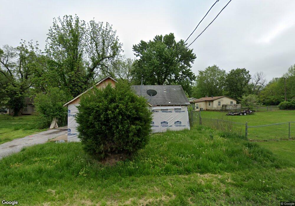
2646 W Calhoun St Springfield, MO 65802
Heart of the Westside NeighborhoodEstimated Value: $115,580 - $138,000
3
Beds
1
Bath
1,044
Sq Ft
$121/Sq Ft
Est. Value
About This Home
This home is located at 2646 W Calhoun St, Springfield, MO 65802 and is currently estimated at $126,395, approximately $121 per square foot. 2646 W Calhoun St is a home located in Greene County with nearby schools including Bissett Elementary School, Pipkin Middle School, and Central High School.
Ownership History
Date
Name
Owned For
Owner Type
Purchase Details
Closed on
Oct 25, 2019
Sold by
Deckard Kenneth and Deckard Lauren
Bought by
Sandoz Michael
Current Estimated Value
Purchase Details
Closed on
Jun 10, 2012
Sold by
Deckard Mike
Bought by
Deckard Kenner and Henxianj Lawerne
Purchase Details
Closed on
Oct 2, 2007
Sold by
Anderson Tina L
Bought by
Deckard Michael W
Purchase Details
Closed on
May 24, 2006
Sold by
Murrell Shirley A
Bought by
Anderson Tina L and Deckard Michael W
Create a Home Valuation Report for This Property
The Home Valuation Report is an in-depth analysis detailing your home's value as well as a comparison with similar homes in the area
Home Values in the Area
Average Home Value in this Area
Purchase History
| Date | Buyer | Sale Price | Title Company |
|---|---|---|---|
| Sandoz Michael | -- | None Available | |
| Deckard Kenner | -- | None Available | |
| Deckard Michael W | -- | None Available | |
| Anderson Tina L | -- | None Available |
Source: Public Records
Tax History
| Year | Tax Paid | Tax Assessment Tax Assessment Total Assessment is a certain percentage of the fair market value that is determined by local assessors to be the total taxable value of land and additions on the property. | Land | Improvement |
|---|---|---|---|---|
| 2025 | $379 | $7,600 | $3,040 | $4,560 |
| 2024 | $308 | $5,740 | $1,900 | $3,840 |
| 2023 | $306 | $5,740 | $1,900 | $3,840 |
| 2022 | $312 | $5,720 | $1,900 | $3,820 |
| 2021 | $312 | $5,720 | $1,900 | $3,820 |
| 2020 | $321 | $5,620 | $1,900 | $3,720 |
| 2019 | $312 | $5,620 | $1,900 | $3,720 |
| 2018 | $344 | $6,210 | $1,900 | $4,310 |
| 2017 | $341 | $6,210 | $1,900 | $4,310 |
| 2016 | $340 | $6,210 | $1,900 | $4,310 |
| 2015 | $337 | $6,210 | $1,900 | $4,310 |
| 2014 | $337 | $6,160 | $1,900 | $4,260 |
Source: Public Records
Map
Nearby Homes
- 1120 N Fulbright Ave
- 1103 N Ethyl Ave
- 1037 N Fulbright Ave
- 1347 N Brown Ave
- 1024 N Brown Ave
- 2435 W Calhoun St
- 2809 W Nichols St
- 939 N Brown Ave
- 1031 N Forest Ave
- 906 N Brown Ave
- 2609 W Brower St
- 2930 W Lynn St
- 1418 N Forest Ave
- 2646 W Brower St
- 928 N Glenn Ave
- 811 N West Ave
- 2336 W Nichols St
- 2944 W Lynn St
- 1229 N Warren Ave
- 810 N West Ave
- 1218 N Fulbright Ave
- 1225 N Ethyl Ave
- 1217 N Ethyl Ave
- 1214 N Fulbright Ave
- 1213 N Ethyl Ave
- 1300 N Fulbright Ave
- 0 Ethyl Ave
- 1400 N Ethyl Ave
- 1400 N Ethyl Ave
- 1307 N Ethyl Ave
- 1207 N Ethyl Ave
- 1202 N Fulbright Ave
- 1310 N Fulbright Ave
- 1224 N Ethyl Ave
- 1311 N Ethyl Ave
- 1234 N Ethyl Ave
- 1229 N Fulbright Ave
- 1216 N Ethyl Ave
- 1201 N Ethyl Ave
- 1140 N Fulbright Ave
Your Personal Tour Guide
Ask me questions while you tour the home.