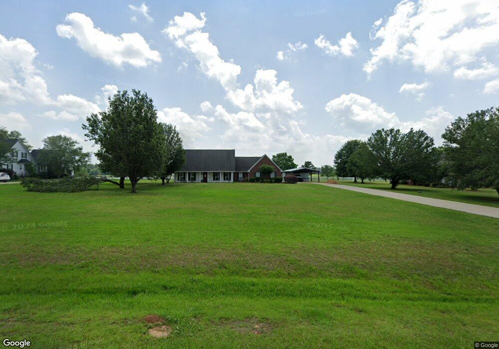
2647 Quail Ridge Rd West Point, MS 39773
Estimated Value: $304,000 - $478,000
4
Beds
--
Bath
3,162
Sq Ft
$121/Sq Ft
Est. Value
About This Home
This home is located at 2647 Quail Ridge Rd, West Point, MS 39773 and is currently estimated at $381,804, approximately $120 per square foot. 2647 Quail Ridge Rd is a home located in Clay County with nearby schools including East Side Elementary School, West Clay Elementary School, and Church Hill Elementary School.
Ownership History
Date
Name
Owned For
Owner Type
Purchase Details
Closed on
May 26, 2022
Sold by
Patricia Greer
Bought by
Obrien Timothy P and Obrien Hailey S
Current Estimated Value
Purchase Details
Closed on
Nov 15, 2013
Sold by
Rhea H Frank and Rhea Linda N
Bought by
Lewis Edwin A and Lewis Laura J
Create a Home Valuation Report for This Property
The Home Valuation Report is an in-depth analysis detailing your home's value as well as a comparison with similar homes in the area
Purchase History
| Date | Buyer | Sale Price | Title Company |
|---|---|---|---|
| Obrien Timothy P | -- | Edward Storey Marshall Helvest | |
| Lewis Edwin A | -- | -- |
Source: Public Records
Tax History
| Year | Tax Paid | Tax Assessment Tax Assessment Total Assessment is a certain percentage of the fair market value that is determined by local assessors to be the total taxable value of land and additions on the property. | Land | Improvement |
|---|---|---|---|---|
| 2025 | $1,244 | $24,790 | $3,125 | $21,665 |
| 2024 | $1,244 | $24,790 | $3,125 | $21,665 |
| 2023 | $2,205 | $22,073 | $3,125 | $18,948 |
| 2022 | $1,083 | $22,073 | $3,125 | $18,948 |
| 2021 | $1,028 | $21,244 | $3,125 | $18,119 |
| 2020 | $1,041 | $21,244 | $3,125 | $18,119 |
| 2019 | $964 | $21,079 | $3,125 | $17,954 |
| 2018 | $920 | $21,079 | $3,125 | $17,954 |
| 2017 | $907 | $20,835 | $3,125 | $17,710 |
| 2016 | $867 | $20,835 | $3,125 | $17,710 |
| 2015 | $848 | $19,885 | $3,125 | $16,760 |
| 2014 | $784 | $19,885 | $3,125 | $16,760 |
| 2013 | $784 | $19,885 | $3,125 | $16,760 |
Source: Public Records
Map
Nearby Homes
- 120 Nelda Dr
- 0 Riverchase Dr
- 0 Officers Lake Rd
- 1873 Sandy Land Rd
- 145 Brownlee Dr
- Lot 1 Old Waverly Rd
- 45 Greenleaf Ln
- 774 River Oaks Dr
- 112 Steeplechase Dr
- 1 Sleepy Hollow Dr
- 1372 Mike Parra Rd
- 0 Benttree Trail
- 0 Downs Rd
- 0 Mississippi 373
- 81 Azalea Trail
- 134 S Perkins Rd
- 4193 Highway 45 N
- 0 Hickory Ridge
- 94 Huckleberry Dr
- 2611 Boyd Rd
- 2986 Quail Ridge Rd
- 2902 Quail Ridge Rd
- 2950 Quail Ridge Rd
- 2860 Quail Ridge Rd
- 2921 Quail Ridge Rd
- 2549 Quail Ridge Rd
- 2553 Quail Ridge Rd
- 2761 Quail Ridge Rd
- 2861 Quail Ridge Rd
- 10608 Mallard Point
- 10636 Mallard Point
- 10526 Mallard Point
- 115 Mallard Point Dr
- 108 Torbert Dr
- 174 Humphries Cove Rd
- 121 Mallard Point Dr
- 10465 Nelda Dr
- 10465 Nelda Dr
- 33 Nelda Dr
- 10575 Melba Dr
Your Personal Tour Guide
Ask me questions while you tour the home.