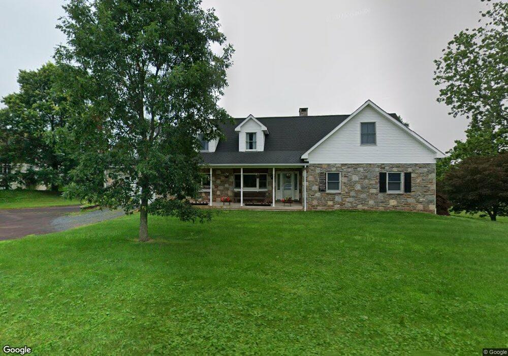
265 Cowpath Rd Unit 34 Souderton, PA 18964
Estimated Value: $562,000 - $670,065
3
Beds
2
Baths
3,270
Sq Ft
$192/Sq Ft
Est. Value
About This Home
This home is located at 265 Cowpath Rd Unit 34, Souderton, PA 18964 and is currently estimated at $628,266, approximately $192 per square foot. 265 Cowpath Rd Unit 34 is a home located in Montgomery County with nearby schools including West Broad Street Elementary School, Indian Crest Middle School, and Souderton Area Senior High School.
Ownership History
Date
Name
Owned For
Owner Type
Purchase Details
Closed on
Jul 15, 2009
Sold by
Halteman Kevin L and Derstine Karen S
Bought by
Derstine Kevin L and Derstine Karen S
Current Estimated Value
Home Financials for this Owner
Home Financials are based on the most recent Mortgage that was taken out on this home.
Original Mortgage
$139,000
Outstanding Balance
$91,272
Interest Rate
5.43%
Estimated Equity
$536,994
Purchase Details
Closed on
Mar 29, 1996
Sold by
Bechtel Grace D and Bechtel Grace C
Bought by
Derstine Kevin L and Halteman Karen S
Create a Home Valuation Report for This Property
The Home Valuation Report is an in-depth analysis detailing your home's value as well as a comparison with similar homes in the area
Home Values in the Area
Average Home Value in this Area
Purchase History
| Date | Buyer | Sale Price | Title Company |
|---|---|---|---|
| Derstine Kevin L | -- | None Available | |
| Derstine Kevin L | $180,000 | -- |
Source: Public Records
Mortgage History
| Date | Status | Borrower | Loan Amount |
|---|---|---|---|
| Open | Derstine Kevin L | $139,000 |
Source: Public Records
Tax History Compared to Growth
Tax History
| Year | Tax Paid | Tax Assessment Tax Assessment Total Assessment is a certain percentage of the fair market value that is determined by local assessors to be the total taxable value of land and additions on the property. | Land | Improvement |
|---|---|---|---|---|
| 2025 | $7,971 | $198,500 | -- | -- |
| 2024 | $7,971 | $198,500 | -- | -- |
| 2023 | $7,606 | $198,500 | $0 | $0 |
| 2022 | $7,374 | $198,500 | $0 | $0 |
| 2021 | $7,220 | $198,500 | $0 | $0 |
| 2020 | $7,122 | $198,500 | $0 | $0 |
| 2019 | $6,500 | $198,500 | $0 | $0 |
| 2018 | $7,037 | $198,500 | $0 | $0 |
| 2017 | $6,859 | $198,500 | $0 | $0 |
| 2016 | $6,782 | $198,500 | $0 | $0 |
| 2015 | $6,598 | $198,500 | $0 | $0 |
| 2014 | $6,598 | $198,500 | $0 | $0 |
Source: Public Records
Map
Nearby Homes
- 124 Hollybush Cir
- 35 Chancery Ct Unit 35
- 51 Cambridge Ct Unit 51
- 44 Adams Ave
- 44 Diamond St
- 554 Harleysville Pike
- 510 Berkshire Dr
- 110 Washington Ave
- 478 Smokepipe Rd
- 552 Creekside Dr
- 316 Penn Ave
- Arcadia Plan at Glenwood Chase
- Sebastian Plan at Glenwood Chase
- Arcadia Plan at Retreat at Boyertown Farms
- Caldwell Plan at Glenwood Chase
- Magnolia Plan at Glenwood Chase
- Harrison Plan at Glenwood Chase
- Savannah Plan at Retreat at Boyertown Farms
- Nottingham Plan at Penshyre Place
- Covington Plan at Glenwood Chase
- 261 Cowpath Rd
- 272 Crown Ct
- 274 Crown Ct Unit 65
- 271 Crown Ct Unit 62
- 276 Crown Ct Unit 66
- 257 Kingsfield Dr Unit 61
- 257 Cowpath Rd
- 280 Westminster Ln Unit 1
- 249 Cowpath Rd
- 281 Westminster Ln
- 283 Westminster Ln
- 261 Kingsfield Dr Unit 35
- 263 Kingsfield Dr Unit 34
- 284 Westminster Ln
- 285 Westminster Ln Unit 57
- 265 Kingsfield Dr Unit 33
- 286 Westminster Ln Unit 4
- 280 Surrey Dr
- 287 Westminster Ln
- 282 Surrey Dr Unit 47