Estimated Value: $281,781 - $301,000
3
Beds
2
Baths
1,931
Sq Ft
$151/Sq Ft
Est. Value
About This Home
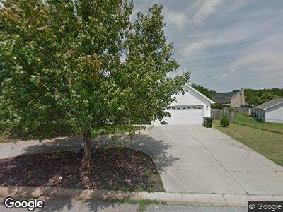
This home is located at 265 Milky Way, Greer, SC 29651 and is currently estimated at $292,445, approximately $151 per square foot. 265 Milky Way is a home located in Spartanburg County with nearby schools including Crestview Elementary School, Greer Middle School, and Greer High School.
Ownership History
Date
Name
Owned For
Owner Type
Purchase Details
Closed on
Nov 23, 2005
Sold by
Arnold Debra
Bought by
Arnold Debra and Arnold Terry
Current Estimated Value
Home Financials for this Owner
Home Financials are based on the most recent Mortgage that was taken out on this home.
Original Mortgage
$26,200
Interest Rate
6.1%
Mortgage Type
Stand Alone Second
Purchase Details
Closed on
Jun 17, 2005
Sold by
Noble William C and Noble Billie Jc
Bought by
Arnold Debra
Home Financials for this Owner
Home Financials are based on the most recent Mortgage that was taken out on this home.
Original Mortgage
$104,800
Interest Rate
6.6%
Mortgage Type
Adjustable Rate Mortgage/ARM
Purchase Details
Closed on
Jun 1, 2000
Sold by
Olsen Elaine
Bought by
Thompson Jimmie K
Create a Home Valuation Report for This Property
The Home Valuation Report is an in-depth analysis detailing your home's value as well as a comparison with similar homes in the area
Home Values in the Area
Average Home Value in this Area
Purchase History
| Date | Buyer | Sale Price | Title Company |
|---|---|---|---|
| Arnold Debra | -- | -- | |
| Arnold Debra | $131,500 | -- | |
| Thompson Jimmie K | $119,000 | -- |
Source: Public Records
Mortgage History
| Date | Status | Borrower | Loan Amount |
|---|---|---|---|
| Open | Arnold Debra | $137,750 | |
| Closed | Arnold Debra | $26,200 | |
| Closed | Arnold Debra | $104,800 | |
| Previous Owner | Arnold Debra | $104,800 |
Source: Public Records
Tax History Compared to Growth
Tax History
| Year | Tax Paid | Tax Assessment Tax Assessment Total Assessment is a certain percentage of the fair market value that is determined by local assessors to be the total taxable value of land and additions on the property. | Land | Improvement |
|---|---|---|---|---|
| 2024 | $1,846 | $6,760 | $747 | $6,013 |
| 2023 | $1,846 | $6,760 | $747 | $6,013 |
| 2022 | $1,577 | $5,879 | $706 | $5,173 |
| 2021 | $1,546 | $5,879 | $706 | $5,173 |
| 2020 | $1,520 | $5,879 | $706 | $5,173 |
| 2019 | $1,514 | $5,879 | $706 | $5,173 |
| 2018 | $1,498 | $5,879 | $706 | $5,173 |
| 2017 | $1,340 | $5,112 | $720 | $4,392 |
| 2016 | $1,316 | $5,112 | $720 | $4,392 |
| 2015 | $1,298 | $5,112 | $720 | $4,392 |
| 2014 | $1,271 | $5,112 | $720 | $4,392 |
Source: Public Records
Map
Nearby Homes
- 504 American Legion Rd
- 104 Autumn Hill Rd
- 1124 Apalache St
- 1231 Apalache St
- 212 Dayside Ct
- 251 Celestial Dr
- 11 Arlington Rd
- 207 American Legion Rd
- 114 Cascade Ln Unit Lot 0004
- 114 Cascade Ln
- 104 Woodvale Cir
- 0 Belue Rd
- 696 Arlington Rd
- 301 Arlington Rd
- 0 High St
- 301 John St
- 338 E Celestial Dr
- 93 Huntress Dr
- 108 Huntress Dr
- 112 Huntress Dr