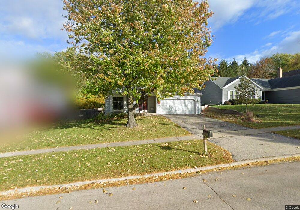
265 Yorkshire Dr Fox River Grove, IL 60021
Estimated Value: $380,229 - $399,000
3
Beds
3
Baths
1,846
Sq Ft
$210/Sq Ft
Est. Value
About This Home
This home is located at 265 Yorkshire Dr, Fox River Grove, IL 60021 and is currently estimated at $388,057, approximately $210 per square foot. 265 Yorkshire Dr is a home located in McHenry County with nearby schools including Algonquin Road Elementary School, Fox River Grove Middle School, and Cary Grove High School.
Ownership History
Date
Name
Owned For
Owner Type
Purchase Details
Closed on
Apr 30, 1999
Sold by
Zumach Douglas C and Zumach Kathleen M
Bought by
Strack Scott and Strack Christine
Current Estimated Value
Home Financials for this Owner
Home Financials are based on the most recent Mortgage that was taken out on this home.
Original Mortgage
$147,900
Interest Rate
7.06%
Purchase Details
Closed on
Sep 15, 1993
Sold by
Zumach Douglas C and Zumach Kathleen M
Bought by
Zumach Douglas C and Zumach Kathleen M
Create a Home Valuation Report for This Property
The Home Valuation Report is an in-depth analysis detailing your home's value as well as a comparison with similar homes in the area
Home Values in the Area
Average Home Value in this Area
Purchase History
| Date | Buyer | Sale Price | Title Company |
|---|---|---|---|
| Strack Scott | $185,000 | Attorneys Title Guaranty Fun | |
| Zumach Douglas C | -- | -- |
Source: Public Records
Mortgage History
| Date | Status | Borrower | Loan Amount |
|---|---|---|---|
| Previous Owner | Strack Scott | $147,900 |
Source: Public Records
Tax History Compared to Growth
Tax History
| Year | Tax Paid | Tax Assessment Tax Assessment Total Assessment is a certain percentage of the fair market value that is determined by local assessors to be the total taxable value of land and additions on the property. | Land | Improvement |
|---|---|---|---|---|
| 2024 | $10,386 | $115,035 | $22,503 | $92,532 |
| 2023 | $10,005 | $102,884 | $20,126 | $82,758 |
| 2022 | $9,925 | $101,260 | $19,398 | $81,862 |
| 2021 | $9,267 | $94,336 | $18,072 | $76,264 |
| 2020 | $9,041 | $90,996 | $17,432 | $73,564 |
| 2019 | $8,732 | $87,095 | $16,685 | $70,410 |
| 2018 | $8,582 | $80,457 | $15,413 | $65,044 |
| 2017 | $8,427 | $75,796 | $14,520 | $61,276 |
| 2016 | $8,294 | $71,089 | $13,618 | $57,471 |
| 2013 | -- | $67,173 | $12,703 | $54,470 |
Source: Public Records
Map
Nearby Homes
- 6 Jacqueline Ln
- 5 Jacqueline Ln
- 346 Bristol Ln Unit 6361
- LOT 2 Asbury Ave
- Lot 1 Asbury Ave
- 460 Hunters Way
- 14 W Surrey Ln
- 500 Tower Place
- 422 Lincoln Ave Unit A
- 111 Grace Ln
- 806 Norge Pkwy
- 300 Opatrny Dr Unit 122
- 300 Opatrny Dr Unit 107
- 209 Gladys Ave
- 1034 Heather Ct
- 208 S River Rd
- 101 Beachway Dr
- 727 Old Hunt Rd
- 9209 Jasmine Way
- 1006 Pine St
- 263 Yorkshire Dr
- 267 Yorkshire Dr
- 269 Yorkshire Dr
- 261 Yorkshire Dr
- 74 Chatham Ct
- 260 Yorkshire Dr
- 271 Yorkshire Dr
- 270 Yorkshire Dr
- 73 Chatham Ct
- 258 Yorkshire Dr
- 273 Yorkshire Dr
- 70 Chatham Ct
- 72 Chatham Ct
- 256 Yorkshire Dr
- 71 Chatham Ct
- 3 Jacqueline Ln
- 255 Yorkshire Dr
- 273 Foxmoor Rd
- 275 Yorkshire Dr
- 254 Yorkshire Dr