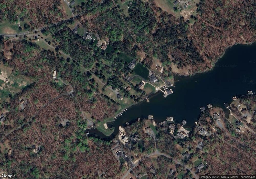
2652 New Bridge Rd Mineral, VA 23117
Estimated Value: $516,000 - $1,132,000
4
Beds
3
Baths
1,239
Sq Ft
$664/Sq Ft
Est. Value
About This Home
This home is located at 2652 New Bridge Rd, Mineral, VA 23117 and is currently estimated at $822,463, approximately $663 per square foot. 2652 New Bridge Rd is a home located in Louisa County with nearby schools including Thomas Jefferson Elementary School, Louisa County Middle School, and Louisa County High School.
Ownership History
Date
Name
Owned For
Owner Type
Purchase Details
Closed on
May 8, 2013
Sold by
Roy Carl W and Roy Van Dalsum
Bought by
Roy Carl W and Roy Sandra R
Current Estimated Value
Home Financials for this Owner
Home Financials are based on the most recent Mortgage that was taken out on this home.
Original Mortgage
$168,600
Interest Rate
3.57%
Mortgage Type
New Conventional
Create a Home Valuation Report for This Property
The Home Valuation Report is an in-depth analysis detailing your home's value as well as a comparison with similar homes in the area
Home Values in the Area
Average Home Value in this Area
Purchase History
| Date | Buyer | Sale Price | Title Company |
|---|---|---|---|
| Roy Carl W | -- | American Guaranty Title Insu |
Source: Public Records
Mortgage History
| Date | Status | Borrower | Loan Amount |
|---|---|---|---|
| Closed | Roy Carl W | $168,600 |
Source: Public Records
Tax History Compared to Growth
Tax History
| Year | Tax Paid | Tax Assessment Tax Assessment Total Assessment is a certain percentage of the fair market value that is determined by local assessors to be the total taxable value of land and additions on the property. | Land | Improvement |
|---|---|---|---|---|
| 2024 | $6,093 | $846,300 | $356,000 | $490,300 |
| 2023 | $5,657 | $827,100 | $324,500 | $502,600 |
| 2022 | $5,041 | $700,200 | $296,100 | $404,100 |
| 2021 | $3,382 | $591,600 | $267,800 | $323,800 |
| 2020 | $3,938 | $547,000 | $267,800 | $279,200 |
| 2019 | $3,794 | $526,900 | $267,800 | $259,100 |
| 2018 | $3,580 | $497,200 | $258,300 | $238,900 |
| 2017 | $3,533 | $488,600 | $258,300 | $230,300 |
| 2016 | $3,533 | $490,700 | $264,600 | $226,100 |
| 2015 | $3,548 | $492,800 | $264,600 | $228,200 |
| 2013 | -- | $497,600 | $280,400 | $217,200 |
Source: Public Records
Map
Nearby Homes
- 0 (Lot 5) New Bridge Rd
- Lot 17 Mary Wayne Ln
- 40 Grandview Dr
- Lot 72 Madeline Ln
- Lot 28 Turkey Trail
- 315 Lakewood Cir
- 184 Anna Coves Blvd
- Lot 7 Pinewood Dr
- Lot 2 & 6 New Bridge Rd
- Lot 11 Park Run
- 219 Oakwood Dr
- 0 Laurelwood Dr Unit VALA2008522
- 60 Laurelwood Dr
- 41 Lakeshore Ln
- 1502 New Bridge Rd
- TBD Tall Pines Dr
- Lot 76 Centerville Rd
- 520 Oak Grove Dr
- 115 Forest Ln
- 5036 Corsair Terrace
- 2632 New Bridge Rd
- 2694 New Bridge Rd
- 2734 New Bridge Rd
- 2738 New Bridge Rd
- 556 Beaver Pond Way
- 2828 New Bridge Rd
- 0 New Bridge Rd Unit LA8693036
- 185 Bernie Cir
- 2730 New Bridge Rd
- 129 Bernie Cir
- 137 Bernie Cir
- 1065 Mitchell Point Rd
- 2726 New Bridge Rd
- 490 Beaver Pond Way
- 551 Beaver Pond Way
- 0 Bernie Cir
- 105 Bernie Cir
- 152 Bernie Cir
- 237 Bernie Cir
- Lot 86 Bernie Cir Unit 86
