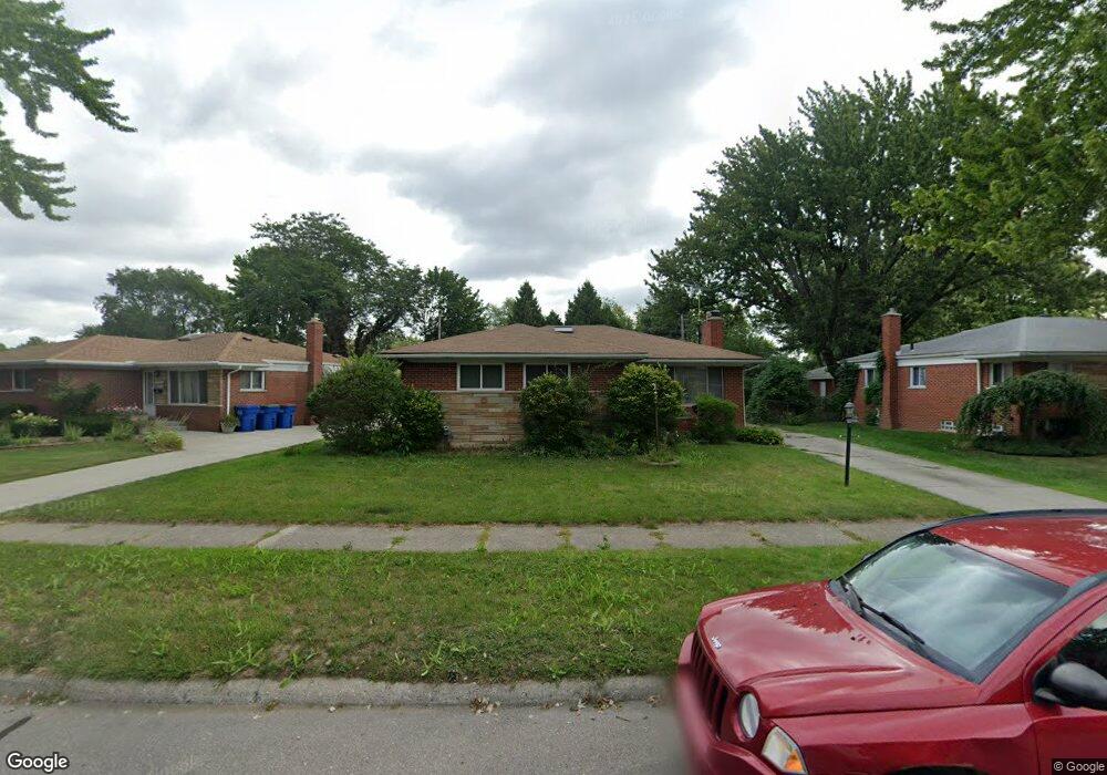
26530 Newport Ave Warren, MI 48089
Southeast Warren NeighborhoodEstimated Value: $255,237 - $281,000
3
Beds
2
Baths
1,715
Sq Ft
$155/Sq Ft
Est. Value
About This Home
This home is located at 26530 Newport Ave, Warren, MI 48089 and is currently estimated at $265,559, approximately $154 per square foot. 26530 Newport Ave is a home located in Macomb County with nearby schools including Warren Woods Tower High School and Frontier International Academy Elementary.
Ownership History
Date
Name
Owned For
Owner Type
Purchase Details
Closed on
Jun 24, 2022
Sold by
Shonka Julia R
Bought by
Julia R Shonka Revocable Living Trust
Current Estimated Value
Purchase Details
Closed on
Nov 26, 2003
Sold by
Shonka John W and Shonka Julia R
Bought by
Shonka John W and Shonka Julia R
Purchase Details
Closed on
Aug 8, 1995
Sold by
Maser Carol A
Bought by
Shonka John W and Shonka Rebecca
Create a Home Valuation Report for This Property
The Home Valuation Report is an in-depth analysis detailing your home's value as well as a comparison with similar homes in the area
Home Values in the Area
Average Home Value in this Area
Purchase History
| Date | Buyer | Sale Price | Title Company |
|---|---|---|---|
| Julia R Shonka Revocable Living Trust | -- | -- | |
| Julia R Shonka Revocable Living Trust | -- | None Listed On Document | |
| Shonka John W | -- | -- | |
| Shonka John W | $107,000 | -- |
Source: Public Records
Tax History Compared to Growth
Tax History
| Year | Tax Paid | Tax Assessment Tax Assessment Total Assessment is a certain percentage of the fair market value that is determined by local assessors to be the total taxable value of land and additions on the property. | Land | Improvement |
|---|---|---|---|---|
| 2025 | $3,242 | $127,440 | $0 | $0 |
| 2024 | $3,150 | $112,710 | $0 | $0 |
| 2023 | $2,976 | $102,270 | $0 | $0 |
| 2022 | $2,918 | $91,870 | $0 | $0 |
| 2021 | $2,863 | $87,780 | $0 | $0 |
| 2020 | $2,744 | $86,140 | $0 | $0 |
| 2019 | $2,622 | $80,460 | $0 | $0 |
| 2018 | $78 | $61,630 | $0 | $0 |
| 2017 | $2,504 | $57,980 | $6,830 | $51,150 |
| 2016 | $2,485 | $57,980 | $0 | $0 |
| 2015 | $1,456 | $53,300 | $0 | $0 |
| 2012 | -- | $49,210 | $0 | $0 |
Source: Public Records
Map
Nearby Homes
- 26515 Newport Ave
- 13144 Stamford Ave
- 13171 Burgundy Ave
- 13203 Frazho Rd
- 26443 Marilyn Ave
- 26552 Wagner Ave
- 12291 E 11 Mile Rd
- 26640 Schoenherr Rd
- 13696 Harthill Ave
- 25653 Palomino Ave
- 11927 Stamford Ave
- 12922 Heritage S Unit 54
- 11920 Carney St
- 0000 Frazho Rd
- 13429 Zagaiski Ave
- 13653 Brainbridge Ave
- 11820 Mckinley Dr
- 27529 Roan Dr
- 27260 Norma Dr
- 13342 De Mott Dr
- 26548 Newport Ave
- 26512 Newport Ave
- 26603 Fairfield Ave
- 26608 Newport Ave
- 26621 Fairfield Ave
- 26620 Newport Ave
- 26527 Newport Ave
- 26633 Fairfield Ave
- 26514 Fairfield Ave
- 26532 Fairfield Ave
- 25239 dale Fairfield Ave
- 26632 Newport Ave
- 26537 Newport Ave
- 26547 Newport Ave
- 26557 Newport Ave
- 26645 Fairfield Ave
- 26345 Newport Ave
- 26607 Newport Ave
- 26364 Newport Ave
- 12911 Stamford Ave