
Seller's Agent in 2025
Rob Schabatka
RE/MAX
(928) 821-3508
103 in this area
209 Total Sales
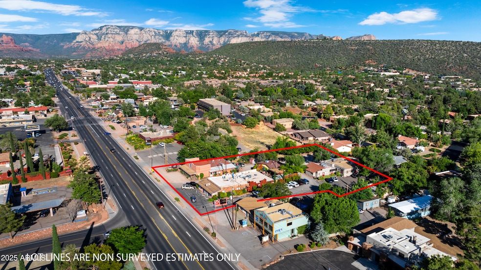
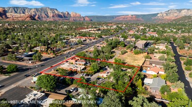
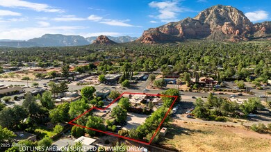
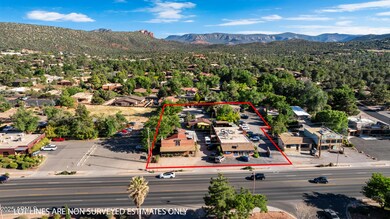
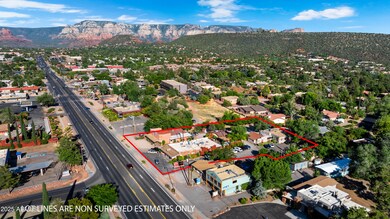
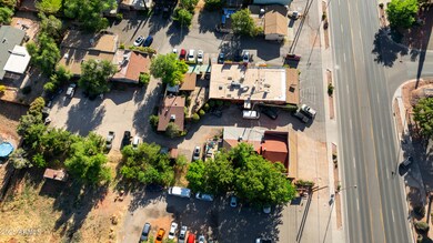
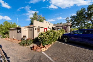
Seize the chance to own a premier commercial property situated in the bustling heart of West Sedona along State Route 89A. This exceptional offering includes five parcels featuring four buildings. All of the buildings are occupied by established tenants with current leases. Don't miss out on this high-demand location with excellent visibility and a strong rental incocme stream. Invest in a property that promieses both immediate returns and long-term grownth potential.
Last Agent to Sell the Property
RE/MAX Sedona License #BR030865000 Listed on: 10/29/2025
| Date | Type | Sale Price | Title Company |
|---|---|---|---|
| Warranty Deed | $2,450,000 | Pioneer Title | |
| Warranty Deed | -- | -- | |
| Warranty Deed | $200,000 | Transamerica Title Ins Co |
| Date | Status | Loan Amount | Loan Type |
|---|---|---|---|
| Previous Owner | $180,000 | Commercial |
| Date | Event | Price | List to Sale | Price per Sq Ft |
|---|---|---|---|---|
| 11/03/2025 11/03/25 | Sold | $2,450,000 | -30.0% | $196 / Sq Ft |
| 10/29/2025 10/29/25 | Pending | -- | -- | -- |
| 10/29/2025 10/29/25 | For Sale | $3,500,000 | -- | $280 / Sq Ft |
| Year | Tax Paid | Tax Assessment Tax Assessment Total Assessment is a certain percentage of the fair market value that is determined by local assessors to be the total taxable value of land and additions on the property. | Land | Improvement |
|---|---|---|---|---|
| 2026 | $994 | -- | -- | -- |
| 2024 | $997 | -- | -- | -- |
| 2023 | $997 | $19,382 | $19,382 | $0 |
| 2022 | $1,008 | $12,421 | $12,421 | $0 |
| 2021 | $1,054 | $11,291 | $11,291 | $0 |
| 2020 | $1,054 | $0 | $0 | $0 |
| 2019 | $1,043 | $0 | $0 | $0 |
| 2018 | $1,046 | $0 | $0 | $0 |
| 2017 | $1,068 | $0 | $0 | $0 |
| 2016 | $1,107 | $0 | $0 | $0 |
| 2015 | -- | $0 | $0 | $0 |
| 2014 | -- | $0 | $0 | $0 |
Seller's Agent in 2025
Rob Schabatka
RE/MAX
(928) 821-3508
103 in this area
209 Total Sales
Seller Co-Listing Agent in 2025
Ricky Schabatka
RE/MAX
(928) 282-4166
97 in this area
192 Total Sales
Source: Arizona Regional Multiple Listing Service (ARMLS)
MLS Number: 6940131
APN: 408-24-014
Disclaimer: Certain information contained herein is derived from information provided by parties other than Homes.com. All information provided is deemed reliable, but is not guaranteed to be accurate and should be independently verified.
![]() All information should be verified by the recipient and none is guaranteed as accurate by ARMLS
All information should be verified by the recipient and none is guaranteed as accurate by ARMLS
Listing Information presented by local MLS brokerage: Ten-X, local REALTOR®- Arlene Richardson - (888)-952-6393