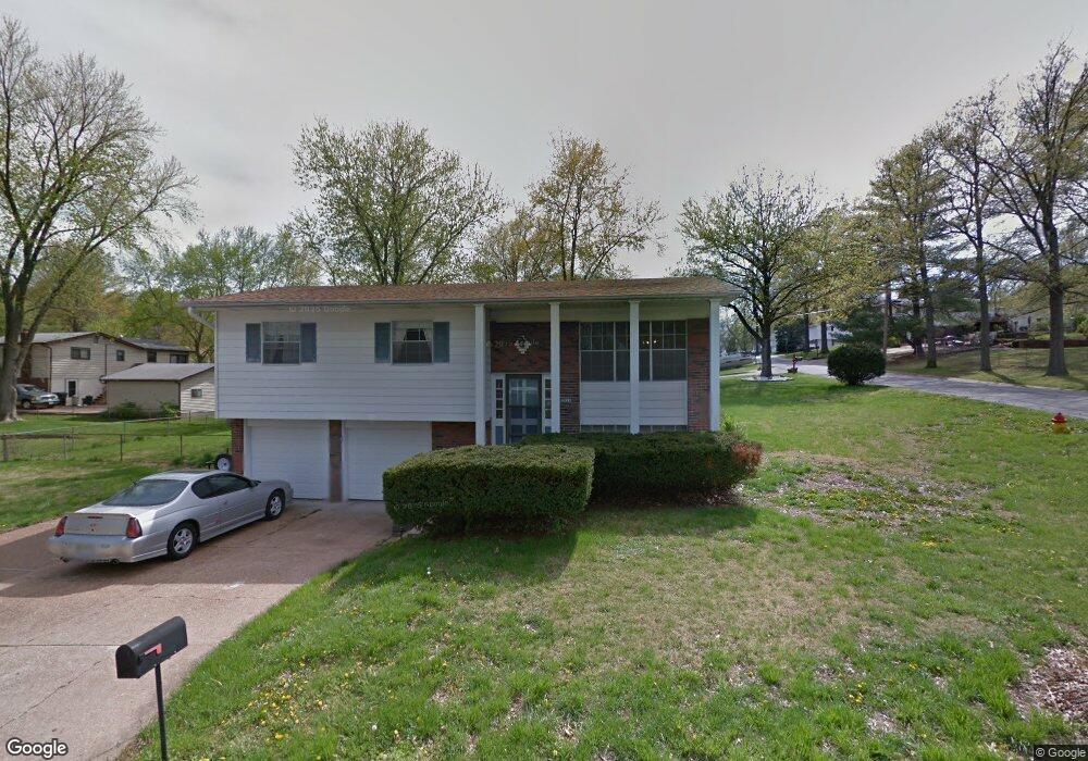
2655 Diane Dr Arnold, MO 63010
Estimated Value: $323,000 - $336,774
Studio
--
Bath
1,352
Sq Ft
$244/Sq Ft
Est. Value
About This Home
This home is located at 2655 Diane Dr, Arnold, MO 63010 and is currently estimated at $330,194, approximately $244 per square foot. 2655 Diane Dr is a home located in Jefferson County with nearby schools including Fox Elementary School, Fox Middle School, and Fox Senior High School.
Ownership History
Date
Name
Owned For
Owner Type
Purchase Details
Closed on
Jul 12, 2024
Sold by
Kile Jessica
Bought by
Dielschneider Robert A and Dielschneider Dorothy M
Current Estimated Value
Purchase Details
Closed on
Sep 19, 2019
Sold by
Hardy Built Llc
Bought by
Kile Jessica
Home Financials for this Owner
Home Financials are based on the most recent Mortgage that was taken out on this home.
Original Mortgage
$167,250
Interest Rate
3.6%
Mortgage Type
New Conventional
Purchase Details
Closed on
Mar 15, 2019
Sold by
Naumer Bradley P and Naumer Pamela M
Bought by
Hardy Built Llc
Create a Home Valuation Report for This Property
The Home Valuation Report is an in-depth analysis detailing your home's value as well as a comparison with similar homes in the area
Home Values in the Area
Average Home Value in this Area
Purchase History
| Date | Buyer | Sale Price | Title Company |
|---|---|---|---|
| Dielschneider Robert A | -- | Title Premier | |
| Kile Jessica | -- | Htc | |
| Hardy Built Llc | -- | Hillsborough Title |
Source: Public Records
Mortgage History
| Date | Status | Borrower | Loan Amount |
|---|---|---|---|
| Previous Owner | Kile Jessica | $167,250 |
Source: Public Records
Tax History
| Year | Tax Paid | Tax Assessment Tax Assessment Total Assessment is a certain percentage of the fair market value that is determined by local assessors to be the total taxable value of land and additions on the property. | Land | Improvement |
|---|---|---|---|---|
| 2025 | $2,742 | $43,100 | $2,500 | $40,600 |
| 2024 | $2,742 | $39,200 | $2,500 | $36,700 |
| 2023 | $2,742 | $39,200 | $2,500 | $36,700 |
| 2022 | $2,759 | $38,700 | $2,500 | $36,200 |
| 2021 | $2,761 | $38,700 | $2,500 | $36,200 |
| 2020 | $2,609 | $34,700 | $2,100 | $32,600 |
| 2019 | $777 | $2,100 | $2,100 | $0 |
| 2018 | $1,416 | $18,900 | $2,100 | $16,800 |
| 2017 | $1,437 | $18,900 | $2,100 | $16,800 |
| 2016 | $1,199 | $16,900 | $2,100 | $14,800 |
| 2015 | $1,202 | $16,900 | $2,100 | $14,800 |
| 2013 | -- | $16,500 | $2,100 | $14,400 |
Source: Public Records
Map
Nearby Homes
- 1267 Arnold Tenbrook Rd
- 1261 Moonlight Dr
- 672 Berrywine Ln
- 809 Brookside Dr
- 0 Unknown Unit 22001740
- 0 Unknown Unit 22071117
- 0 Unknown Unit 22001730
- 0 Unknown Unit 21017758
- 866 Sunset Dr
- 704 Idaho Dr
- 2268 Sunnyridge Dr
- 851 Morningside Ln
- 2287 Tenbrook Rd
- 2554 Starling Airport Rd
- 2216 Jackson Dr
- 3.5 Acres - Ridge Dr
- 2872 Fox Meadow Ln
- 423 Kathryn Dr
- 638 Jeffco Blvd
- 0000 Botanical Dr
Your Personal Tour Guide
Ask me questions while you tour the home.