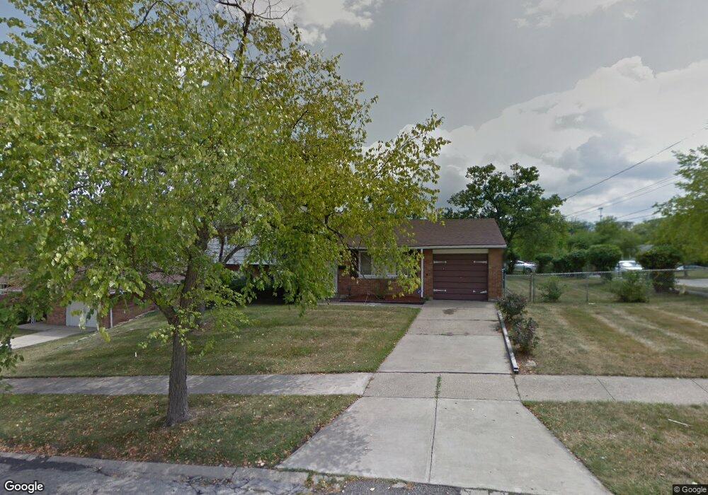
2655 Mustang Dr Cincinnati, OH 45211
Westwood NeighborhoodEstimated Value: $193,000 - $213,307
3
Beds
3
Baths
1,530
Sq Ft
$135/Sq Ft
Est. Value
About This Home
This home is located at 2655 Mustang Dr, Cincinnati, OH 45211 and is currently estimated at $205,827, approximately $134 per square foot. 2655 Mustang Dr is a home located in Hamilton County with nearby schools including Western Hills High School, Gilbert A. Dater High School, and Robert A. Taft Information Technology High School.
Ownership History
Date
Name
Owned For
Owner Type
Purchase Details
Closed on
Dec 21, 2001
Sold by
Lynch William F and Lynch Judy A
Bought by
Scott Melvin and Scott Melissa A
Current Estimated Value
Home Financials for this Owner
Home Financials are based on the most recent Mortgage that was taken out on this home.
Original Mortgage
$106,160
Outstanding Balance
$43,602
Interest Rate
7.26%
Mortgage Type
FHA
Estimated Equity
$162,225
Create a Home Valuation Report for This Property
The Home Valuation Report is an in-depth analysis detailing your home's value as well as a comparison with similar homes in the area
Home Values in the Area
Average Home Value in this Area
Purchase History
| Date | Buyer | Sale Price | Title Company |
|---|---|---|---|
| Scott Melvin | $107,000 | River Valley Title Agency |
Source: Public Records
Mortgage History
| Date | Status | Borrower | Loan Amount |
|---|---|---|---|
| Open | Scott Melvin | $106,160 |
Source: Public Records
Tax History Compared to Growth
Tax History
| Year | Tax Paid | Tax Assessment Tax Assessment Total Assessment is a certain percentage of the fair market value that is determined by local assessors to be the total taxable value of land and additions on the property. | Land | Improvement |
|---|---|---|---|---|
| 2024 | $3,177 | $52,350 | $8,439 | $43,911 |
| 2023 | $3,247 | $52,350 | $8,439 | $43,911 |
| 2022 | $2,038 | $29,145 | $6,850 | $22,295 |
| 2021 | $1,946 | $29,145 | $6,850 | $22,295 |
| 2020 | $2,002 | $29,145 | $6,850 | $22,295 |
| 2019 | $1,990 | $26,496 | $6,227 | $20,269 |
| 2018 | $1,993 | $26,496 | $6,227 | $20,269 |
| 2017 | $1,892 | $26,496 | $6,227 | $20,269 |
| 2016 | $2,010 | $27,790 | $7,203 | $20,587 |
| 2015 | $1,815 | $27,790 | $7,203 | $20,587 |
| 2014 | $1,828 | $27,790 | $7,203 | $20,587 |
| 2013 | $1,933 | $28,949 | $7,504 | $21,445 |
Source: Public Records
Map
Nearby Homes
- 3418 Millrich Ave
- 2508 Mustang Dr
- 2562 Montana Ave
- 2454 Mustang Dr
- 3116 Gobel Ave
- 3162 Sunshine Ave
- 2469 Montana Ave
- 3331 Felicity Dr
- 2822 Montana Ave
- 2424 Westwood Northern Blvd
- 3072 Worthington Ave
- 3046 Bracken Woods Ln
- 3413 Fyffe Ave
- 3073 Bracken Woods Ln
- 3069 Bracken Woods Ln
- 3345 Meyer Place
- 3042 Percy Ave
- 3064 Mchenry Ave
- 3501 Mcfarlan Rd
- 3025 Mchenry Ave
- 2651 Mustang Dr
- 3390 Goldrush Ct
- 3386 Goldrush Ct
- 3393 Goldrush Ct
- 2654 Mustang Dr
- 3399 Bighorn Ct
- 3395 Bighorn Ct
- 3389 Goldrush Ct
- 3397 Goldrush Ct
- 2650 Mustang Dr
- 3391 Bighorn Ct
- 3382 Goldrush Ct
- 2658 Mustang Dr
- 2664 Mustang Dr
- 3385 Goldrush Ct
- 2666 Mustang Dr
- 3403 Bighorn Ct
- 3387 Bighorn Ct
- 3378 Goldrush Ct
- 3381 Goldrush Ct