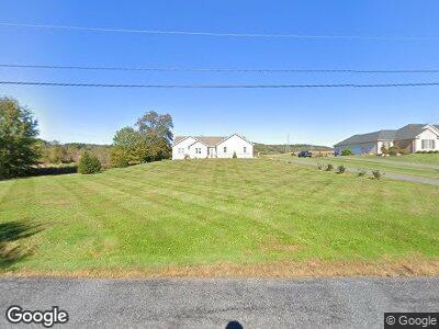
2657 Shuler Rd Palm, PA 18070
Hereford NeighborhoodEstimated Value: $351,000 - $416,762
3
Beds
2
Baths
1,804
Sq Ft
$217/Sq Ft
Est. Value
About This Home
This home is located at 2657 Shuler Rd, Palm, PA 18070 and is currently estimated at $391,921, approximately $217 per square foot. 2657 Shuler Rd is a home with nearby schools including Upper Perkiomen 4th & 5th Grade Center, Upper Perkiomen Middle School, and Upper Perkiomen High School.
Ownership History
Date
Name
Owned For
Owner Type
Purchase Details
Closed on
Jul 1, 2014
Sold by
Kokoszka Stanley and Kokoszka Diane
Bought by
Kokoszka Stanley S and Kokoszka Diane M
Current Estimated Value
Home Financials for this Owner
Home Financials are based on the most recent Mortgage that was taken out on this home.
Original Mortgage
$272,000
Interest Rate
4.16%
Mortgage Type
Purchase Money Mortgage
Purchase Details
Closed on
Nov 15, 2013
Sold by
Mack James H and Mack Bonita J
Bought by
Kokoszka Stanley and Kokoszka Diane
Create a Home Valuation Report for This Property
The Home Valuation Report is an in-depth analysis detailing your home's value as well as a comparison with similar homes in the area
Home Values in the Area
Average Home Value in this Area
Purchase History
| Date | Buyer | Sale Price | Title Company |
|---|---|---|---|
| Kokoszka Stanley S | -- | None Available | |
| Kokoszka Stanley | $70,000 | None Available |
Source: Public Records
Mortgage History
| Date | Status | Borrower | Loan Amount |
|---|---|---|---|
| Closed | Kokoszka Stanley S | $272,000 |
Source: Public Records
Tax History Compared to Growth
Tax History
| Year | Tax Paid | Tax Assessment Tax Assessment Total Assessment is a certain percentage of the fair market value that is determined by local assessors to be the total taxable value of land and additions on the property. | Land | Improvement |
|---|---|---|---|---|
| 2025 | $2,044 | $194,400 | $45,600 | $148,800 |
| 2024 | $1,914 | $194,400 | $45,600 | $148,800 |
| 2023 | $1,780 | $194,400 | $45,600 | $148,800 |
| 2022 | $1,780 | $194,400 | $45,600 | $148,800 |
| 2021 | $1,722 | $194,400 | $45,600 | $148,800 |
| 2020 | $1,722 | $194,400 | $45,600 | $148,800 |
| 2019 | $1,722 | $194,400 | $45,600 | $148,800 |
| 2018 | $1,722 | $194,400 | $45,600 | $148,800 |
| 2017 | $1,666 | $194,400 | $45,600 | $148,800 |
| 2016 | $1,633 | $194,400 | $45,600 | $148,800 |
| 2015 | $1,633 | $194,400 | $45,600 | $148,800 |
| 2014 | $281 | $34,400 | $34,400 | $0 |
Source: Public Records
Map
Nearby Homes
- 317 Ashford Ln
- 6528 Crown Ln
- 2088 Tollgate Rd
- 1734 Huffs Church Rd
- 10 Mountain Rd
- 2145 County Line Rd
- 6271 Batman Rd
- 6480 Sweetbriar Ln
- LOT Township Rd
- 6549 Sweetbriar Ln
- 6335 Sweetbriar Ln
- 5810 Tomahawk Ln
- 7632 Kings Hwy S
- 5240 Geissinger Rd
- 6112 Chestnut St
- 629 Arlington St
- 10 Wheeler Ln
- 522 Colonial Dr
- 5201 Stansfield Dr
- 6566 Kings Hwy S