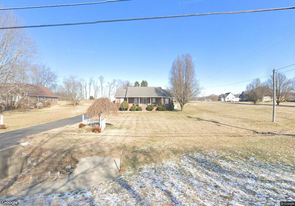
266 Brattontown Cir Lafayette, TN 37083
Estimated Value: $268,413 - $344,000
--
Bed
2
Baths
1,576
Sq Ft
$194/Sq Ft
Est. Value
About This Home
This home is located at 266 Brattontown Cir, Lafayette, TN 37083 and is currently estimated at $305,603, approximately $193 per square foot. 266 Brattontown Cir is a home located in Macon County with nearby schools including Macon Christian Academy and Lighthouse Academy.
Ownership History
Date
Name
Owned For
Owner Type
Purchase Details
Closed on
Aug 5, 2008
Sold by
Edens David R
Bought by
Jimmy Walrond
Current Estimated Value
Purchase Details
Closed on
Oct 30, 2006
Sold by
Patrick Rich
Bought by
Edens David R
Home Financials for this Owner
Home Financials are based on the most recent Mortgage that was taken out on this home.
Original Mortgage
$130,000
Interest Rate
10.09%
Mortgage Type
Cash
Purchase Details
Closed on
Oct 23, 1997
Sold by
Jesse Woodmore and Jesse Dorothy
Bought by
Patrick Rich and Patrick Wendi
Purchase Details
Closed on
Jun 12, 1997
Bought by
Woodmore Jesse and Woodmore Dorothy
Create a Home Valuation Report for This Property
The Home Valuation Report is an in-depth analysis detailing your home's value as well as a comparison with similar homes in the area
Home Values in the Area
Average Home Value in this Area
Purchase History
| Date | Buyer | Sale Price | Title Company |
|---|---|---|---|
| Jimmy Walrond | $140,000 | -- | |
| Edens David R | $130,000 | -- | |
| Patrick Rich | $88,000 | -- | |
| Woodmore Jesse | $7,000 | -- |
Source: Public Records
Mortgage History
| Date | Status | Borrower | Loan Amount |
|---|---|---|---|
| Previous Owner | Woodmore Jesse | $130,000 |
Source: Public Records
Tax History Compared to Growth
Tax History
| Year | Tax Paid | Tax Assessment Tax Assessment Total Assessment is a certain percentage of the fair market value that is determined by local assessors to be the total taxable value of land and additions on the property. | Land | Improvement |
|---|---|---|---|---|
| 2025 | $945 | $61,025 | $8,000 | $53,025 |
| 2024 | $1,116 | $59,400 | $8,000 | $51,400 |
| 2023 | $1,116 | $59,400 | $0 | $0 |
| 2022 | $1,011 | $32,075 | $4,000 | $28,075 |
| 2021 | $995 | $32,075 | $4,000 | $28,075 |
| 2020 | $995 | $32,075 | $4,000 | $28,075 |
| 2019 | $995 | $32,075 | $4,000 | $28,075 |
| 2018 | $919 | $32,075 | $4,000 | $28,075 |
| 2017 | $964 | $29,500 | $3,750 | $25,750 |
| 2016 | $929 | $29,500 | $3,750 | $25,750 |
| 2015 | $929 | $29,500 | $3,750 | $25,750 |
| 2014 | $930 | $29,508 | $0 | $0 |
Source: Public Records
Map
Nearby Homes
- 351 Michael Cir
- 195 Froedge Dr
- 315 Froedge Dr
- 495 Froedge Dr
- 90 Long Creek Rd
- 5142 Highway 52 W
- 10 Mcnabb Ln
- 1401 Ellington Dr
- 1021 Maple Grove Rd
- 1400 Dogwood Ln
- 414 Meador Dr
- 412 Meador Dr
- 100 Ourtown Ct
- - Key Rd
- 1305 Scottsville Rd
- 788 Long Creek Rd
- 1234 Old Highway 52
- 1414 Hillwood Cir
- 912 Long Creek Rd
- 1212 Hollis Ln
- 294 Brattontown Cir
- 382 Michael Cir
- 316 Brattontown Cir
- 371 Michael Cir
- 325 Brattontown Cir
- 350 Michael Cir
- 0 Sharon Dr
- 184 Brattontown Cir
- 187 Brattontown Cir
- 64 Susan Ln
- 79 Michael Cir
- 328 Michael Cir
- 111 Michael Cir
- 388 Brattontown Cir
- 159 Brattontown Cir
- 244 Sharon Ln
- 300 Michael Cir
- 393 Brattontown Cir
- 0 Michael Cir