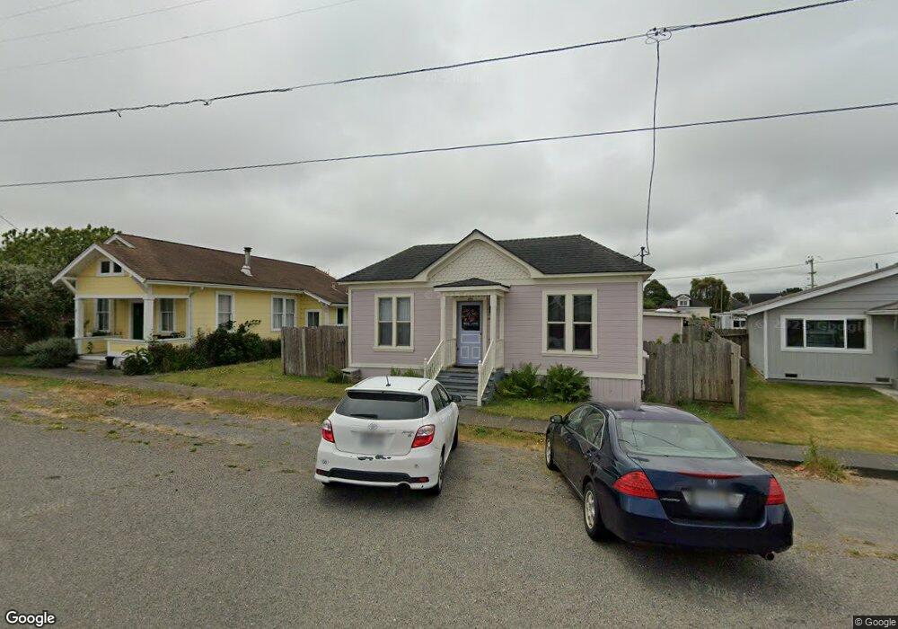
266 Spring St Loleta, CA 95551
Loleta NeighborhoodEstimated Value: $150,000 - $328,000
2
Beds
1
Bath
910
Sq Ft
$294/Sq Ft
Est. Value
About This Home
This home is located at 266 Spring St, Loleta, CA 95551 and is currently estimated at $267,343, approximately $293 per square foot. 266 Spring St is a home located in Humboldt County with nearby schools including Loleta Elementary School, East High School, and Fortuna Union High School.
Ownership History
Date
Name
Owned For
Owner Type
Purchase Details
Closed on
Apr 15, 2002
Sold by
Skofield Paul D and Skofield Debra L
Bought by
Kolstad Dylan
Current Estimated Value
Home Financials for this Owner
Home Financials are based on the most recent Mortgage that was taken out on this home.
Original Mortgage
$96,500
Outstanding Balance
$40,375
Interest Rate
6.94%
Mortgage Type
Purchase Money Mortgage
Estimated Equity
$226,968
Purchase Details
Closed on
May 30, 1997
Sold by
Armstrong James E
Bought by
Skofield Paul D and Skofield Debra L
Home Financials for this Owner
Home Financials are based on the most recent Mortgage that was taken out on this home.
Original Mortgage
$48,000
Interest Rate
7.94%
Mortgage Type
Purchase Money Mortgage
Create a Home Valuation Report for This Property
The Home Valuation Report is an in-depth analysis detailing your home's value as well as a comparison with similar homes in the area
Home Values in the Area
Average Home Value in this Area
Purchase History
| Date | Buyer | Sale Price | Title Company |
|---|---|---|---|
| Kolstad Dylan | $99,500 | First American Title Ins Co | |
| Skofield Paul D | $60,000 | First American Title Ins Co |
Source: Public Records
Mortgage History
| Date | Status | Borrower | Loan Amount |
|---|---|---|---|
| Open | Kolstad Dylan | $96,500 | |
| Previous Owner | Skofield Paul D | $48,000 |
Source: Public Records
Tax History
| Year | Tax Paid | Tax Assessment Tax Assessment Total Assessment is a certain percentage of the fair market value that is determined by local assessors to be the total taxable value of land and additions on the property. | Land | Improvement |
|---|---|---|---|---|
| 2025 | $2,934 | $146,964 | $69,421 | $77,543 |
| 2024 | $2,934 | $144,083 | $68,060 | $76,023 |
| 2023 | $2,729 | $141,259 | $66,726 | $74,533 |
| 2022 | $2,373 | $138,490 | $65,418 | $73,072 |
| 2021 | $2,344 | $135,776 | $64,136 | $71,640 |
| 2020 | $2,336 | $134,385 | $63,479 | $70,906 |
| 2019 | $2,008 | $131,751 | $62,235 | $69,516 |
| 2018 | $1,976 | $129,168 | $61,015 | $68,153 |
| 2017 | $1,883 | $126,636 | $59,819 | $66,817 |
| 2016 | $1,858 | $124,154 | $58,647 | $65,507 |
| 2015 | -- | $122,291 | $57,767 | $64,524 |
| 2014 | -- | $119,897 | $56,636 | $63,261 |
Source: Public Records
Map
Nearby Homes
- 275 Church St
- 0 Church St Unit 326015012
- 0 Church St Unit 271562
- 711 Franklin Ave
- 85 Shadowbrook St
- 135 Clough Rd
- 887 Fernbridge Dr
- 1770 Tompkins Hill Rd
- 32 Summit View Ln
- 500 Sage Rd
- 781 Tompkins Hill Rd
- 420 Valley Ave
- 105 Annahy Dr
- 630 Palmer Blvd
- 545 Garland Ave
- 0 Ambrosini Ln
- 1395/1392 Port Kenyon Rd
- 984 Tennyson Ave
- 370 Main St
- 1289 Madison St
Your Personal Tour Guide
Ask me questions while you tour the home.