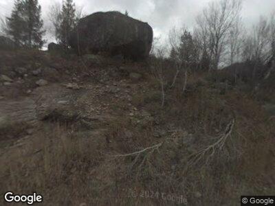
26611 Frying Pan Rd Meredith, CO 81642
Estimated Value: $1,119,416 - $1,233,000
4
Beds
2
Baths
2,274
Sq Ft
$510/Sq Ft
Est. Value
About This Home
This home is located at 26611 Frying Pan Rd, Meredith, CO 81642 and is currently estimated at $1,159,805, approximately $510 per square foot. 26611 Frying Pan Rd is a home.
Ownership History
Date
Name
Owned For
Owner Type
Purchase Details
Closed on
Dec 10, 2024
Sold by
Swomley-Roberts Limited Liability Limite
Bought by
Jennifer G Roberts Trust and John G Swomley Trust
Current Estimated Value
Purchase Details
Closed on
Sep 6, 2024
Sold by
Swomley John G
Bought by
Swomley-Roberts Limited Liability Limited Par
Purchase Details
Closed on
Jan 23, 2015
Sold by
Swomley Joanna R and Litvack Sanford
Bought by
Swomley John G
Purchase Details
Closed on
Dec 23, 2014
Sold by
Swomley Joanna R and Litvack Sanford
Bought by
Swomley John G
Purchase Details
Closed on
Aug 29, 2014
Sold by
Swomley John G and Estate Of Marjie Lynette Swoml
Bought by
Swomley John G and Swomley Joanna R
Create a Home Valuation Report for This Property
The Home Valuation Report is an in-depth analysis detailing your home's value as well as a comparison with similar homes in the area
Home Values in the Area
Average Home Value in this Area
Purchase History
| Date | Buyer | Sale Price | Title Company |
|---|---|---|---|
| Jennifer G Roberts Trust | -- | None Listed On Document | |
| Swomley-Roberts Limited Liability Limited Par | -- | None Listed On Document | |
| Swomley John G | -- | None Available | |
| Swomley John G | -- | None Available | |
| Swomley John G | -- | None Available | |
| Swomley John G | -- | None Available |
Source: Public Records
Mortgage History
| Date | Status | Borrower | Loan Amount |
|---|---|---|---|
| Previous Owner | Swomley John G | $206,000 |
Source: Public Records
Tax History Compared to Growth
Tax History
| Year | Tax Paid | Tax Assessment Tax Assessment Total Assessment is a certain percentage of the fair market value that is determined by local assessors to be the total taxable value of land and additions on the property. | Land | Improvement |
|---|---|---|---|---|
| 2024 | $4,193 | $53,360 | $12,540 | $40,820 |
| 2023 | $4,193 | $56,570 | $13,290 | $43,280 |
| 2022 | $3,330 | $40,670 | $10,430 | $30,240 |
| 2021 | $3,417 | $41,840 | $10,730 | $31,110 |
| 2020 | $3,240 | $41,250 | $10,730 | $30,520 |
| 2019 | $3,240 | $41,250 | $10,730 | $30,520 |
| 2018 | $2,995 | $43,520 | $10,800 | $32,720 |
| 2017 | $2,822 | $51,580 | $24,120 | $27,460 |
| 2016 | $3,313 | $43,170 | $11,140 | $32,030 |
| 2015 | $3,325 | $43,170 | $11,140 | $32,030 |
| 2014 | $4,324 | $59,070 | $26,670 | $32,400 |
Source: Public Records
Map
Nearby Homes
- TDR Tdr
- TBD Woods Lake Area Basalt Rural
- 238 Hawk Ln
- 197 Wild Strawberry Ln Unit Lot 24
- 575 Mclaughlin Ln
- 8266 Woody Creek Rd
- 54 Spruce Rd
- 750 S Starwood Rd
- 746 Hunter Creek Rd
- 395 E Reds Rd
- 910 White Star Dr
- 116 White Star Dr
- 754 Eppley Dr
- 200 Stewart Dr
- 623 Johnson Dr
- TBD Trentaz Dr
- 372 Sunnyside Ln
- 602 Eppley Dr
- 699 Eppley Dr
- 709 N Spruce
