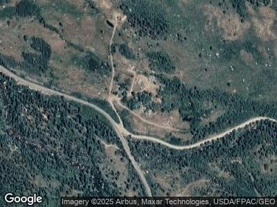
26617 Frying Pan Rd Meredith, CO 81642
Estimated Value: $648,963 - $1,923,000
--
Bed
--
Bath
1,976
Sq Ft
$548/Sq Ft
Est. Value
About This Home
This home is located at 26617 Frying Pan Rd, Meredith, CO 81642 and is currently estimated at $1,083,321, approximately $548 per square foot. 26617 Frying Pan Rd is a home located in Pitkin County.
Ownership History
Date
Name
Owned For
Owner Type
Purchase Details
Closed on
Sep 6, 2024
Sold by
John G Swomley Trust and Jennifer G Roberts Trust
Bought by
Swomley-Roberts Limited Liability Limitedpart
Current Estimated Value
Purchase Details
Closed on
Jul 19, 2021
Sold by
Cosinuke Robert L
Bought by
The John G Swomiey Trust
Purchase Details
Closed on
May 19, 2008
Sold by
Cutler Andrew J
Bought by
Swomley John G and Roberts Jennifer G
Home Financials for this Owner
Home Financials are based on the most recent Mortgage that was taken out on this home.
Original Mortgage
$340,000
Interest Rate
6.52%
Mortgage Type
Purchase Money Mortgage
Purchase Details
Closed on
Jan 24, 2003
Sold by
Baker Lindel C
Bought by
Swomley John G and Roberts Jennifer G
Home Financials for this Owner
Home Financials are based on the most recent Mortgage that was taken out on this home.
Original Mortgage
$450,000
Interest Rate
5.84%
Mortgage Type
Purchase Money Mortgage
Create a Home Valuation Report for This Property
The Home Valuation Report is an in-depth analysis detailing your home's value as well as a comparison with similar homes in the area
Home Values in the Area
Average Home Value in this Area
Purchase History
| Date | Buyer | Sale Price | Title Company |
|---|---|---|---|
| Swomley-Roberts Limited Liability Limitedpart | -- | None Listed On Document | |
| The John G Swomiey Trust | -- | None Available | |
| Swomley John G | -- | None Available | |
| Swomley John G | $800,000 | Stewart Title |
Source: Public Records
Mortgage History
| Date | Status | Borrower | Loan Amount |
|---|---|---|---|
| Previous Owner | Swomley John G | $340,000 | |
| Previous Owner | Swomley John G | $450,000 |
Source: Public Records
Tax History Compared to Growth
Tax History
| Year | Tax Paid | Tax Assessment Tax Assessment Total Assessment is a certain percentage of the fair market value that is determined by local assessors to be the total taxable value of land and additions on the property. | Land | Improvement |
|---|---|---|---|---|
| 2024 | $2,236 | $28,460 | $11,870 | $16,590 |
| 2023 | $2,236 | $31,430 | $13,100 | $18,330 |
| 2022 | $1,911 | $23,340 | $10,430 | $12,910 |
| 2021 | $1,961 | $24,010 | $10,730 | $13,280 |
| 2020 | $2,247 | $28,610 | $10,730 | $17,880 |
| 2019 | $2,247 | $28,610 | $10,730 | $17,880 |
| 2018 | $2,830 | $39,280 | $10,800 | $28,480 |
| 2017 | $2,668 | $49,520 | $24,120 | $25,400 |
| 2016 | $3,264 | $42,530 | $11,140 | $31,390 |
| 2015 | $3,276 | $42,530 | $11,140 | $31,390 |
| 2014 | $3,918 | $53,520 | $29,870 | $23,650 |
Source: Public Records
Map
Nearby Homes
- TDR Tdr
- TBD Woods Lake Area Basalt Rural
- 238 Hawk Ln
- 197 Wild Strawberry Ln Unit Lot 24
- 8266 Woody Creek Rd
- 750 S Starwood Rd
- 54 Spruce Rd
- 746 Hunter Creek Rd
- 395 E Reds Rd
- 910 White Star Dr
- 116 White Star Dr
- 754 Eppley Dr
- 200 Stewart Dr
- 623 Johnson Dr
- TBD Trentaz Dr
- 602 Eppley Dr
- 372 Sunnyside Ln
- 709 N Spruce
- 699 Eppley Dr
- 349 Draw Dr
