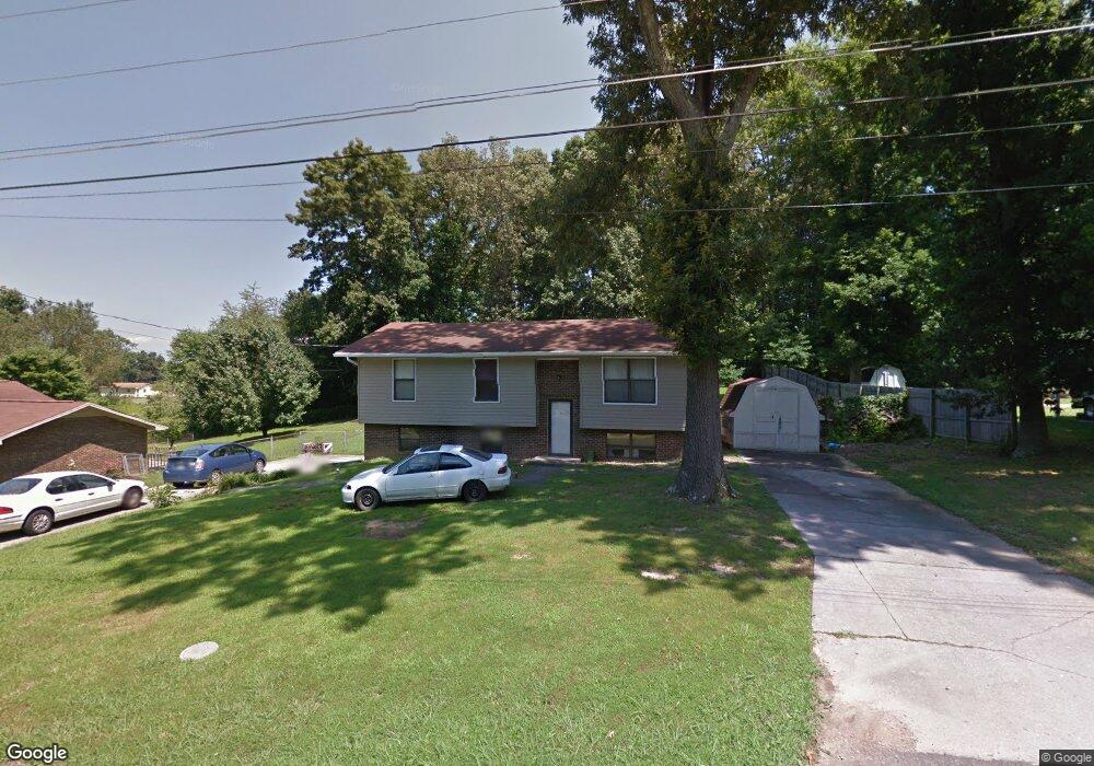
2663 Keystone Dr Morristown, TN 37814
Estimated Value: $181,000 - $236,000
--
Bed
2
Baths
1,002
Sq Ft
$211/Sq Ft
Est. Value
About This Home
This home is located at 2663 Keystone Dr, Morristown, TN 37814 and is currently estimated at $211,572, approximately $211 per square foot. 2663 Keystone Dr is a home located in Hamblen County with nearby schools including Fairview-Marguerite Elementary School, Meadowview Middle School, and Morristown East High School.
Ownership History
Date
Name
Owned For
Owner Type
Purchase Details
Closed on
May 11, 2022
Sold by
Conry Ruth P and Baker Ruth P
Bought by
Russell James B and Russell Teresa D
Current Estimated Value
Home Financials for this Owner
Home Financials are based on the most recent Mortgage that was taken out on this home.
Original Mortgage
$132,000
Outstanding Balance
$125,307
Interest Rate
4.67%
Mortgage Type
Balloon
Estimated Equity
$86,265
Purchase Details
Closed on
Oct 21, 1991
Bought by
Conry Neal Dean and Conry Ruth P
Purchase Details
Closed on
Jul 22, 1988
Bought by
Hurst Carson E and Hurst Sandra A
Purchase Details
Closed on
Feb 14, 1979
Bought by
Tipton Daniel E and Tipton Kristine B
Create a Home Valuation Report for This Property
The Home Valuation Report is an in-depth analysis detailing your home's value as well as a comparison with similar homes in the area
Home Values in the Area
Average Home Value in this Area
Purchase History
| Date | Buyer | Sale Price | Title Company |
|---|---|---|---|
| Russell James B | $165,000 | Lakeway Title Services | |
| Conry Neal Dean | $47,500 | -- | |
| Hurst Carson E | $39,000 | -- | |
| Tipton Daniel E | $33,900 | -- |
Source: Public Records
Mortgage History
| Date | Status | Borrower | Loan Amount |
|---|---|---|---|
| Open | Russell James B | $132,000 | |
| Previous Owner | Conry Ruth P | $45,000 | |
| Previous Owner | Conry Ruth P | $10,000 |
Source: Public Records
Tax History Compared to Growth
Tax History
| Year | Tax Paid | Tax Assessment Tax Assessment Total Assessment is a certain percentage of the fair market value that is determined by local assessors to be the total taxable value of land and additions on the property. | Land | Improvement |
|---|---|---|---|---|
| 2024 | $510 | $28,975 | $5,100 | $23,875 |
| 2023 | $510 | $28,975 | $0 | $0 |
| 2022 | $752 | $23,800 | $5,100 | $18,700 |
| 2021 | $752 | $23,800 | $5,100 | $18,700 |
| 2020 | $332 | $23,800 | $5,100 | $18,700 |
| 2019 | $684 | $20,100 | $4,425 | $15,675 |
| 2018 | $633 | $20,100 | $4,425 | $15,675 |
| 2017 | $623 | $20,100 | $4,425 | $15,675 |
| 2016 | $595 | $20,100 | $4,425 | $15,675 |
| 2015 | $554 | $20,100 | $4,425 | $15,675 |
| 2014 | -- | $20,100 | $4,425 | $15,675 |
| 2013 | -- | $22,975 | $0 | $0 |
Source: Public Records
Map
Nearby Homes
- 2909 Nicole Cir
- 2993 Nicole Cir
- 2405 Southern Dr
- 1683 Pebblestone Ct
- 2998 Nicole Cir
- 3004 Nicole Cir
- Lot 1 N Davy Crockett Pkwy
- 00 N Davy Crockett Pkwy
- 2320 Southern Dr
- 1864 Limestone Path
- 1961 Brights View Ln
- Lot 2 Morelock Rd
- 2035 Reese St
- 1250 N Liberty Hill Rd
- 2828 Reeds Chapel Rd
- 1250 N Liberty Hill Dr
- 2165 Brights Pike
- 3113 Berna Way
- 0 Brights Pike
- 512 Cliff St
- 2639 Keystone Dr
- 2687 Keystone Dr
- 2662 Keystone Dr
- 2621 Keystone Dr
- 2707 Keystone Dr
- 2638 Keystone Dr
- 2686 Keystone Dr
- 2708 Keystone Dr
- 2620 Keystone Dr
- 2605 Keystone Dr
- 2725 Keystone Dr
- 2666 Lanter Dr
- 2682 Lanter Dr
- 2646 Lanter Dr
- 2606 Keystone Dr
- 2724 Keystone Dr
- 2358 Patricia Cir
- 2360 Patricia Cir
- 2712 Lanter Dr
- 2356 Patricia Cir