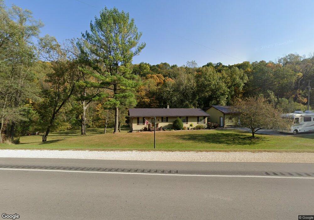
26642 Highway 13 Elkader, IA 52043
Estimated Value: $218,000 - $243,000
3
Beds
3
Baths
1,173
Sq Ft
$197/Sq Ft
Est. Value
About This Home
This home is located at 26642 Highway 13, Elkader, IA 52043 and is currently estimated at $231,026, approximately $196 per square foot. 26642 Highway 13 is a home located in Clayton County with nearby schools including Central Elementary School and Central Middle School/High School.
Ownership History
Date
Name
Owned For
Owner Type
Purchase Details
Closed on
Jan 13, 2024
Sold by
Cook Cynthia Lea and Cook Michael H
Bought by
Cook Michael H and Cook Cindy L
Current Estimated Value
Home Financials for this Owner
Home Financials are based on the most recent Mortgage that was taken out on this home.
Original Mortgage
$146,520
Outstanding Balance
$143,860
Interest Rate
7.03%
Mortgage Type
FHA
Estimated Equity
$87,166
Create a Home Valuation Report for This Property
The Home Valuation Report is an in-depth analysis detailing your home's value as well as a comparison with similar homes in the area
Home Values in the Area
Average Home Value in this Area
Purchase History
| Date | Buyer | Sale Price | Title Company |
|---|---|---|---|
| Cook Michael H | -- | None Listed On Document |
Source: Public Records
Mortgage History
| Date | Status | Borrower | Loan Amount |
|---|---|---|---|
| Open | Cook Michael H | $146,520 |
Source: Public Records
Tax History Compared to Growth
Tax History
| Year | Tax Paid | Tax Assessment Tax Assessment Total Assessment is a certain percentage of the fair market value that is determined by local assessors to be the total taxable value of land and additions on the property. | Land | Improvement |
|---|---|---|---|---|
| 2025 | $1,454 | $168,465 | $47,495 | $120,970 |
| 2024 | $1,490 | $141,572 | $41,300 | $100,272 |
| 2023 | $1,498 | $141,572 | $41,300 | $100,272 |
| 2022 | $1,444 | $116,199 | $36,040 | $80,159 |
| 2021 | $1,340 | $116,199 | $36,040 | $80,159 |
| 2020 | $1,340 | $104,859 | $30,910 | $73,949 |
| 2019 | $1,338 | $104,859 | $30,910 | $73,949 |
| 2018 | $1,338 | $102,017 | $30,910 | $71,107 |
| 2017 | $1,314 | $102,017 | $30,910 | $71,107 |
| 2015 | $1,126 | $94,893 | $15,800 | $79,093 |
| 2014 | $1,114 | $88,263 | $13,125 | $75,138 |
Source: Public Records
Map
Nearby Homes
- 209 2nd St SW
- 117 S Main St
- 301 N 1st St
- 27766 Highway 13
- 0 E Bridge St
- 302 N 3rd St
- 702 N Main St
- 707 N Main St
- 710 Woodland Dr NW
- 247 Franzen Ridge Rd
- 249 Franzen Ridge Rd
- 0 13 Hwy Unit NBR20255145
- 0 Grandview Rd
- 27455 Harbor Rd
- 14149 Iowa 56
- TBD Birch Rd
- TBD Country Rd
- 305 S Russell St
- 108 Adams Ct
- 306 S Monroe St
- 26642 Highway 13
- 20460 265th St
- 19747 270th St
- 20138 Highway 56
- 20124 Highway 56
- 20124 Highway 56
- 20122 Highway 56
- 20122 Hwy 56
- 709 Highway 56
- 703 Strawberry Point Rd
- 123 Reimer St SW
- 121 Reimer St SW
- 119 Reimer St SW
- 117 Reimer St SW
- 115 Reimer St SW
- 19862 270th St
- 111 Reimer St SW
- 600 Strawberry Point Rd SW
- 109 Reimer St SW
- 107 Reimer St SW