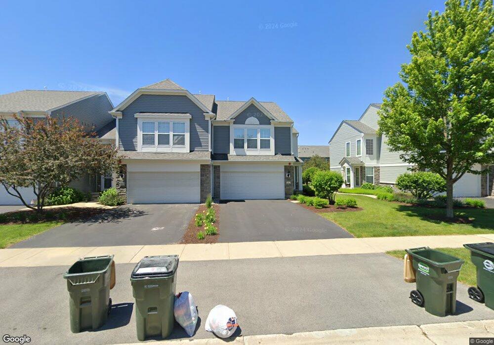
267 Devoe Dr Unit 324 Oswego, IL 60543
North Oswego NeighborhoodEstimated Value: $312,000 - $321,000
2
Beds
3
Baths
1,521
Sq Ft
$208/Sq Ft
Est. Value
About This Home
This home is located at 267 Devoe Dr Unit 324, Oswego, IL 60543 and is currently estimated at $316,097, approximately $207 per square foot. 267 Devoe Dr Unit 324 is a home located in Kendall County with nearby schools including Southbury Elementary School, Murphy Junior High School, and Oswego East High School.
Ownership History
Date
Name
Owned For
Owner Type
Purchase Details
Closed on
Jun 19, 2025
Sold by
Steele Patricia L and Steele Tedd P
Bought by
Steele Patricia L
Current Estimated Value
Purchase Details
Closed on
Jul 29, 2011
Sold by
Pulte Home Corporation
Bought by
Steele Patricia L and Steele Tedd P
Home Financials for this Owner
Home Financials are based on the most recent Mortgage that was taken out on this home.
Original Mortgage
$136,060
Interest Rate
4.64%
Mortgage Type
New Conventional
Create a Home Valuation Report for This Property
The Home Valuation Report is an in-depth analysis detailing your home's value as well as a comparison with similar homes in the area
Home Values in the Area
Average Home Value in this Area
Purchase History
| Date | Buyer | Sale Price | Title Company |
|---|---|---|---|
| Steele Patricia L | -- | None Listed On Document | |
| Steele Patricia L | $170,500 | None Available |
Source: Public Records
Mortgage History
| Date | Status | Borrower | Loan Amount |
|---|---|---|---|
| Previous Owner | Steele Patricia L | $136,060 |
Source: Public Records
Tax History
| Year | Tax Paid | Tax Assessment Tax Assessment Total Assessment is a certain percentage of the fair market value that is determined by local assessors to be the total taxable value of land and additions on the property. | Land | Improvement |
|---|---|---|---|---|
| 2024 | $6,474 | $86,448 | $19,034 | $67,414 |
| 2023 | $5,796 | $76,502 | $16,844 | $59,658 |
| 2022 | $5,796 | $70,185 | $15,453 | $54,732 |
| 2021 | $5,877 | $68,809 | $15,150 | $53,659 |
| 2020 | $5,870 | $68,128 | $15,000 | $53,128 |
| 2019 | $5,964 | $68,128 | $15,000 | $53,128 |
| 2018 | $5,569 | $63,529 | $11,208 | $52,321 |
| 2017 | $5,387 | $58,552 | $10,330 | $48,222 |
| 2016 | $5,015 | $54,215 | $9,565 | $44,650 |
| 2015 | $4,722 | $49,286 | $8,695 | $40,591 |
| 2014 | $2,506 | $47,391 | $8,361 | $39,030 |
| 2013 | $2,506 | $49,885 | $8,801 | $41,084 |
Source: Public Records
Map
Nearby Homes
- 608 Hawley Dr Unit 4342
- 240 Devoe Dr
- 464 Valentine Way
- 460 Valentine Way
- 314 Parker Place
- 3017 Lundquist Dr
- 605 Murdock Place
- 241 Cooney Way
- 353 Danforth Dr
- 601 Murdock Place
- 234 Cooney Way
- 391 Danforth Dr
- 602 Murdock Place
- 347 Danforth Dr
- 339 Danforth Dr
- 115 Henderson St
- 377 Danforth Dr
- 379 Danforth Dr
- 375 Danforth Dr
- 385 Danforth Dr
- 263 Devoe Dr
- 261 Devoe Dr Unit 4321
- 263 Devoe Dr Unit 322
- 263 Devoe Dr Unit 7-2
- 265 Devoe Dr Unit 265
- 265 Devoe Dr Unit 543
- 265 Devoe Dr
- 265 Devoe Dr Unit 323
- 630 Hawley Dr Unit 4364
- 632 Hawley Dr Unit 4363
- 636 Hawley Dr Unit 4361
- 630 Hawley Dr Unit 630
- 632 Hawley Dr Unit 363
- 634 Hawley Dr Unit 4362
- 634 Hawley Dr Unit 634
- 260 Devoe Dr
- 291 Devoe Dr Unit 4316
- 289 Devoe Dr Unit 4315
- 287 Devoe Dr Unit 4314
- 285 Devoe Dr Unit 4313
Your Personal Tour Guide
Ask me questions while you tour the home.