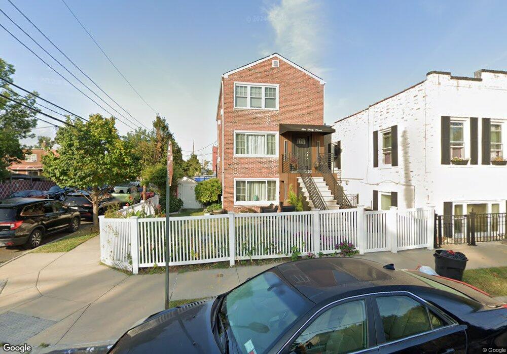
267 Swinton Ave Bronx, NY 10465
Throgs Neck-Edgewater Park NeighborhoodEstimated Value: $789,459 - $963,000
Studio
--
Bath
2,109
Sq Ft
$412/Sq Ft
Est. Value
About This Home
This home is located at 267 Swinton Ave, Bronx, NY 10465 and is currently estimated at $868,615, approximately $411 per square foot. 267 Swinton Ave is a home located in Bronx County with nearby schools including P.S. 72 - Dr. William Dorney, Herbert H Lehman High School, and St. Frances de Chantal School.
Ownership History
Date
Name
Owned For
Owner Type
Purchase Details
Closed on
Oct 14, 1999
Sold by
Poppiti Anna Marie
Bought by
Roman Ferdinand and Correa Roman Allison
Current Estimated Value
Home Financials for this Owner
Home Financials are based on the most recent Mortgage that was taken out on this home.
Original Mortgage
$220,875
Interest Rate
7.73%
Create a Home Valuation Report for This Property
The Home Valuation Report is an in-depth analysis detailing your home's value as well as a comparison with similar homes in the area
Home Values in the Area
Average Home Value in this Area
Purchase History
| Date | Buyer | Sale Price | Title Company |
|---|---|---|---|
| Roman Ferdinand | $232,500 | Fidelity National Title Ins |
Source: Public Records
Mortgage History
| Date | Status | Borrower | Loan Amount |
|---|---|---|---|
| Previous Owner | Roman Ferdinand | $220,875 |
Source: Public Records
Tax History
| Year | Tax Paid | Tax Assessment Tax Assessment Total Assessment is a certain percentage of the fair market value that is determined by local assessors to be the total taxable value of land and additions on the property. | Land | Improvement |
|---|---|---|---|---|
| 2025 | $7,397 | $38,219 | $9,687 | $28,532 |
| 2024 | $7,397 | $36,826 | $8,879 | $27,947 |
| 2023 | $7,331 | $36,098 | $8,196 | $27,902 |
| 2022 | $6,799 | $47,340 | $10,980 | $36,360 |
| 2021 | $6,782 | $40,440 | $10,980 | $29,460 |
| 2020 | $6,741 | $37,380 | $10,980 | $26,400 |
| 2019 | $6,420 | $35,580 | $10,980 | $24,600 |
| 2018 | $6,132 | $30,082 | $8,229 | $21,853 |
| 2017 | $5,785 | $28,380 | $10,980 | $17,400 |
| 2016 | $5,369 | $26,856 | $9,810 | $17,046 |
| 2015 | $3,019 | $26,541 | $12,162 | $14,379 |
| 2014 | $3,019 | $25,574 | $11,237 | $14,337 |
Source: Public Records
Map
Nearby Homes
- 276 Brinsmade Ave
- 252 Brinsmade Ave
- 238 Swinton Ave
- 249 Calhoun Ave
- 239 Brinsmade Ave
- 227 Calhoun Ave
- 310 Huntington Ave
- 2738 Miles Ave
- 2832 Harding Ave
- 278 Balcom Ave
- 280 Balcom Ave
- 2819 Collis Place
- 244 Revere Ave
- 346 Brinsmade Ave
- 192 Huntington Ave
- 4190 E Tremont Ave
- 4216 E Tremont Ave
- 2816 Collis Place
- 269 Balcom Ave
- 2780 Sampson Ave
- 269 Swinton Ave
- 273 Swinton Ave
- 259 Swinton Ave
- 262 Brinsmade Ave
- 264 Brinsmade Ave
- 266 Brinsmade Ave
- 257 Swinton Ave
- 275 Swinton Ave
- 268 Brinsmade Ave
- 270 Brinsmade Ave
- 254 Brinsmade Ave
- 255 Swinton Ave
- 272 Brinsmade Ave
- 274 Brinsmade Ave
- 2811 Lawton Ave
- 264 Swinton Ave
- 279 Swinton Ave
- 250 Brinsmade Ave
- 266 Swinton Ave
- 251 Swinton Ave
Your Personal Tour Guide
Ask me questions while you tour the home.