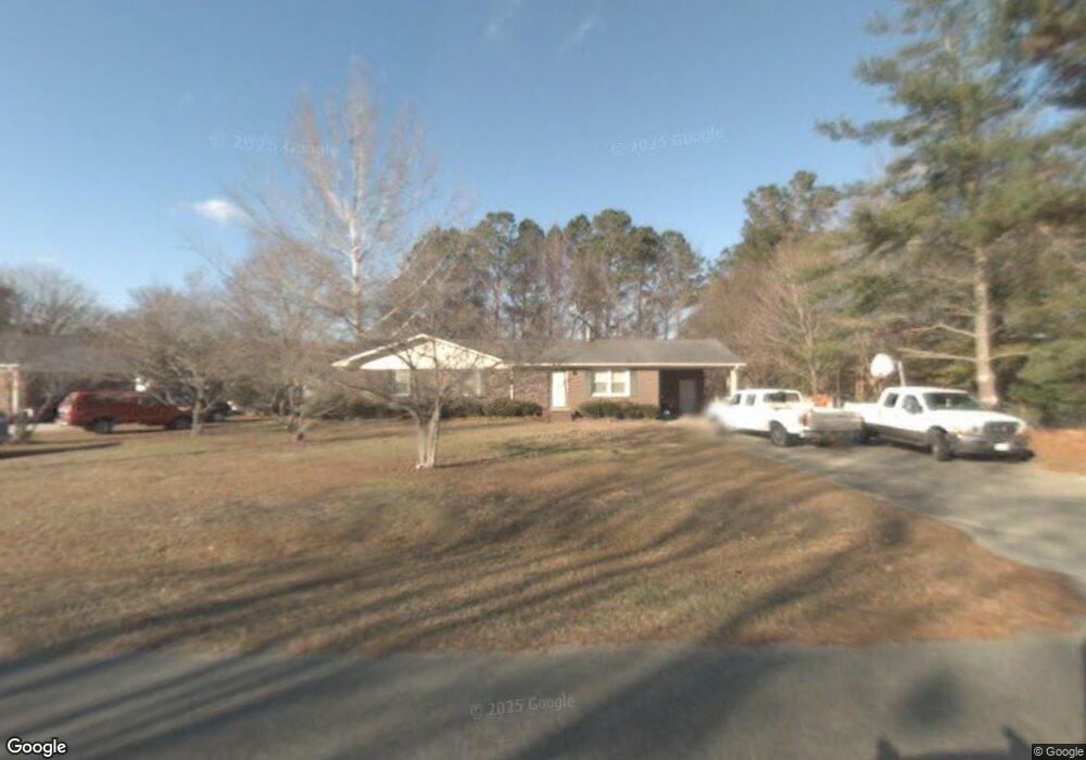
2670 Forrest Dr Kinston, NC 28504
Estimated Value: $156,000 - $200,000
3
Beds
2
Baths
1,521
Sq Ft
$119/Sq Ft
Est. Value
About This Home
This home is located at 2670 Forrest Dr, Kinston, NC 28504 and is currently estimated at $180,840, approximately $118 per square foot. 2670 Forrest Dr is a home located in Lenoir County with nearby schools including Banks Elementary School, E.B. Frink Middle School, and North Lenoir High School.
Ownership History
Date
Name
Owned For
Owner Type
Purchase Details
Closed on
Apr 14, 2016
Sold by
Cannon Wesley Alton and Cannon Jennifer
Bought by
Arthur Rick L and Arthur Judy L
Current Estimated Value
Purchase Details
Closed on
Sep 14, 2007
Sold by
Harper David Blackledge
Bought by
Cannon Wesley Alton
Home Financials for this Owner
Home Financials are based on the most recent Mortgage that was taken out on this home.
Original Mortgage
$49,500
Interest Rate
6.62%
Mortgage Type
New Conventional
Create a Home Valuation Report for This Property
The Home Valuation Report is an in-depth analysis detailing your home's value as well as a comparison with similar homes in the area
Home Values in the Area
Average Home Value in this Area
Purchase History
| Date | Buyer | Sale Price | Title Company |
|---|---|---|---|
| Arthur Rick L | $65,000 | None Available | |
| Cannon Wesley Alton | $55,000 | None Available |
Source: Public Records
Mortgage History
| Date | Status | Borrower | Loan Amount |
|---|---|---|---|
| Previous Owner | Cannon Wesley Alton | $49,500 |
Source: Public Records
Tax History
| Year | Tax Paid | Tax Assessment Tax Assessment Total Assessment is a certain percentage of the fair market value that is determined by local assessors to be the total taxable value of land and additions on the property. | Land | Improvement |
|---|---|---|---|---|
| 2025 | $1,014 | $127,523 | $17,215 | $110,308 |
| 2024 | $873 | $96,702 | $15,000 | $81,702 |
| 2023 | $963 | $96,702 | $15,000 | $81,702 |
| 2022 | $963 | $96,702 | $15,000 | $81,702 |
| 2021 | $960 | $96,702 | $15,000 | $81,702 |
| 2020 | $960 | $96,702 | $15,000 | $81,702 |
| 2019 | $963 | $96,702 | $15,000 | $81,702 |
| 2018 | $948 | $96,702 | $15,000 | $81,702 |
| 2017 | $947 | $96,702 | $15,000 | $81,702 |
| 2014 | -- | $115,304 | $15,000 | $100,304 |
| 2013 | $1,099 | $115,304 | $15,000 | $100,304 |
| 2011 | -- | $115,304 | $15,000 | $100,304 |
Source: Public Records
Map
Nearby Homes
- 2634 Forrest Dr
- 2131 Brinson St
- 0 Dogwood Ln Unit 100189056
- 2193 Dogwood Ln
- 2917 Laurel Ridge Ln
- 2111 Hunt Hill Place
- 2585 Cabin Branch Rd
- 1729 Holly Ridge Rd
- 3101 Marion Heights Dr
- 2660 Saint John Cir Unit Na
- 1801 Crestview St
- 2443 Creekside Rd
- 3145 Lakewood Dr Unit 3155
- 3128 Kelly Rd
- 3118 Kelly Rd
- 2857 Branchwood Dr
- 2012 Hwy 258 N
- 2100 Hwy 258 N
- 1596 Hwy 258 N
- 3216 Dexter Cir
- 2682 Forrest Dr
- 2660 Forrest Dr
- 2663 Pine Knoll Dr
- 2671 Pine Knoll Dr
- Lot 5 Forrest Dr
- 2655 Pine Knoll Dr
- 2692 Forrest Dr
- 2648 Forrest Dr
- 2679 Pine Knoll Dr
- 2675 Forrest Dr
- 2665 Forrest Dr
- 2645 Pine Knoll Dr
- 2687 Forrest Dr
- 2685 Pine Knoll Dr
- 2653 Forrest Dr
- 2637 Pine Knoll Dr
- 2704 Forrest Dr
- 2689 Pine Knoll Dr
- 2641 Forrest Dr
- 2629 Pine Knoll Dr