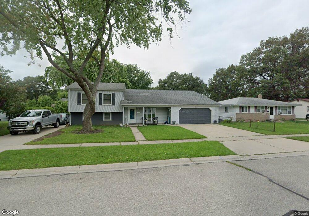
2671 E Rick Dr Port Huron, MI 48060
Estimated Value: $240,000 - $372,000
4
Beds
4
Baths
2,967
Sq Ft
$99/Sq Ft
Est. Value
About This Home
This home is located at 2671 E Rick Dr, Port Huron, MI 48060 and is currently estimated at $294,314, approximately $99 per square foot. 2671 E Rick Dr is a home located in St. Clair County with nearby schools including Michigamme Elementary School, Central Middle School, and Port Huron High School.
Ownership History
Date
Name
Owned For
Owner Type
Purchase Details
Closed on
Apr 13, 2021
Sold by
Burrell Tyrone and Burrell Laura P
Bought by
Burrell Tyrone and Burrell Laura P
Current Estimated Value
Home Financials for this Owner
Home Financials are based on the most recent Mortgage that was taken out on this home.
Original Mortgage
$130,000
Interest Rate
2.3%
Mortgage Type
New Conventional
Create a Home Valuation Report for This Property
The Home Valuation Report is an in-depth analysis detailing your home's value as well as a comparison with similar homes in the area
Home Values in the Area
Average Home Value in this Area
Purchase History
We collect this data history from publicly available records. To have your information removed, we recommend requesting removal directly through your county’s website.
| Date | Buyer | Sale Price | Title Company |
|---|---|---|---|
| Burrell Tyrone | -- | None Listed On Document |
Source: Public Records
Mortgage History
We collect this data history from publicly available records. To have your information removed, we recommend requesting removal directly through your county’s website.
| Date | Status | Borrower | Loan Amount |
|---|---|---|---|
| Previous Owner | Burrell Tyrone | $130,000 |
Source: Public Records
Tax History
| Year | Tax Paid | Tax Assessment Tax Assessment Total Assessment is a certain percentage of the fair market value that is determined by local assessors to be the total taxable value of land and additions on the property. | Land | Improvement |
|---|---|---|---|---|
| 2025 | $2,851 | $134,000 | $0 | $0 |
| 2024 | $2,781 | $129,300 | $0 | $0 |
| 2023 | $2,627 | $115,600 | $0 | $0 |
| 2022 | $2,823 | $99,800 | $0 | $0 |
| 2020 | $2,709 | $86,600 | $86,600 | $0 |
| 2019 | $2,608 | $62,200 | $0 | $0 |
| 2018 | $2,550 | $62,200 | $0 | $0 |
| 2017 | $2,275 | $56,500 | $0 | $0 |
| 2016 | $1,956 | $56,500 | $0 | $0 |
| 2015 | $1,920 | $56,400 | $56,400 | $0 |
| 2014 | $1,920 | $54,100 | $54,100 | $0 |
| 2013 | -- | $52,700 | $0 | $0 |
Source: Public Records
Map
Nearby Homes
- 1218 Center Ave
- 1334 Beard St
- 2712 Military St
- 2704 Military St
- 1303 Beard St
- 3136 Military St
- 2444 Military St
- 1301 Bancroft St
- 1026 Bancroft St
- 1412 Minnie St
- 1211 Minnie St
- 1825 16th St
- 1831 11th St
- 0 Military Vl St
- Lot 3 24th St
- 1918 Minnie St
- 738 Bancroft St
- 2203 VL Railroad St
- 2200 VL Railroad St
- 929 Division St
Your Personal Tour Guide
Ask me questions while you tour the home.