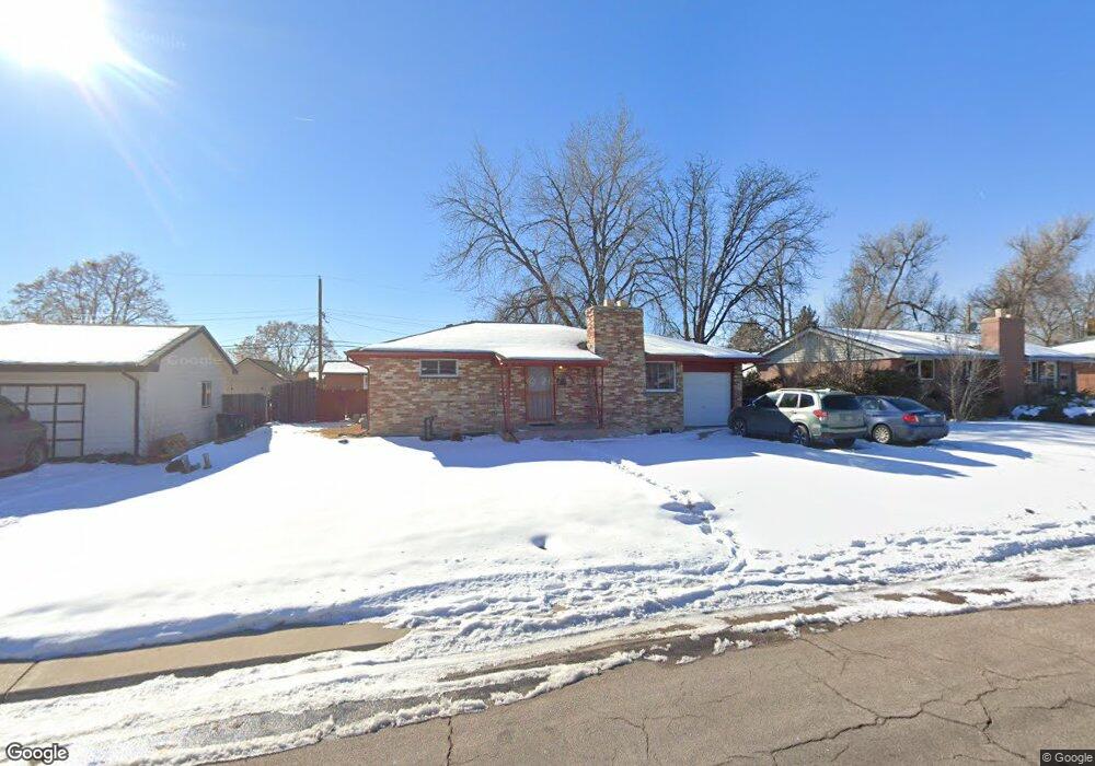
2672 Meadowbrook Dr Denver, CO 80221
Sherrelwood NeighborhoodEstimated Value: $402,000 - $456,000
2
Beds
2
Baths
875
Sq Ft
$490/Sq Ft
Est. Value
About This Home
This home is located at 2672 Meadowbrook Dr, Denver, CO 80221 and is currently estimated at $428,602, approximately $489 per square foot. 2672 Meadowbrook Dr is a home located in Adams County with nearby schools including Fairview PK-8, Iver C. Ranum Middle School, and Westminster High School.
Ownership History
Date
Name
Owned For
Owner Type
Purchase Details
Closed on
Jul 25, 2003
Sold by
Welch Beverly A
Bought by
Rodriguez Carlos F and Rodriguez Michelle A
Current Estimated Value
Home Financials for this Owner
Home Financials are based on the most recent Mortgage that was taken out on this home.
Original Mortgage
$140,400
Outstanding Balance
$59,376
Interest Rate
5.19%
Mortgage Type
Unknown
Estimated Equity
$369,226
Create a Home Valuation Report for This Property
The Home Valuation Report is an in-depth analysis detailing your home's value as well as a comparison with similar homes in the area
Home Values in the Area
Average Home Value in this Area
Purchase History
| Date | Buyer | Sale Price | Title Company |
|---|---|---|---|
| Rodriguez Carlos F | $156,000 | Landamerica Lawyers Title |
Source: Public Records
Mortgage History
| Date | Status | Borrower | Loan Amount |
|---|---|---|---|
| Open | Rodriguez Carlos F | $140,400 |
Source: Public Records
Tax History Compared to Growth
Tax History
| Year | Tax Paid | Tax Assessment Tax Assessment Total Assessment is a certain percentage of the fair market value that is determined by local assessors to be the total taxable value of land and additions on the property. | Land | Improvement |
|---|---|---|---|---|
| 2024 | $2,992 | $26,070 | $5,380 | $20,690 |
| 2023 | $2,975 | $29,500 | $5,550 | $23,950 |
| 2022 | $2,808 | $22,930 | $5,700 | $17,230 |
| 2021 | $2,864 | $22,930 | $5,700 | $17,230 |
| 2020 | $2,894 | $23,560 | $5,860 | $17,700 |
| 2019 | $2,884 | $23,560 | $5,860 | $17,700 |
| 2018 | $2,231 | $18,020 | $5,900 | $12,120 |
| 2017 | $1,956 | $18,020 | $5,900 | $12,120 |
| 2016 | $1,479 | $12,860 | $2,790 | $10,070 |
| 2015 | $1,476 | $12,860 | $2,790 | $10,070 |
| 2014 | $1,449 | $12,050 | $2,470 | $9,580 |
Source: Public Records
Map
Nearby Homes
- 2612 Meadowbrook Dr
- 2785 Skyline Dr
- 2840 Cottonwood Dr
- 7898 Applewood Ln
- 7482 Beach Ct
- 2580 Valley View Dr
- 7644 Wyandot St
- 7952 Zuni St
- 2420 W 80th Ave
- 8034 Decatur St
- 2281 Samuel Dr
- 8028 Bryant St
- 2241 Samuel Dr
- 7940 Appleblossom Ln
- 7819 Tejon St
- 7620 Hooker St
- 7361 Clay St
- 7351 Canosa Ct
- 7350 Dale Ct
- 7610 Tejon St
- 2652 Meadowbrook Dr
- 2682 Meadowbrook Dr
- 2643 Westchester Dr
- 2632 Meadowbrook Dr
- 2653 Westchester Dr
- 2692 Meadowbrook Dr
- 2633 Westchester Dr
- 2633 Meadowbrook Dr
- 2653 Meadowbrook Dr
- 2613 Meadowbrook Dr
- 2673 Meadowbrook Dr
- 2623 Westchester Dr
- 2722 Meadowbrook Dr
- 2663 Westchester Dr
- 2603 Meadowbrook Dr
- 2683 Meadowbrook Dr
- 2613 Westchester Dr
- 2650 Westchester Dr
- 2583 Meadowbrook Dr
- 2650 Cottonwood Dr