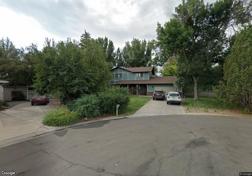
2675 Storm King Ave Montrose, CO 81401
Estimated Value: $476,000 - $496,000
3
Beds
3
Baths
2,020
Sq Ft
$240/Sq Ft
Est. Value
About This Home
This home is located at 2675 Storm King Ave, Montrose, CO 81401 and is currently estimated at $484,706, approximately $239 per square foot. 2675 Storm King Ave is a home located in Montrose County with nearby schools including Cottonwood Elementary School, Columbine Middle School, and Montrose High School.
Ownership History
Date
Name
Owned For
Owner Type
Purchase Details
Closed on
Dec 13, 2019
Sold by
Rusk Kala and Rusk Michael
Bought by
Barnett Zack and Barnett Jessica
Current Estimated Value
Home Financials for this Owner
Home Financials are based on the most recent Mortgage that was taken out on this home.
Original Mortgage
$236,000
Outstanding Balance
$208,474
Interest Rate
3.7%
Mortgage Type
New Conventional
Estimated Equity
$276,232
Purchase Details
Closed on
Sep 10, 2019
Sold by
Wilson Diane L and Wilson Robert D
Bought by
Rusk Kala and Rusk Michael
Purchase Details
Closed on
Jun 15, 2001
Sold by
Roberts James M and Roberts Lenora A
Bought by
Wilson Robert D and Wilson Diane L
Purchase Details
Closed on
Sep 15, 1986
Sold by
Omalley Charles M and Omalley Nancy L
Bought by
Roberts James M and Roberts Lenora A
Purchase Details
Closed on
Jul 8, 1980
Sold by
Vista San Juan Inc
Bought by
Omalley Charles M and Omalley Nancy L
Create a Home Valuation Report for This Property
The Home Valuation Report is an in-depth analysis detailing your home's value as well as a comparison with similar homes in the area
Home Values in the Area
Average Home Value in this Area
Purchase History
| Date | Buyer | Sale Price | Title Company |
|---|---|---|---|
| Barnett Zack | $281,000 | Fidelity National Title | |
| Rusk Kala | -- | None Available | |
| Wilson Robert D | $189,900 | -- | |
| Roberts James M | $87,500 | -- | |
| Omalley Charles M | $12,500 | -- |
Source: Public Records
Mortgage History
| Date | Status | Borrower | Loan Amount |
|---|---|---|---|
| Open | Barnett Zack | $236,000 |
Source: Public Records
Tax History Compared to Growth
Tax History
| Year | Tax Paid | Tax Assessment Tax Assessment Total Assessment is a certain percentage of the fair market value that is determined by local assessors to be the total taxable value of land and additions on the property. | Land | Improvement |
|---|---|---|---|---|
| 2024 | $1,844 | $25,590 | $3,220 | $22,370 |
| 2023 | $1,844 | $30,360 | $3,820 | $26,540 |
| 2022 | $1,264 | $18,110 | $2,430 | $15,680 |
| 2021 | $1,302 | $18,630 | $2,500 | $16,130 |
| 2020 | $1,061 | $15,610 | $2,270 | $13,340 |
| 2019 | $1,068 | $15,610 | $2,270 | $13,340 |
| 2018 | $1,046 | $14,900 | $1,990 | $12,910 |
| 2017 | $1,038 | $14,900 | $1,990 | $12,910 |
| 2016 | $970 | $14,150 | $2,010 | $12,140 |
| 2015 | $952 | $14,150 | $2,010 | $12,140 |
| 2014 | $852 | $13,530 | $2,010 | $11,520 |
Source: Public Records
Map
Nearby Homes
- 2669 Lone Cone Ave
- 1649 Sneffels St
- 1649 Hermosa St
- 1600 Arland Rd Unit 3
- 0 E Oak Grove Rd
- Tract A & 3 E Oak Grove Rd
- Tract 3 E Oak Grove Rd
- Tract A, 3 Lot2 E Oak Grove Rd
- Tract A E Oak Grove Rd
- Lot 2 E Oak Grove Rd
- Lot 5 TBD E Oak Grove Rd
- TBD Lot 1 E Oak Grove Rd
- TBD Odelle Rd
- TBD Tbd Lot 2-B
- 1686 Rheims Ct
- TBD Tbd Lot 4-B
- 1691 Rheims Ct
- TBD Tbd Lot 2-A
- 2707 Abrams Ave
- TBD Tbd Lot 4-D
- 2686 Storm King Ave
- 2671 Storm King Ave
- 1632 Wetterhorn Ct
- 2770 Woodgate Rd
- 1635 Wetterhorn Ct
- 1635 Ironton Ct
- 1540 Sneffles St
- 1580 Sneffles St
- 1638 Wetterhorn Ct
- 0 Wetterhorn Ct
- 2798 Woodgate Rd Unit B
- 2798 Woodgate Rd Unit C
- 2798 Woodgate Rd
- 2798 Woodgate Rd Unit A
- 0 Woodgate Rd #A Unit 671006
- 0 Woodgate Rd #A Unit 683315
- 1600 Sneffles St
- 1639 Ironton Ct
- 1639 Wetterhorn Ct
- 0 Ironton Ct