Estimated Value: $175,829 - $193,000
3
Beds
1
Bath
970
Sq Ft
$188/Sq Ft
Est. Value
About This Home
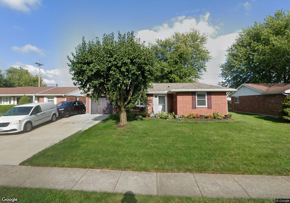
This home is located at 2675 Wyoming Dr, Xenia, OH 45385 and is currently estimated at $182,707, approximately $188 per square foot. 2675 Wyoming Dr is a home located in Greene County with nearby schools including Xenia High School and Summit Academy Community School for Alternative Learners - Xenia.
Ownership History
Date
Name
Owned For
Owner Type
Purchase Details
Closed on
Jun 29, 1998
Sold by
Brooks Brian K and Brooks Rachel M
Bought by
Vaughn Walter A and Vaughn Joanna M
Current Estimated Value
Home Financials for this Owner
Home Financials are based on the most recent Mortgage that was taken out on this home.
Original Mortgage
$73,926
Outstanding Balance
$15,352
Interest Rate
7.17%
Mortgage Type
FHA
Estimated Equity
$167,355
Purchase Details
Closed on
Aug 12, 1997
Sold by
Mesnard Bryan M
Bought by
Brooks Brian K and Brooks M
Home Financials for this Owner
Home Financials are based on the most recent Mortgage that was taken out on this home.
Original Mortgage
$60,500
Interest Rate
7.68%
Mortgage Type
New Conventional
Purchase Details
Closed on
Apr 28, 1995
Sold by
Hilliard David C
Bought by
Mesnard Bryan M and Mesnard M
Home Financials for this Owner
Home Financials are based on the most recent Mortgage that was taken out on this home.
Original Mortgage
$61,250
Interest Rate
8.42%
Mortgage Type
New Conventional
Create a Home Valuation Report for This Property
The Home Valuation Report is an in-depth analysis detailing your home's value as well as a comparison with similar homes in the area
Home Values in the Area
Average Home Value in this Area
Purchase History
| Date | Buyer | Sale Price | Title Company |
|---|---|---|---|
| Vaughn Walter A | $74,000 | -- | |
| Brooks Brian K | $69,000 | -- | |
| Mesnard Bryan M | $64,500 | -- |
Source: Public Records
Mortgage History
| Date | Status | Borrower | Loan Amount |
|---|---|---|---|
| Open | Vaughn Walter A | $73,926 | |
| Closed | Brooks Brian K | $60,500 | |
| Previous Owner | Mesnard Bryan M | $61,250 |
Source: Public Records
Tax History Compared to Growth
Tax History
| Year | Tax Paid | Tax Assessment Tax Assessment Total Assessment is a certain percentage of the fair market value that is determined by local assessors to be the total taxable value of land and additions on the property. | Land | Improvement |
|---|---|---|---|---|
| 2024 | $1,818 | $42,490 | $11,140 | $31,350 |
| 2023 | $1,818 | $42,490 | $11,140 | $31,350 |
| 2022 | $1,502 | $29,930 | $6,550 | $23,380 |
| 2021 | $1,522 | $29,930 | $6,550 | $23,380 |
| 2020 | $1,458 | $29,930 | $6,550 | $23,380 |
| 2019 | $1,230 | $23,760 | $6,370 | $17,390 |
| 2018 | $1,234 | $23,760 | $6,370 | $17,390 |
| 2017 | $1,199 | $23,760 | $6,370 | $17,390 |
| 2016 | $1,130 | $21,350 | $6,370 | $14,980 |
| 2015 | $1,133 | $21,350 | $6,370 | $14,980 |
| 2014 | $1,085 | $21,350 | $6,370 | $14,980 |
Source: Public Records
Map
Nearby Homes
- 161 Montana Dr
- 2758 Wyoming Dr
- 219 Kansas Dr
- 414 Whisper Ln
- 1568 Cheyenne Dr
- 1653 Seneca Dr
- 2142 Michigan Dr
- 2545 Harmony Dr
- 121 S Progress Dr
- 1769 Gayhart Dr
- 1829 Gayhart Dr
- 1403 Texas Dr
- 1778 Arapaho Dr
- 2257 Maryland Dr
- 1144 Rockwell Dr
- 1866 Roxbury Dr
- 1107 Arkansas Dr
- 1255 Colorado Dr
- 1342 Kylemore Dr
- 1391 June Dr
- 2687 Wyoming Dr
- 2663 Wyoming Dr
- 2699 Wyoming Dr
- 2651 Wyoming Dr
- 2642 Wyoming Dr
- 2682 Wyoming Dr
- 2639 Wyoming Dr
- 2711 Wyoming Dr
- 2696 Wyoming Dr
- 2627 Wyoming Dr
- 2723 Wyoming Dr
- 2710 Wyoming Dr
- 2615 Wyoming Dr
- 179 Montana Dr
- 2722 Wyoming Dr
- 151 Montana Dr
- 2735 Wyoming Dr
- 193 Montana Dr
- 2603 Wyoming Dr
- 207 Montana Dr