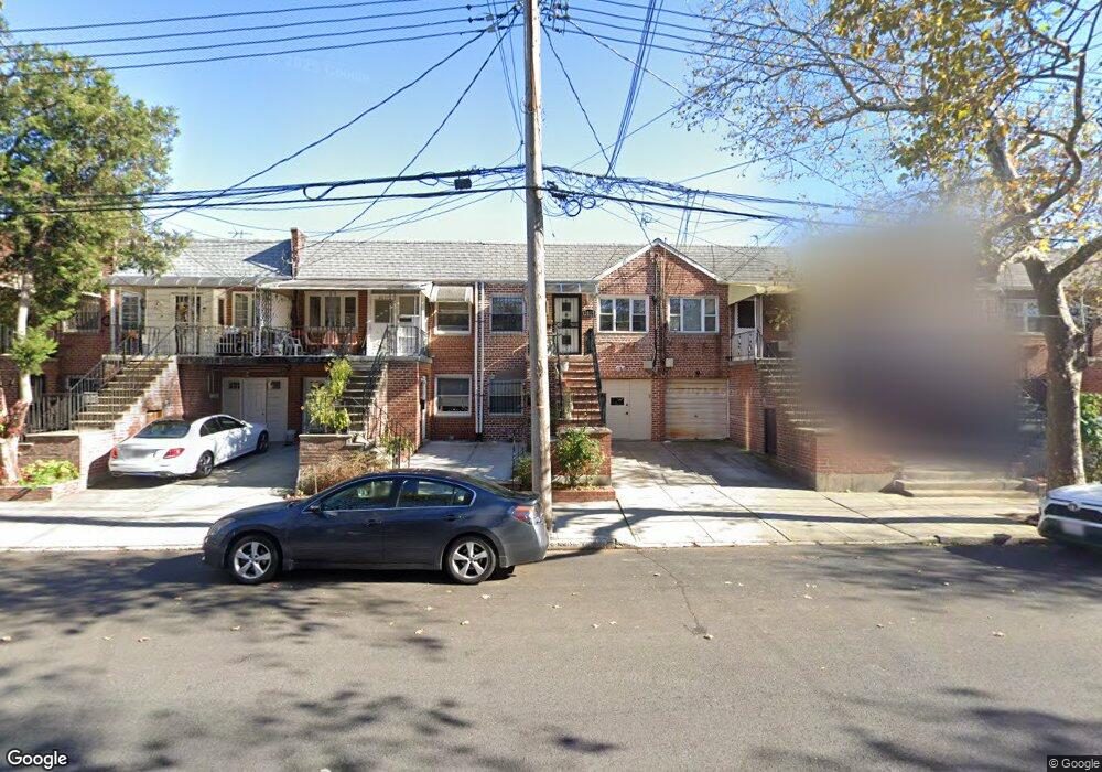
2679 Batchelder St Brooklyn, NY 11235
Sheepshead Bay NeighborhoodEstimated Value: $833,111 - $905,000
--
Bed
--
Bath
1,400
Sq Ft
$620/Sq Ft
Est. Value
About This Home
This home is located at 2679 Batchelder St, Brooklyn, NY 11235 and is currently estimated at $868,278, approximately $620 per square foot. 2679 Batchelder St is a home located in Kings County with nearby schools including P.S. 52 Sheepshead Bay, Jhs 14 Shell Bank, and New Visions Charter High School for Advanced Math/ Science.
Ownership History
Date
Name
Owned For
Owner Type
Purchase Details
Closed on
Aug 6, 2009
Sold by
Klein Martin A
Bought by
Auguste-Holder Yanick
Current Estimated Value
Home Financials for this Owner
Home Financials are based on the most recent Mortgage that was taken out on this home.
Original Mortgage
$363,247
Outstanding Balance
$236,597
Interest Rate
5.19%
Mortgage Type
Purchase Money Mortgage
Estimated Equity
$631,681
Create a Home Valuation Report for This Property
The Home Valuation Report is an in-depth analysis detailing your home's value as well as a comparison with similar homes in the area
Home Values in the Area
Average Home Value in this Area
Purchase History
| Date | Buyer | Sale Price | Title Company |
|---|---|---|---|
| Auguste-Holder Yanick | $420,000 | -- |
Source: Public Records
Mortgage History
| Date | Status | Borrower | Loan Amount |
|---|---|---|---|
| Open | Auguste-Holder Yanick | $363,247 |
Source: Public Records
Tax History Compared to Growth
Tax History
| Year | Tax Paid | Tax Assessment Tax Assessment Total Assessment is a certain percentage of the fair market value that is determined by local assessors to be the total taxable value of land and additions on the property. | Land | Improvement |
|---|---|---|---|---|
| 2025 | $5,883 | $47,400 | $8,280 | $39,120 |
| 2024 | $5,883 | $39,120 | $8,280 | $30,840 |
| 2023 | $5,904 | $42,420 | $8,280 | $34,140 |
| 2022 | $5,475 | $35,880 | $8,280 | $27,600 |
| 2021 | $5,445 | $35,880 | $8,280 | $27,600 |
| 2020 | $2,553 | $34,680 | $8,280 | $26,400 |
| 2019 | $5,106 | $37,560 | $8,280 | $29,280 |
| 2018 | $4,938 | $24,224 | $6,726 | $17,498 |
| 2017 | $4,659 | $22,853 | $5,662 | $17,191 |
| 2016 | $4,310 | $21,560 | $6,496 | $15,064 |
| 2015 | $3,237 | $20,340 | $9,180 | $11,160 |
| 2014 | $3,237 | $20,340 | $9,180 | $11,160 |
Source: Public Records
Map
Nearby Homes
- 2710 Ford St
- 2963 Voorhies Ave
- 2961 Voorhies Ave
- 2663 Haring St
- 3701 Shore Pkwy Unit 1
- 2616 Brown St
- 2803 Batchelder St Unit 1A
- 3901 Nostrand Ave Unit 3T
- 3901 Nostrand Ave Unit 3-O
- 3901 Nostrand Ave Unit LL4
- 3855 Shore Pkwy Unit 3m
- 3855 Shore Pkwy Unit 2L
- 3845 Shore Pkwy Unit 6K
- 2811 Haring St
- 3956 Nostrand Ave
- 2800 Coyle St Unit 622
- 2800 Coyle St Unit 616
- 2800 Coyle St Unit 119
- 2800 Coyle St Unit 201
- 3903 Nostrand Ave Unit 3J
- 2681 Batchelder St
- 2677 Batchelder St
- 2685 Batchelder St
- 2675 Batchelder St
- 2675 Batchelder St Unit 1
- 2687 Batchelder St
- 2671 Batchelder St
- 2689 Batchelder St
- 2669 Batchelder St
- 2678 Ford St
- 2680 Ford St
- 2667 Batchelder St
- 2676 Ford St
- 2682 Ford St
- 2691 Batchelder St
- 2672 Ford St Unit 2
- 2672 Ford St Unit 1
- 2686 Ford St
- 2670 Ford St
- 2688 Ford St