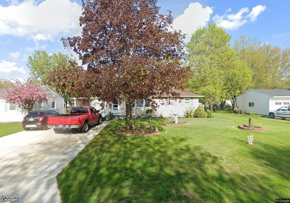
2679 Park Dr Adrian, MI 49221
Estimated Value: $179,742 - $231,000
3
Beds
1
Bath
1,092
Sq Ft
$187/Sq Ft
Est. Value
About This Home
This home is located at 2679 Park Dr, Adrian, MI 49221 and is currently estimated at $204,436, approximately $187 per square foot. 2679 Park Dr is a home located in Lenawee County with nearby schools including Adrian High School, Berean Baptist Academy, and St. Stephen Lutheran School.
Ownership History
Date
Name
Owned For
Owner Type
Purchase Details
Closed on
Sep 28, 2009
Sold by
Heistad Mary E
Bought by
Butts Lorrie E and Butts Rona L
Current Estimated Value
Home Financials for this Owner
Home Financials are based on the most recent Mortgage that was taken out on this home.
Original Mortgage
$73,641
Outstanding Balance
$48,356
Interest Rate
5.19%
Mortgage Type
FHA
Estimated Equity
$156,080
Purchase Details
Closed on
Feb 9, 2007
Sold by
Heistand Mary E and Heistand Clarence G
Bought by
Heistand Mary E and Mary E Heistand Revocable Living Trust
Create a Home Valuation Report for This Property
The Home Valuation Report is an in-depth analysis detailing your home's value as well as a comparison with similar homes in the area
Home Values in the Area
Average Home Value in this Area
Purchase History
| Date | Buyer | Sale Price | Title Company |
|---|---|---|---|
| Butts Lorrie E | $77,300 | None Available | |
| Heistand Mary E | -- | None Available |
Source: Public Records
Mortgage History
| Date | Status | Borrower | Loan Amount |
|---|---|---|---|
| Open | Butts Lorrie E | $73,641 |
Source: Public Records
Tax History
| Year | Tax Paid | Tax Assessment Tax Assessment Total Assessment is a certain percentage of the fair market value that is determined by local assessors to be the total taxable value of land and additions on the property. | Land | Improvement |
|---|---|---|---|---|
| 2025 | $1,429 | $76,900 | $0 | $0 |
| 2024 | $8 | $69,900 | $0 | $0 |
| 2022 | $748 | $51,100 | $0 | $0 |
| 2021 | $1,300 | $49,200 | $0 | $0 |
| 2020 | $1,299 | $50,900 | $0 | $0 |
| 2019 | $112,458 | $42,800 | $0 | $0 |
| 2018 | $1,260 | $42,762 | $0 | $0 |
| 2017 | $1,215 | $42,357 | $0 | $0 |
| 2016 | $1,463 | $39,983 | $0 | $0 |
| 2014 | -- | $36,902 | $0 | $0 |
Source: Public Records
Map
Nearby Homes
- 2673 Airport Rd
- 2821 Eunice Cir
- 1840 Taylor Dr
- 2018 Green Acres Dr
- 2029 Green Acres Dr
- 2012 Green Acres Dr
- 2010 Green Acres Dr
- 2008 Green Acres Dr
- 2016 Green Acres Dr
- 2026 Green Acres Dr
- 2303 Lakewood Dr
- 2004 Green Acres Dr
- 2101 Lakewood Dr
- 1637 Rivers Edge Ct
- 1639 Rivers Edge Ct
- 809 Missouri River Dr
- 521 Rio Grande Dr
- 301 Hidden River Dr
- 217 Red River Dr
- 1335 Spencer Place
- 2675 Park Dr
- 2473 Macarthur Dr
- 2689 Park Dr
- 2664 Park Dr
- 2670 Park Dr
- 2670 Park Dr Unit PARK
- 2470 Macarthur Dr
- 2680 Park Dr
- 2478 Macarthur Dr
- 2703 Park Dr
- 2493 Macarthur Dr
- 2640 Elmwood Dr
- 2654 Elmwood Dr
- 2668 Elmwood Dr
- 2501 Macarthur Dr
- 2706 Park Dr
- 2655 Elmwood Dr
- 2612 Park Dr
- 2626 Elmwood Dr
- 2639 Park Dr
Your Personal Tour Guide
Ask me questions while you tour the home.