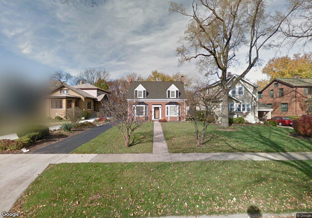
268 Addison Rd Riverside, IL 60546
Estimated Value: $493,228 - $712,000
3
Beds
2
Baths
1,520
Sq Ft
$372/Sq Ft
Est. Value
About This Home
This home is located at 268 Addison Rd, Riverside, IL 60546 and is currently estimated at $565,307, approximately $371 per square foot. 268 Addison Rd is a home located in Cook County with nearby schools including Central Elementary School, L J Hauser Jr High School, and Riverside Brookfield High School.
Ownership History
Date
Name
Owned For
Owner Type
Purchase Details
Closed on
Jun 23, 2011
Sold by
Wallace Mary E
Bought by
Bolt Adam D and Bolt Kathleen S
Current Estimated Value
Home Financials for this Owner
Home Financials are based on the most recent Mortgage that was taken out on this home.
Original Mortgage
$266,800
Outstanding Balance
$181,930
Interest Rate
4.63%
Mortgage Type
New Conventional
Estimated Equity
$383,377
Purchase Details
Closed on
Feb 21, 2001
Sold by
Wallace Mary C
Bought by
Wallace Mary C and Mary C Wallace Trust
Create a Home Valuation Report for This Property
The Home Valuation Report is an in-depth analysis detailing your home's value as well as a comparison with similar homes in the area
Home Values in the Area
Average Home Value in this Area
Purchase History
| Date | Buyer | Sale Price | Title Company |
|---|---|---|---|
| Bolt Adam D | $333,500 | Cti | |
| Wallace Mary C | -- | -- |
Source: Public Records
Mortgage History
| Date | Status | Borrower | Loan Amount |
|---|---|---|---|
| Open | Bolt Adam D | $266,800 |
Source: Public Records
Tax History
| Year | Tax Paid | Tax Assessment Tax Assessment Total Assessment is a certain percentage of the fair market value that is determined by local assessors to be the total taxable value of land and additions on the property. | Land | Improvement |
|---|---|---|---|---|
| 2025 | $11,373 | $38,867 | $9,212 | $29,655 |
| 2024 | $11,373 | $38,867 | $9,212 | $29,655 |
| 2023 | $11,553 | $38,867 | $9,212 | $29,655 |
| 2022 | $11,553 | $33,582 | $8,061 | $25,521 |
| 2021 | $11,732 | $35,207 | $8,060 | $27,147 |
| 2020 | $12,051 | $36,955 | $8,060 | $28,895 |
| 2019 | $9,411 | $30,169 | $7,369 | $22,800 |
| 2018 | $9,133 | $30,169 | $7,369 | $22,800 |
| 2017 | $9,384 | $31,765 | $7,369 | $24,396 |
| 2016 | $10,250 | $31,604 | $6,448 | $25,156 |
| 2015 | $9,972 | $31,604 | $6,448 | $25,156 |
| 2014 | $9,820 | $31,604 | $6,448 | $25,156 |
| 2013 | $9,584 | $33,350 | $6,448 | $26,902 |
Source: Public Records
Map
Nearby Homes
- 269 Shenstone Rd
- 369 Addison Rd
- 475 Shenstone Rd Unit 104
- 475 Shenstone Rd Unit 304
- 475 Shenstone Rd Unit 303
- 484 Shenstone Rd
- 231 Bartram Rd
- 478 Kent Rd
- 10 E Burlington St Unit 2C
- 10 E Burlington St Unit 2B
- 280 Blackhawk Rd
- 176 Riverside Rd
- 315 Bartram Rd
- 7048 35th St
- 262 Lionel Rd
- 303 Lionel Rd
- 101 Southcote Rd
- 3111 Wenonah Ave
- 305 Desplaines Ave
- 78 Pine Ave
- 272 Addison Rd
- 264 Addison Rd
- 276 Addison Rd
- 260 Addison Rd
- 256 Addison Rd
- 293 Shenstone Rd
- 297 Shenstone Rd
- 289 Shenstone Rd
- 252 Addison Rd
- 301 Shenstone Rd
- 285 Shenstone Rd
- 61 N Herbert Rd
- 305 Shenstone Rd
- 288 Addison Rd
- 248 Addison Rd
- 281 Shenstone Rd
- 309 Shenstone Rd
- 279 Addison Rd
- 292 Addison Rd
- 277 Shenstone Rd
Your Personal Tour Guide
Ask me questions while you tour the home.