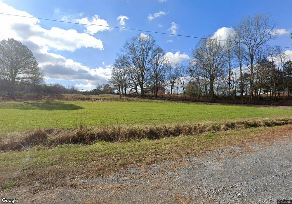
268 W Kinman Rd SW Calhoun, GA 30701
Estimated Value: $304,000 - $645,000
2
Beds
1
Bath
1,272
Sq Ft
$359/Sq Ft
Est. Value
About This Home
This home is located at 268 W Kinman Rd SW, Calhoun, GA 30701 and is currently estimated at $456,972, approximately $359 per square foot. 268 W Kinman Rd SW is a home located in Gordon County with nearby schools including Swain Elementary School, Ashworth Middle School, and Gordon Central High School.
Ownership History
Date
Name
Owned For
Owner Type
Purchase Details
Closed on
May 21, 2021
Sold by
West Michael Gary
Bought by
West Cody M and West Belinda Ann
Current Estimated Value
Purchase Details
Closed on
Oct 17, 2000
Sold by
West Jeanette
Bought by
West Michael Gary
Purchase Details
Closed on
Nov 19, 1999
Bought by
West Jeanette
Purchase Details
Closed on
Aug 18, 1997
Bought by
West Michael Gary Etal
Purchase Details
Closed on
Mar 27, 1996
Bought by
West Bonnie L Etal
Create a Home Valuation Report for This Property
The Home Valuation Report is an in-depth analysis detailing your home's value as well as a comparison with similar homes in the area
Home Values in the Area
Average Home Value in this Area
Purchase History
| Date | Buyer | Sale Price | Title Company |
|---|---|---|---|
| West Cody M | -- | -- | |
| West Michael Gary | -- | -- | |
| West Jeanette | -- | -- | |
| West Michael Gary Etal | -- | -- | |
| West Bonnie L Etal | -- | -- |
Source: Public Records
Tax History Compared to Growth
Tax History
| Year | Tax Paid | Tax Assessment Tax Assessment Total Assessment is a certain percentage of the fair market value that is determined by local assessors to be the total taxable value of land and additions on the property. | Land | Improvement |
|---|---|---|---|---|
| 2024 | $1,047 | $128,080 | $106,200 | $21,880 |
| 2023 | $1,009 | $127,080 | $106,200 | $20,880 |
| 2022 | $1,035 | $126,200 | $106,200 | $20,000 |
| 2021 | $983 | $126,080 | $109,440 | $16,640 |
| 2020 | $999 | $126,360 | $109,440 | $16,920 |
| 2019 | $991 | $126,360 | $109,440 | $16,920 |
| 2018 | $960 | $125,720 | $109,440 | $16,280 |
| 2017 | $780 | $122,960 | $106,640 | $16,320 |
| 2016 | $773 | $122,980 | $106,640 | $16,340 |
| 2015 | $757 | $127,579 | $111,480 | $16,100 |
| 2014 | $716 | $126,944 | $111,509 | $15,436 |
Source: Public Records
Map
Nearby Homes
- 3293 Rome Rd SW
- 187 Cantrell Dr SW
- 221 Hardin Rd SW
- 2857 McDaniel Station Rd SW
- 273 Webberdale Dr SW
- 3610 Rome Rd SW
- 1943 Rome Rd SW
- 154 Honeysuckle Dr SW
- 180 Honeysuckle Vine Rd
- 301 Switch Rd SW
- 159 Moores Ferry Rd SW
- 110 Darby Rd SW
- 238 Lighthouse Cove SW
- 365 Riverboat Dr
- 0 Reeves Station Rd SW Unit 10548197
- 0 Reeves Station Rd SW Unit 7601645
- 211 Darby Rd SW
- 332 Old Calhoun Rd SW
- 244 W Kinman Rd SW
- 180 W Kinman Rd SW
- 326 W Kinman Rd SW
- 309 W Kinman Rd SW
- 276 W Kinman Rd SW
- W W Kinman Rd SW
- 427 W Kinman Rd SW
- 2272 Miller Ferry Rd SW
- 000 W Kinman Rd
- 00 W Kinman Rd
- 2069 Miller Ferry Rd SW
- 2285 Miller Ferry Rd SW
- 2159 Miller Ferry Rd SW
- 2354 Miller Ferry Rd SW
- 2033 Miller Ferry Rd SW
- 129 Robbins Creek Trail SW
- 2362 Miller Ferry Rd SW
- 2351 Miller Ferry Rd SW
- 2444 Miller Ferry Rd SW
- 2546 Miller Ferry Rd SW
