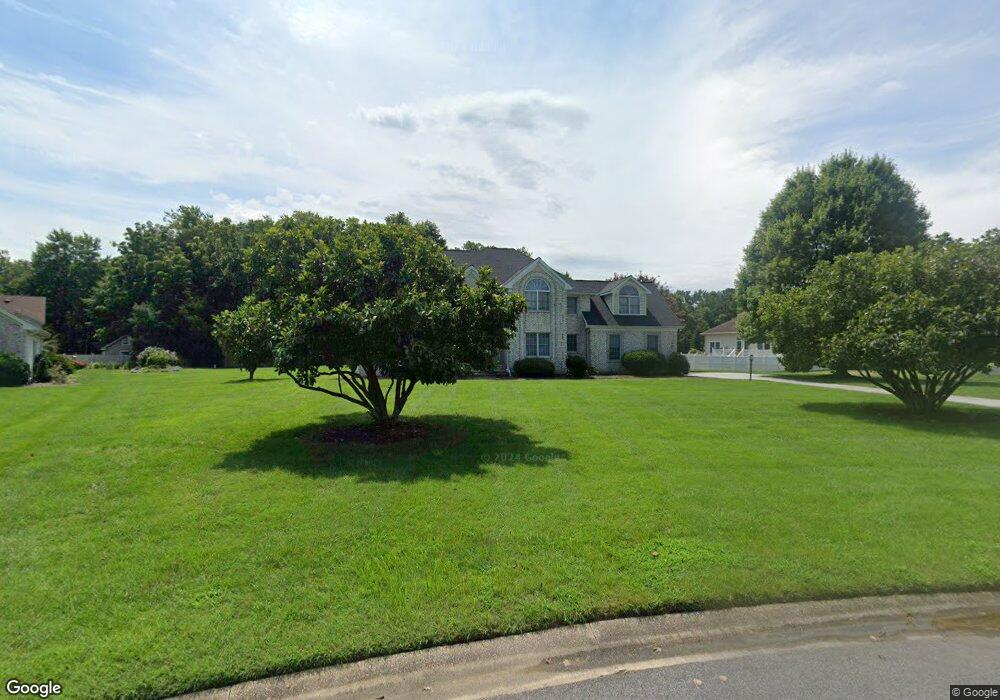
26807 Robert Burns Ln Salisbury, MD 21801
South Salisbury NeighborhoodEstimated Value: $583,135 - $707,000
4
Beds
3
Baths
3,924
Sq Ft
$165/Sq Ft
Est. Value
About This Home
This home is located at 26807 Robert Burns Ln, Salisbury, MD 21801 and is currently estimated at $648,034, approximately $165 per square foot. 26807 Robert Burns Ln is a home located in Wicomico County with nearby schools including Westside Primary School, Westside Intermediate School, and Salisbury Middle School.
Ownership History
Date
Name
Owned For
Owner Type
Purchase Details
Closed on
Jul 14, 2017
Sold by
Sharma Virendra K and Sharma Rekha
Bought by
Smith Carlos M and Smith Jerrona I
Current Estimated Value
Home Financials for this Owner
Home Financials are based on the most recent Mortgage that was taken out on this home.
Original Mortgage
$360,000
Outstanding Balance
$299,099
Interest Rate
3.89%
Mortgage Type
VA
Estimated Equity
$348,935
Purchase Details
Closed on
Jan 12, 1999
Sold by
Homes By Bijan Inc
Bought by
Sharma Virendra K and Sharma Rekha
Purchase Details
Closed on
Apr 27, 1998
Sold by
Nithsdale Inc
Bought by
Homrd By Bijan Inc
Create a Home Valuation Report for This Property
The Home Valuation Report is an in-depth analysis detailing your home's value as well as a comparison with similar homes in the area
Home Values in the Area
Average Home Value in this Area
Purchase History
| Date | Buyer | Sale Price | Title Company |
|---|---|---|---|
| Smith Carlos M | $360,000 | Sage Title Group Llc | |
| Sharma Virendra K | $295,500 | -- | |
| Homrd By Bijan Inc | $25,000 | -- |
Source: Public Records
Mortgage History
| Date | Status | Borrower | Loan Amount |
|---|---|---|---|
| Open | Smith Carlos M | $360,000 | |
| Closed | Homrd By Bijan Inc | -- |
Source: Public Records
Tax History Compared to Growth
Tax History
| Year | Tax Paid | Tax Assessment Tax Assessment Total Assessment is a certain percentage of the fair market value that is determined by local assessors to be the total taxable value of land and additions on the property. | Land | Improvement |
|---|---|---|---|---|
| 2025 | $3,806 | $485,733 | $0 | $0 |
| 2024 | $3,806 | $427,867 | $0 | $0 |
| 2023 | $3,691 | $370,000 | $51,000 | $319,000 |
| 2022 | $3,699 | $357,067 | $0 | $0 |
| 2021 | $3,476 | $344,133 | $0 | $0 |
| 2020 | $3,476 | $331,200 | $44,000 | $287,200 |
| 2019 | $3,526 | $331,200 | $44,000 | $287,200 |
| 2018 | $3,544 | $331,200 | $44,000 | $287,200 |
| 2017 | $3,649 | $341,200 | $0 | $0 |
| 2016 | -- | $339,300 | $0 | $0 |
| 2015 | $3,158 | $337,400 | $0 | $0 |
| 2014 | $3,158 | $335,500 | $0 | $0 |
Source: Public Records
Map
Nearby Homes
- 5497 Abbey Ln
- 5474 Royal Mile Blvd
- 0 King Stuart Dr Unit MDWC2018516
- 5688 Kirkpatrick Ct
- 5703 Royal Mile Blvd
- 0 (Lot 31) Maxwell Ln
- 0 (Lot 32) Maxwell Ln
- Lot 27 Maxwell Ln
- 5709 Royal Mile Blvd
- 5437 Nithsdale Dr
- 5781 King Stuart Dr
- 26694 Pemberton Dr
- 5686 N Nithsdale Dr Unit N
- 5541 E Nithsdale Dr
- 26882 Pratt Rd
- 26298 High Banks Dr
- 5088 Sailfish Dr
- 26244 Kensington Ln
- LOT 19 Brandywood Ln
- 6151 Trails End Ct
- 26821 Robert Burns Ln
- 5539 Robert Burns Ln
- 5521 King Stuart Dr
- 5502 Abbey Ln
- 5516 Abbey Ln
- 26800 Robert Burns Ln
- 26833 Robert Burns Ln
- 26822 Robert Burns Ln
- 5496 Abbey Ln
- 5505 King Stuart Dr
- 5520 Abbey Ln
- 5520 King Stuart Dr
- 5480 Abbey Ln
- 26836 Robert Burns Ln
- 5534 King Stuart Dr
- 5506 King Stuart Dr
- 5579 King Stuart Dr
- 26839 Robert Burns Ln
- 5542 King Stuart Dr
- 5524 Abbey Ln