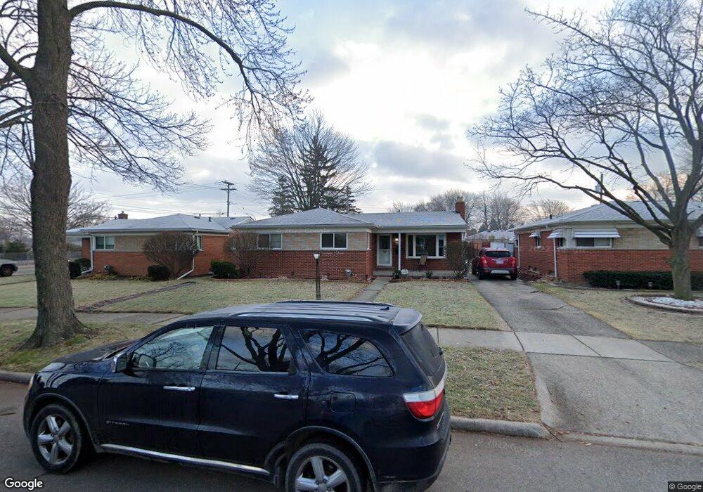
26818 Newport Ave Warren, MI 48089
Southeast Warren NeighborhoodEstimated Value: $225,000 - $243,000
3
Beds
2
Baths
1,156
Sq Ft
$203/Sq Ft
Est. Value
About This Home
This home is located at 26818 Newport Ave, Warren, MI 48089 and is currently estimated at $234,392, approximately $202 per square foot. 26818 Newport Ave is a home located in Macomb County with nearby schools including Warren Woods Tower High School and Frontier International Academy Elementary.
Ownership History
Date
Name
Owned For
Owner Type
Purchase Details
Closed on
Apr 24, 2009
Sold by
Secretary Of Housing & Urban Development
Bought by
Bowens Rochelle
Current Estimated Value
Purchase Details
Closed on
Aug 4, 2008
Sold by
Mortgage Electronic Registration Systems
Bought by
Hud
Purchase Details
Closed on
Aug 24, 2007
Sold by
Jackson Danyell
Bought by
Mortgage Electronic Registration Systems
Purchase Details
Closed on
Apr 29, 2005
Sold by
Batayeh Nader A and Batayeh Laurie A
Bought by
Jackson Danyell
Purchase Details
Closed on
Jan 28, 1998
Sold by
Sheehan K
Bought by
Batayeh N L
Create a Home Valuation Report for This Property
The Home Valuation Report is an in-depth analysis detailing your home's value as well as a comparison with similar homes in the area
Home Values in the Area
Average Home Value in this Area
Purchase History
| Date | Buyer | Sale Price | Title Company |
|---|---|---|---|
| Bowens Rochelle | $60,000 | Stewart Title | |
| Hud | -- | None Available | |
| Mortgage Electronic Registration Systems | $189,688 | None Available | |
| Jackson Danyell | $182,625 | Homeowners Title Agency | |
| Batayeh N L | $107,000 | -- |
Source: Public Records
Tax History Compared to Growth
Tax History
| Year | Tax Paid | Tax Assessment Tax Assessment Total Assessment is a certain percentage of the fair market value that is determined by local assessors to be the total taxable value of land and additions on the property. | Land | Improvement |
|---|---|---|---|---|
| 2025 | $2,624 | $103,230 | $0 | $0 |
| 2024 | $2,550 | $91,330 | $0 | $0 |
| 2023 | $2,409 | $82,910 | $0 | $0 |
| 2022 | $2,362 | $74,460 | $0 | $0 |
| 2021 | $2,318 | $71,150 | $0 | $0 |
| 2020 | $2,222 | $66,730 | $0 | $0 |
| 2019 | $2,123 | $62,380 | $0 | $0 |
| 2018 | $63 | $50,220 | $0 | $0 |
| 2017 | $2,028 | $46,360 | $5,800 | $40,560 |
| 2016 | $2,012 | $46,360 | $0 | $0 |
| 2015 | -- | $42,640 | $0 | $0 |
| 2013 | $1,944 | $38,050 | $0 | $0 |
Source: Public Records
Map
Nearby Homes
- 26515 Newport Ave
- 12291 E 11 Mile Rd
- 13144 Stamford Ave
- 26552 Wagner Ave
- 26443 Marilyn Ave
- 13171 Burgundy Ave
- 27529 Roan Dr
- 26640 Schoenherr Rd
- 13203 Frazho Rd
- 11927 Stamford Ave
- 27260 Norma Dr
- 13342 De Mott Dr
- 12855 Ray Dr
- 11820 Mckinley Dr
- 13696 Harthill Ave
- 27483 Norma Dr
- 13510 Angela Dr
- 27480 Shackett Ave
- 12876 Martin Rd
- 11920 Carney St
- 26830 Newport Ave
- 26806 Newport Ave
- 26752 Newport Ave
- 26831 Fairfield Ave
- 26819 Fairfield Ave Unit Bldg-Unit
- 26819 Fairfield Ave
- 26843 Fairfield Ave
- 26740 Newport Ave
- 26807 Fairfield Ave
- 26829 Newport Ave
- 26805 Newport Ave
- 26757 Fairfield Ave
- 26728 Newport Ave
- 26751 Newport Ave
- 26745 Fairfield Ave
- 26739 Newport Ave
- 26716 Newport Ave
- 26727 Newport Ave
- 26733 Fairfield Ave
- 26834 Fairfield Ave