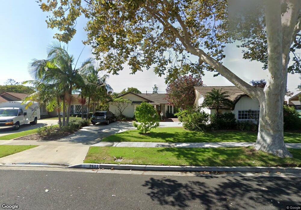
2682 Kempton Dr Los Alamitos, CA 90720
Rossmoor NeighborhoodEstimated Value: $1,463,589 - $1,877,000
3
Beds
2
Baths
1,953
Sq Ft
$889/Sq Ft
Est. Value
About This Home
This home is located at 2682 Kempton Dr, Los Alamitos, CA 90720 and is currently estimated at $1,736,397, approximately $889 per square foot. 2682 Kempton Dr is a home located in Orange County with nearby schools including Francis Hopkinson Elementary School, Jack L. Weaver Elementary School, and Oak Middle School.
Ownership History
Date
Name
Owned For
Owner Type
Purchase Details
Closed on
Apr 15, 1994
Sold by
Rollins Joseph S and Rollins Kaye R
Bought by
Breytspraak William E and Fujimoto Misue
Current Estimated Value
Home Financials for this Owner
Home Financials are based on the most recent Mortgage that was taken out on this home.
Original Mortgage
$203,150
Interest Rate
8.25%
Create a Home Valuation Report for This Property
The Home Valuation Report is an in-depth analysis detailing your home's value as well as a comparison with similar homes in the area
Home Values in the Area
Average Home Value in this Area
Purchase History
| Date | Buyer | Sale Price | Title Company |
|---|---|---|---|
| Breytspraak William E | $315,000 | Gateway Title Company |
Source: Public Records
Mortgage History
| Date | Status | Borrower | Loan Amount |
|---|---|---|---|
| Previous Owner | Breytspraak William E | $203,150 |
Source: Public Records
Tax History
| Year | Tax Paid | Tax Assessment Tax Assessment Total Assessment is a certain percentage of the fair market value that is determined by local assessors to be the total taxable value of land and additions on the property. | Land | Improvement |
|---|---|---|---|---|
| 2025 | $6,316 | $531,856 | $409,594 | $122,262 |
| 2024 | $6,316 | $521,428 | $401,563 | $119,865 |
| 2023 | $6,168 | $511,204 | $393,689 | $117,515 |
| 2022 | $6,136 | $501,181 | $385,970 | $115,211 |
| 2021 | $6,002 | $491,354 | $378,402 | $112,952 |
| 2020 | $6,016 | $486,316 | $374,522 | $111,794 |
| 2019 | $5,866 | $476,781 | $367,179 | $109,602 |
| 2018 | $5,638 | $467,433 | $359,980 | $107,453 |
| 2017 | $5,520 | $458,268 | $352,921 | $105,347 |
| 2016 | $5,414 | $449,283 | $346,001 | $103,282 |
| 2015 | $5,375 | $442,535 | $340,804 | $101,731 |
| 2014 | $5,192 | $433,867 | $334,128 | $99,739 |
Source: Public Records
Map
Nearby Homes
- 2671 Saint Albans Dr
- 2692 Salmon Dr
- 12672 Foster Rd
- 3181 Blume Dr
- 3092 Copa de Oro Dr
- 12746 Martha Ann Dr
- 6976 E El Cedral St
- 3232 Brimhall Dr
- 12200 Montecito Rd Unit D221
- 12200 Montecito Rd Unit B315
- 12200 Montecito Rd Unit D303
- 12200 Montecito Rd Unit D101
- 12200 Montecito Rd Unit H207
- 12200 Montecito Rd Unit D301
- 12021 Old Mill Rd
- 2024 Shipway Ave
- 173 College Park Dr
- 6841 E Bacarro St
- 6911 E 10th St
- 1541 Northwood Rd Unit 273D
- 2702 Kempton Dr
- 2672 Kempton Dr
- 2671 Mainway Dr
- 2662 Kempton Dr
- 2691 Mainway Dr
- 2661 Mainway Dr
- 2681 Kempton Dr
- 2671 Kempton Dr
- 2701 Kempton Dr
- 2711 Mainway Dr
- 2641 Mainway Dr
- 2642 Kempton Dr
- 2732 Kempton Dr
- 2661 Kempton Dr
- 2711 Kempton Dr
- 2721 Mainway Dr
- 2631 Mainway Dr
- 2641 Kempton Dr
- 2682 Woodstock Rd
- 2742 Kempton Dr
Your Personal Tour Guide
Ask me questions while you tour the home.