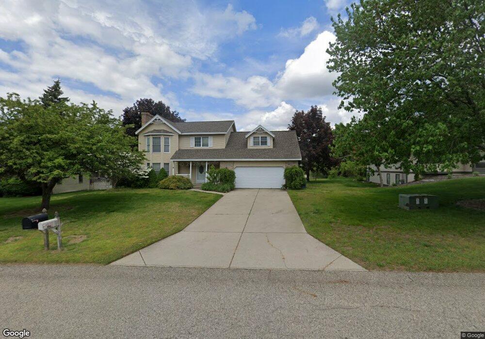
2683 Falcon Dr Jenison, MI 49428
Estimated Value: $437,000 - $498,000
4
Beds
3
Baths
2,832
Sq Ft
$166/Sq Ft
Est. Value
About This Home
This home is located at 2683 Falcon Dr, Jenison, MI 49428 and is currently estimated at $470,084, approximately $165 per square foot. 2683 Falcon Dr is a home located in Ottawa County with nearby schools including Pinewood Elementary School, Jenison High School, and Jenison Junior High School.
Ownership History
Date
Name
Owned For
Owner Type
Purchase Details
Closed on
Feb 4, 2020
Sold by
Jimenez Humberto and Jimenez Carmen
Bought by
Jimenez Maritza and Jimenez Jeneli
Current Estimated Value
Purchase Details
Closed on
Nov 30, 2011
Sold by
Wiltrakis Joseph William and Wiltrakis Anne
Bought by
Jimenez Humberto and Jimenez Carmen
Home Financials for this Owner
Home Financials are based on the most recent Mortgage that was taken out on this home.
Original Mortgage
$160,817
Outstanding Balance
$110,537
Interest Rate
4.11%
Mortgage Type
FHA
Estimated Equity
$359,548
Create a Home Valuation Report for This Property
The Home Valuation Report is an in-depth analysis detailing your home's value as well as a comparison with similar homes in the area
Home Values in the Area
Average Home Value in this Area
Purchase History
| Date | Buyer | Sale Price | Title Company |
|---|---|---|---|
| Jimenez Maritza | -- | None Available | |
| Jimenez Humberto | $165,000 | None Available |
Source: Public Records
Mortgage History
| Date | Status | Borrower | Loan Amount |
|---|---|---|---|
| Open | Jimenez Humberto | $160,817 |
Source: Public Records
Tax History
| Year | Tax Paid | Tax Assessment Tax Assessment Total Assessment is a certain percentage of the fair market value that is determined by local assessors to be the total taxable value of land and additions on the property. | Land | Improvement |
|---|---|---|---|---|
| 2025 | $3,206 | $195,200 | $0 | $0 |
| 2024 | $31 | $183,600 | $0 | $0 |
| 2023 | $2,942 | $180,900 | $0 | $0 |
| 2022 | $3,230 | $166,400 | $0 | $0 |
| 2021 | $3,137 | $156,000 | $0 | $0 |
| 2020 | $3,102 | $144,700 | $0 | $0 |
| 2019 | $3,105 | $136,800 | $0 | $0 |
| 2018 | $2,896 | $136,300 | $0 | $0 |
| 2017 | $2,845 | $131,500 | $0 | $0 |
| 2016 | $2,827 | $122,700 | $0 | $0 |
| 2015 | $2,698 | $115,500 | $0 | $0 |
| 2014 | $2,698 | $102,200 | $0 | $0 |
Source: Public Records
Map
Nearby Homes
- 2934 Parkside Dr Unit 54
- 2843 Parkside Dr Unit 14
- 2890 Parkside Dr Unit 33
- 2898 Parkside Dr Unit 40
- 8252 Lamplight Dr
- 8232 Park West Dr
- 3361 Box Elder Dr
- 2921 Rosewood St
- 1951 Mulberry Ln
- 8206 Eagle Peak Dr
- 2143 Sandstone Dr
- 8316 Bauerridge Ave
- 8316 Bauer Ridge Ave
- 8288 Eagle Peak Dr
- 7954 Bald Eagle Pass Unit 130
- 8540 Twin Lakes Dr
- 9067 Hollace Ct
- 3270 Hollace Dr
- 8531 Twin Lakes Dr
- 7373 Pinegrove Dr Unit 109
- 2671 Falcon Dr
- 2699 Falcon Dr
- 2668 Thrush Dr
- 2698 Thrush Dr
- 2659 Falcon Dr
- 2696 Falcon Dr
- 2654 Thrush Dr
- 2674 Falcon Dr
- 7735 Finch Ave
- 7723 Finch Ave
- 7749 Finch Ave
- 7737 Cardinal Dr
- 7751 Cardinal Dr
- 7709 Finch Ave
- 7761 Finch Ave
- 7721 Cardinal Dr
- 7765 Cardinal Dr
- 2687 Thrush Dr
- 2675 Thrush Dr
- 7665 Cardinal Dr
Your Personal Tour Guide
Ask me questions while you tour the home.
