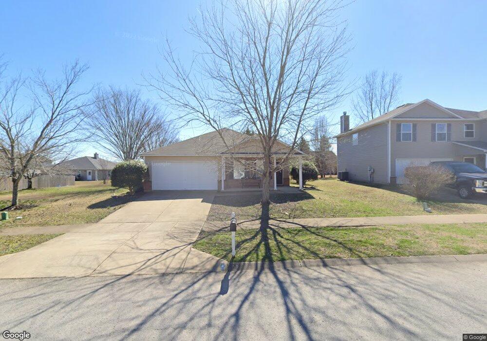
2684 New Port Royal Rd Thompsons Station, TN 37179
Estimated Value: $393,000 - $432,000
--
Bed
3
Baths
1,664
Sq Ft
$249/Sq Ft
Est. Value
About This Home
This home is located at 2684 New Port Royal Rd, Thompsons Station, TN 37179 and is currently estimated at $413,544, approximately $248 per square foot. 2684 New Port Royal Rd is a home located in Williamson County.
Ownership History
Date
Name
Owned For
Owner Type
Purchase Details
Closed on
Jan 27, 2004
Sold by
Centex Homes
Bought by
Schaffel Mark
Current Estimated Value
Home Financials for this Owner
Home Financials are based on the most recent Mortgage that was taken out on this home.
Original Mortgage
$106,009
Outstanding Balance
$48,124
Interest Rate
5.37%
Mortgage Type
Purchase Money Mortgage
Estimated Equity
$365,420
Create a Home Valuation Report for This Property
The Home Valuation Report is an in-depth analysis detailing your home's value as well as a comparison with similar homes in the area
Home Values in the Area
Average Home Value in this Area
Purchase History
| Date | Buyer | Sale Price | Title Company |
|---|---|---|---|
| Schaffel Mark | $132,512 | -- |
Source: Public Records
Mortgage History
| Date | Status | Borrower | Loan Amount |
|---|---|---|---|
| Open | Schaffel Mark | $106,009 |
Source: Public Records
Tax History Compared to Growth
Tax History
| Year | Tax Paid | Tax Assessment Tax Assessment Total Assessment is a certain percentage of the fair market value that is determined by local assessors to be the total taxable value of land and additions on the property. | Land | Improvement |
|---|---|---|---|---|
| 2024 | $487 | $65,850 | $18,750 | $47,100 |
| 2023 | $487 | $65,850 | $18,750 | $47,100 |
| 2022 | $1,205 | $65,850 | $18,750 | $47,100 |
| 2021 | $1,205 | $65,850 | $18,750 | $47,100 |
| 2020 | $968 | $44,800 | $11,250 | $33,550 |
| 2019 | $968 | $44,800 | $11,250 | $33,550 |
| 2018 | $936 | $44,800 | $11,250 | $33,550 |
| 2017 | $927 | $44,800 | $11,250 | $33,550 |
| 2016 | $0 | $44,800 | $11,250 | $33,550 |
| 2015 | -- | $38,625 | $8,750 | $29,875 |
| 2014 | -- | $38,625 | $8,750 | $29,875 |
Source: Public Records
Map
Nearby Homes
- 458 Buckwood Ave W
- 311 Buckwood Ln N
- 452 Buckwood Ave W
- 465 Buckwood Ave
- 2131 Carlton Ln
- 454 Buckwood Ave E
- 466 Buckwood Ave W
- 462 Buckwood Ave W
- 303 Buckwood Ln
- 450 Buckwood Ave W
- 457 Buckwood Ave E
- 321 Buckwood Ln N
- 440 Buckwood Ave W
- 2104 Loudenslager Dr
- 461 Buckwood Ave E
- 455 Buckwood Ave W
- 467 Buckwood Ave E
- Charleville Plan at Emberly
- Belmont Plan at Emberly
- Corsair Plan at Emberly
- 2686 New Port Royal Rd
- 2113 Carlton Ln
- 2682 New Port Royal Rd
- 2688 New Port Royal Rd
- 2111 Carlton Ln
- 2117 Carlton Ln
- 2685 New Port Royal Rd
- 2109 Carlton Ln
- 2680 New Port Royal Rd
- 2687 New Port Royal Rd
- 2683 New Port Royal Rd
- 2690 New Port Royal Rd
- 2690 New Port Royal Rd
- 2119 Carlton Ln
- 2689 New Port Royal Rd
- 2107 Carlton Ln
- 2681 New Port Royal Rd
- 2678 New Port Royal Rd
- 2119 Carlton
- 2692 New Port Royal Rd