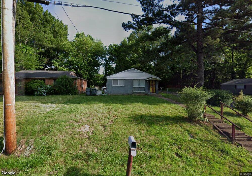
269 Charter Ave Memphis, TN 38109
Whitehaven NeighborhoodEstimated Value: $58,000 - $77,568
3
Beds
1
Bath
900
Sq Ft
$78/Sq Ft
Est. Value
About This Home
This home is located at 269 Charter Ave, Memphis, TN 38109 and is currently estimated at $70,642, approximately $78 per square foot. 269 Charter Ave is a home located in Shelby County with nearby schools including Geeter School, Freedom Preparatory Academy Charter Elementary School - Westwood Campus, and Freedom Preparatory Academy Westwood Elementary at Parkrose.
Ownership History
Date
Name
Owned For
Owner Type
Purchase Details
Closed on
Dec 13, 2010
Sold by
Usa Rental Fund Llc
Bought by
Mckissick Hayes and Mckissick Berna
Current Estimated Value
Purchase Details
Closed on
Sep 30, 2010
Sold by
Fannie Mae
Bought by
Usa Rental Fund Llc
Purchase Details
Closed on
May 20, 2010
Sold by
Sims Ronnie
Bought by
Federal National Mortgage Association
Purchase Details
Closed on
Apr 14, 2005
Sold by
Wesson Anedra
Bought by
Sims Ronnie
Purchase Details
Closed on
Oct 4, 2004
Sold by
Johns James G and Day Dennis
Bought by
Hud
Create a Home Valuation Report for This Property
The Home Valuation Report is an in-depth analysis detailing your home's value as well as a comparison with similar homes in the area
Home Values in the Area
Average Home Value in this Area
Purchase History
| Date | Buyer | Sale Price | Title Company |
|---|---|---|---|
| Mckissick Hayes | $6,000 | None Available | |
| Usa Rental Fund Llc | $1,500 | None Available | |
| Federal National Mortgage Association | $40,300 | None Available | |
| Sims Ronnie | -- | -- | |
| Hud | $28,162 | -- |
Source: Public Records
Tax History
| Year | Tax Paid | Tax Assessment Tax Assessment Total Assessment is a certain percentage of the fair market value that is determined by local assessors to be the total taxable value of land and additions on the property. | Land | Improvement |
|---|---|---|---|---|
| 2025 | $313 | $13,400 | $1,725 | $11,675 |
| 2024 | $313 | $9,225 | $1,125 | $8,100 |
| 2023 | $562 | $9,225 | $1,125 | $8,100 |
| 2022 | $562 | $9,225 | $1,125 | $8,100 |
| 2021 | $569 | $9,225 | $1,125 | $8,100 |
| 2020 | $581 | $8,025 | $1,125 | $6,900 |
| 2019 | $581 | $8,025 | $1,125 | $6,900 |
| 2018 | $581 | $8,025 | $1,125 | $6,900 |
| 2017 | $330 | $8,025 | $1,125 | $6,900 |
| 2016 | $359 | $8,225 | $0 | $0 |
| 2014 | $359 | $8,225 | $0 | $0 |
Source: Public Records
Map
Nearby Homes
- 278 Hewlett Rd
- 356 Delta Rd
- 4744 Percy Rd
- 4777 Horn Lake Rd
- 4826 Peace St
- 417 Charter Ave
- 3794 Horn Lake Rd
- 426 Hewlett Rd
- 0 Hewlett Rd
- 179 Honduras Dr
- 51 W Byfield Dr
- 0 E Shelby Dr
- 0 Horn Lake Cove
- 5 E Byfield Dr
- 8 E Paxton Ln
- 33 E Geeter Rd
- 5003 Deneen Dr
- 71 E Geeter Rd
- 386 Mcfarland Dr
- 79 E Shelby Dr
- 265 Charter Ave
- 279 Charter Ave
- 261 Charter Ave
- 283 Charter Ave
- 257 Charter Ave
- 264 Delta Rd
- 289 Charter Ave
- 253 Charter Ave
- 278 Delta Rd
- 260 Delta Rd
- 268 Charter Ave
- 282 Delta Rd
- 264 Charter Ave
- 293 Charter Ave
- 278 Charter Ave
- 260 Charter Ave
- 288 Delta Rd
- 252 Delta Rd
- 282 Charter Ave
- 256 Charter Ave
Your Personal Tour Guide
Ask me questions while you tour the home.