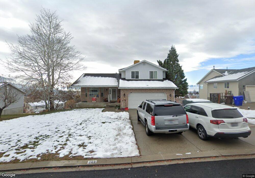
269 Hillside Cir Alpine, UT 84004
Estimated Value: $679,000 - $845,000
3
Beds
4
Baths
2,066
Sq Ft
$367/Sq Ft
Est. Value
About This Home
This home is located at 269 Hillside Cir, Alpine, UT 84004 and is currently estimated at $759,107, approximately $367 per square foot. 269 Hillside Cir is a home located in Utah County with nearby schools including Westfield School, Timberline Middle School, and Lone Peak High School.
Ownership History
Date
Name
Owned For
Owner Type
Purchase Details
Closed on
Feb 15, 2024
Sold by
Anderson Janelle L
Bought by
Anderson Winkelkotter Trust and Anderson
Current Estimated Value
Purchase Details
Closed on
Nov 21, 2018
Sold by
Anderson Michael M
Bought by
Anderson Janelie L
Purchase Details
Closed on
May 9, 2013
Sold by
Porter Luella J
Bought by
Anderson Michael M and Anderson Janelle L
Home Financials for this Owner
Home Financials are based on the most recent Mortgage that was taken out on this home.
Original Mortgage
$216,000
Interest Rate
3.54%
Mortgage Type
New Conventional
Purchase Details
Closed on
Jan 23, 2003
Sold by
Porter Lawrence D and Porter Luella J
Bought by
Porter Lawrence Dale and Porter Luella J
Purchase Details
Closed on
Dec 27, 2002
Sold by
Irwin Mortgage Corp
Bought by
Hud
Purchase Details
Closed on
Dec 11, 2002
Sold by
Herrin Thomas C and Herrin Carolina M
Bought by
Irwin Mortgage Corp
Create a Home Valuation Report for This Property
The Home Valuation Report is an in-depth analysis detailing your home's value as well as a comparison with similar homes in the area
Home Values in the Area
Average Home Value in this Area
Purchase History
| Date | Buyer | Sale Price | Title Company |
|---|---|---|---|
| Anderson Winkelkotter Trust | -- | None Listed On Document | |
| Anderson Janelie L | -- | Accommodation | |
| Anderson Michael M | -- | Us Title Insurance Agency | |
| Porter Lawrence Dale | -- | -- | |
| Porter Lawrence Dale | -- | -- | |
| Hud | -- | Backman Stewart Title Servi | |
| Irwin Mortgage Corp | $129,299 | Backman Stewart Title Servi |
Source: Public Records
Mortgage History
| Date | Status | Borrower | Loan Amount |
|---|---|---|---|
| Previous Owner | Anderson Michael M | $216,000 |
Source: Public Records
Tax History
| Year | Tax Paid | Tax Assessment Tax Assessment Total Assessment is a certain percentage of the fair market value that is determined by local assessors to be the total taxable value of land and additions on the property. | Land | Improvement |
|---|---|---|---|---|
| 2025 | $2,972 | $357,775 | -- | -- |
| 2024 | $2,972 | $346,335 | $0 | $0 |
| 2023 | $2,823 | $353,210 | $0 | $0 |
| 2022 | $2,814 | $341,990 | $0 | $0 |
| 2021 | $154 | $462,500 | $196,200 | $266,300 |
| 2020 | $2,296 | $424,200 | $170,600 | $253,600 |
| 2019 | $2,162 | $416,900 | $170,600 | $246,300 |
| 2018 | $1,950 | $371,600 | $157,000 | $214,600 |
| 2017 | $1,797 | $182,215 | $0 | $0 |
| 2016 | $1,741 | $164,560 | $0 | $0 |
| 2015 | $1,777 | $158,895 | $0 | $0 |
| 2014 | $1,539 | $136,125 | $0 | $0 |
Source: Public Records
Map
Nearby Homes
- 353 International Way
- 820 Eagleview Dr
- 151 Glacier Lily Dr
- 501 W Devey Dr
- 684 N Summit Way
- 248 Deerfield Dr
- 475 Grove Dr
- 19 E Elk Ct
- 48 N 100 E
- 30 S Main St
- 128 E Deer Crest Ln Unit 304
- 512 Eastridge Cir
- 522 N Pfeifferhorn Dr
- 591 N Pfeifferhorn Dr
- 287 Heritage Hills Dr
- 381 E Watkins Cir Unit 28
- 102 E Deer Crest Ln
- 499 E 300 N
- 382 E Heritage Hills Dr
- 259 Twin River Loop
- 283 Hillside Cir
- 251 Hillside Cir
- 649 Hillside Cir
- 631 Hillside Cir
- 631 N Hillside Dr
- 297 Hillside Cir
- 276 Hillside Cir
- 278 Hillside Cir
- 262 Hillside Cir
- 233 Hillside Cir
- 246 Hillside Cir
- 613 Hillside Cir
- 292 Hillside Cir
- 315 Hillside Cir
- 601 Hillside Cir
- 232 Hillside Cir
- 308 Hillside Cir
- 591 Hillside Cir
- 591 Hillside Cir
- 591 Hillside Cir Unit 48
Your Personal Tour Guide
Ask me questions while you tour the home.