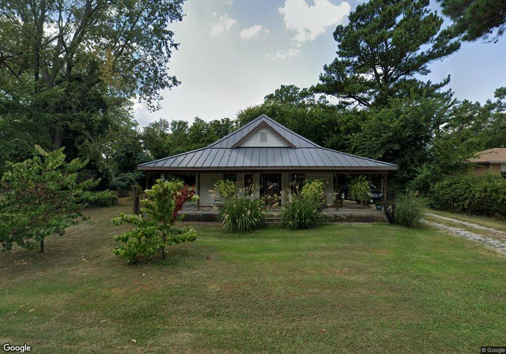
269 N B St Centerton, AR 72719
Estimated Value: $218,000 - $236,073
Studio
1
Bath
1,140
Sq Ft
$198/Sq Ft
Est. Value
About This Home
This home is located at 269 N B St, Centerton, AR 72719 and is currently estimated at $225,518, approximately $197 per square foot. 269 N B St is a home located in Benton County with nearby schools including Centerton Gamble Elementary School, Grimsley Junior High School, and Creekside Middle School.
Ownership History
Date
Name
Owned For
Owner Type
Purchase Details
Closed on
May 4, 2017
Sold by
Adams Helen D
Bought by
Barrett Lindy and Barrett Shirley
Current Estimated Value
Purchase Details
Closed on
Feb 27, 2009
Sold by
Vanmatre Benny Joe and Van Matre Mary Jane
Bought by
Adams Helen D
Purchase Details
Closed on
Oct 7, 2003
Bought by
Vanmatre
Purchase Details
Closed on
Mar 12, 1997
Bought by
Vanmatre
Purchase Details
Closed on
Dec 19, 1994
Bought by
R Witcher Inv Inc
Purchase Details
Closed on
Nov 3, 1994
Bought by
Wood
Purchase Details
Closed on
May 26, 1989
Bought by
Wood
Purchase Details
Closed on
May 18, 1989
Bought by
Wood
Purchase Details
Closed on
Oct 19, 1977
Bought by
Wood
Create a Home Valuation Report for This Property
The Home Valuation Report is an in-depth analysis detailing your home's value as well as a comparison with similar homes in the area
Home Values in the Area
Average Home Value in this Area
Purchase History
| Date | Buyer | Sale Price | Title Company |
|---|---|---|---|
| Barrett Lindy | $50,000 | Waco Title Company | |
| Adams Helen D | $25,000 | None Available | |
| Vanmatre | -- | -- | |
| Vanmatre | $30,000 | -- | |
| R Witcher Inv Inc | $12,000 | -- | |
| Wood | $1,200 | -- | |
| Wood | -- | -- | |
| Wood | -- | -- | |
| Wood | $8,000 | -- |
Source: Public Records
Tax History
| Year | Tax Paid | Tax Assessment Tax Assessment Total Assessment is a certain percentage of the fair market value that is determined by local assessors to be the total taxable value of land and additions on the property. | Land | Improvement |
|---|---|---|---|---|
| 2025 | $1,410 | $38,407 | $17,000 | $21,407 |
| 2024 | $1,425 | $38,407 | $17,000 | $21,407 |
| 2023 | $1,425 | $23,090 | $7,000 | $16,090 |
| 2022 | $1,084 | $23,090 | $7,000 | $16,090 |
| 2021 | $1,072 | $23,090 | $7,000 | $16,090 |
| 2020 | $302 | $10,640 | $2,700 | $7,940 |
| 2019 | $302 | $10,640 | $2,700 | $7,940 |
| 2018 | $327 | $10,640 | $2,700 | $7,940 |
| 2017 | $269 | $10,640 | $2,700 | $7,940 |
| 2016 | $269 | $10,640 | $2,700 | $7,940 |
| 2015 | $242 | $3,930 | $2,000 | $1,930 |
| 2014 | $242 | $3,930 | $2,000 | $1,930 |
Source: Public Records
Map
Nearby Homes
- 195 N A St
- 930 Thornwood Place
- 940 Thornwood Place
- 920 Thornwood Place
- 392 N Main St
- 1730 Greenbank Dr
- 190 & 192 E 2nd St
- 230 Fern St
- 940 Moksha St
- 269 Fern St
- 1771 King Rd
- 397 Thompson St
- 2041 Tallgrass Terrace
- 571 Stoneseed St
- 2131 Periwinkle Place
- 471 Stoneseed St
- 561 Stoneseed St
- 133 Fox Run Cir
- 350 Coopers Farm Rd
- 1041 Applewood Cir
Your Personal Tour Guide
Ask me questions while you tour the home.